South Dublin County Libraries
Please use this identifier to cite or link to this item:
https://hdl.handle.net/10599/10686Full metadata record
| DC Field | Value | Language |
|---|---|---|
| dc.contributor.other | South Dublin Libraries - Local Studies | en_IE |
| dc.contributor.other | Photography: Rob O'Connor, Rocshot.com | en_IE |
| dc.coverage.spatial | ---Newcastle | en_IE |
| dc.coverage.temporal | 12 September 2013 | en_IE |
| dc.date.accessioned | 2014-02-07T03:00:28Z | - |
| dc.date.available | 2014-02-07T03:00:28Z | - |
| dc.date.issued | 2013-09-12 | en_IE |
| dc.identifier.other | wm_Newcastle_96dpi-4.jpg Stop2_BurgagePlots.mp3 | |
| dc.identifier.uri | https://hdl.handle.net/10599/10686 | - |
| dc.description | South Dublin Village Walks - Newcastle Step 2: Burgage plots. Burgage plots were a type of Medieval allotment; long and narrow plots of land were situated at the back of, and the same width as, street-facing properties and were used to grow foodstuffs. These are particularly well-preserved examples. | en_IE |
| dc.format | JPEG | en_IE |
| dc.language.iso | English | en_IE |
| dc.rights | South Dublin Libraries - Local Studies | en_IE |
| dc.subject | South Dublin Village Walks | en_IE |
| dc.subject | Newcastle | en_IE |
| dc.subject | Burgage Plots | en_IE |
| dc.subject | Medieval Town feature | en_IE |
| dc.title | South Dublin Village Walks - Newcastle Step 2: Burgage plots. | en_IE |
| dc.type | Image | en_IE |
| dc.internal.visibility | 1 | en_IE |
| dc.coverage.latitude | 53.300960 | en_IE |
| dc.coverage.longitude | -6.49811 | en_IE |
| dc.rights.allowmp3download | Yes | en_IE |
| Appears in Collections: | Published Items South Dublin Heritage Walks Collection | |
Files in This Item:
| File | Description | Size | Format | |
|---|---|---|---|---|
| Stop2_BurgagePlots.mp3 | Heritage Walk Audio | 934.75 kB | Unknown | View/Open |
| wm_Newcastle_96dpi-4.jpg | Generated Web Image | 195.35 kB | JPEG | 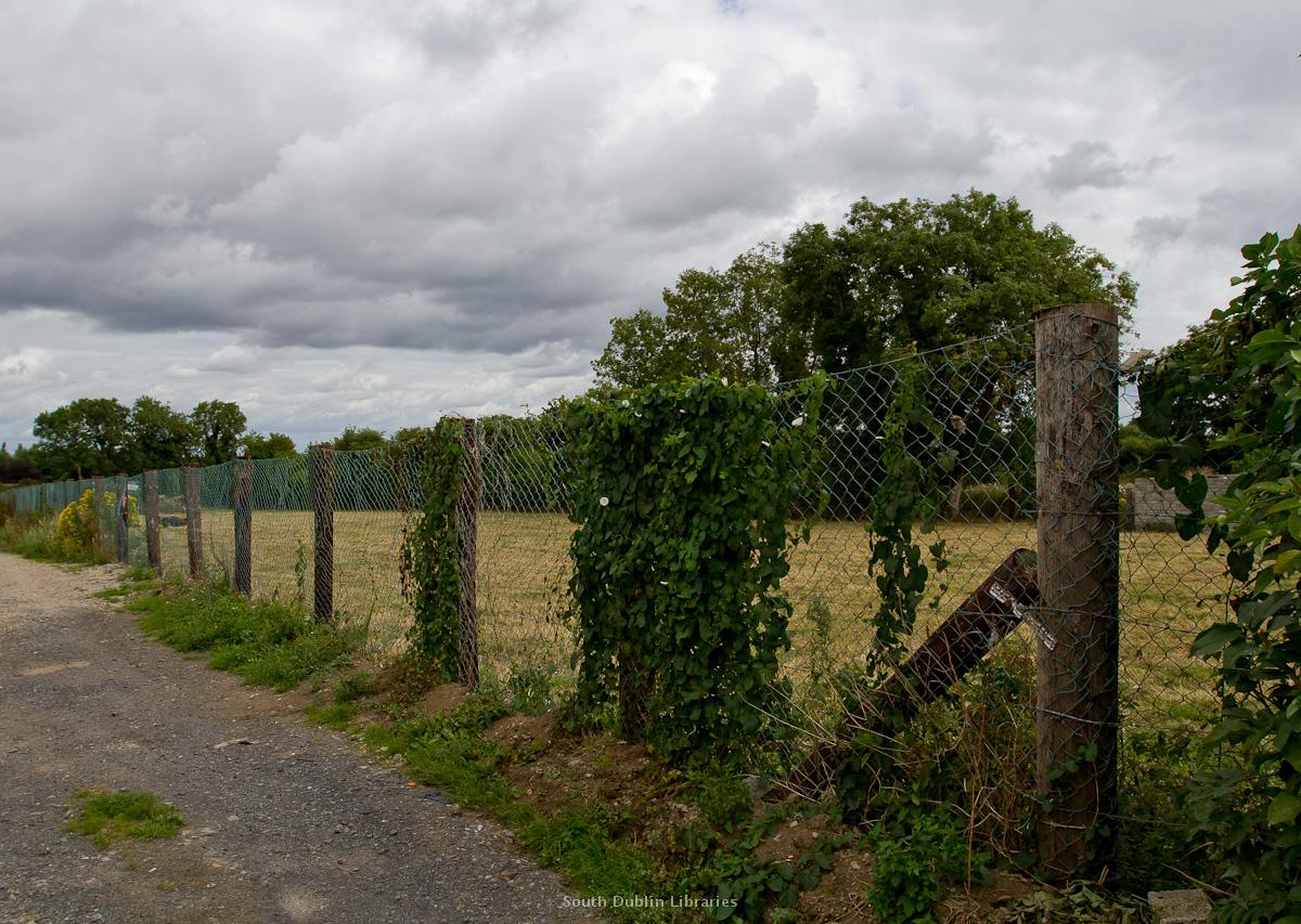 View/Open |
This item is protected by original copyright |
Items in Source are protected by copyright, with all rights reserved, unless otherwise indicated.