South Dublin County Libraries
Please use this identifier to cite or link to this item:
https://hdl.handle.net/10599/10786Full metadata record
| DC Field | Value | Language |
|---|---|---|
| dc.contributor.other | South Dublin Libraries - Local Studies | en_IE |
| dc.contributor.other | Photography: Rocshot.com/Rob O'Connor. | en_IE |
| dc.coverage.spatial | ---Templeogue | en_IE |
| dc.coverage.temporal | 27 September 2013 | en_IE |
| dc.date.accessioned | 2014-03-25T03:00:45Z | - |
| dc.date.available | 2014-03-25T03:00:45Z | - |
| dc.date.issued | 2013-09-27 | en_IE |
| dc.identifier.other | wm_Templeogue_300dpi-18.jpg wm_Templeogue_300dpi-16.jpg wm_Templeogue_300dpi-17.jpg wm_Templeogue_300dpi-19.jpg Stop9_Graveyard.mp3 | |
| dc.identifier.uri | https://hdl.handle.net/10599/10786 | - |
| dc.description | South Dublin Village Walks - Templeogue Step 9: Medieval Church Ruins and Burial Ground. Templeogue graveyard is the site of an early monastery which gave the townland its name. A list of saints in the Book of Lecan includes Molcae tigi Molocal – in documents of the 13th century the name is written Tachmelog (St. Melog’s house or church). No part of the church can be dated to the time of the original monastery but part of it may be earlier than the Norman Invasion. In 1615, the church was reported to be utterly in ruin. Externally, the building measures 17.68 x 5.72 metres. The east gable is complete and contains a late splayed window. The north wall is about 50cm high, uniform, and with no indication of a door opening. The south wall has a distinct kink about half way along with a buttress outside. The western end of this wall is about three metres high. The west wall has a doorway about midway with steps leading up to it and there are three early cross-inscribed slabs in the burial ground, one of which is deeply sunk within the church. | en_IE |
| dc.format | JPEG | en_IE |
| dc.language.iso | English | en_IE |
| dc.relation | For full details of this and other walks see: http://heritagewalks.sdcc.ie/ | en_IE |
| dc.rights | South Dublin Libraries - Local Studies | en_IE |
| dc.subject | South Dublin Village Walks | en_IE |
| dc.subject | Medieval Church Ruins and Burial Ground | en_IE |
| dc.subject | Monastery Ruin | en_IE |
| dc.title | South Dublin Village Walks - Templeogue Step 9: Medieval Church Ruins and Burial Ground | en_IE |
| dc.type | Image | en_IE |
| dc.internal.visibility | 1 | en_IE |
| dc.coverage.latitude | 53.294357 | en_IE |
| dc.coverage.longitude | -6.319454 | en_IE |
| dc.rights.allowmp3download | Yes | en_IE |
| Appears in Collections: | Published Items South Dublin Heritage Walks Collection | |
Files in This Item:
| File | Description | Size | Format | |
|---|---|---|---|---|
| wm_Templeogue_300dpi-16.jpg | Generated Web Image | 558.26 kB | JPEG | 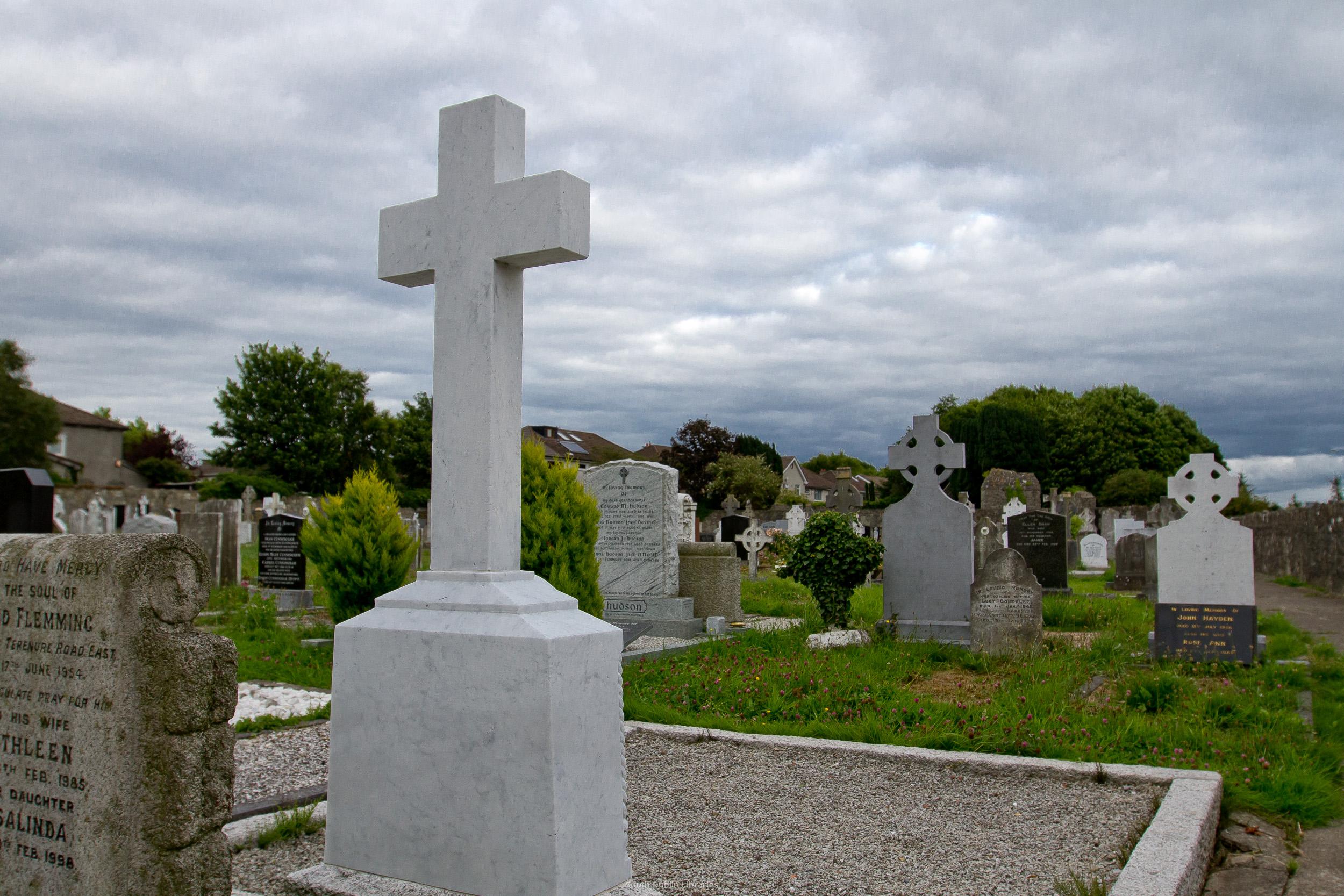 View/Open |
| wm_Templeogue_300dpi-17.jpg | Generated Web Image | 703.8 kB | JPEG | 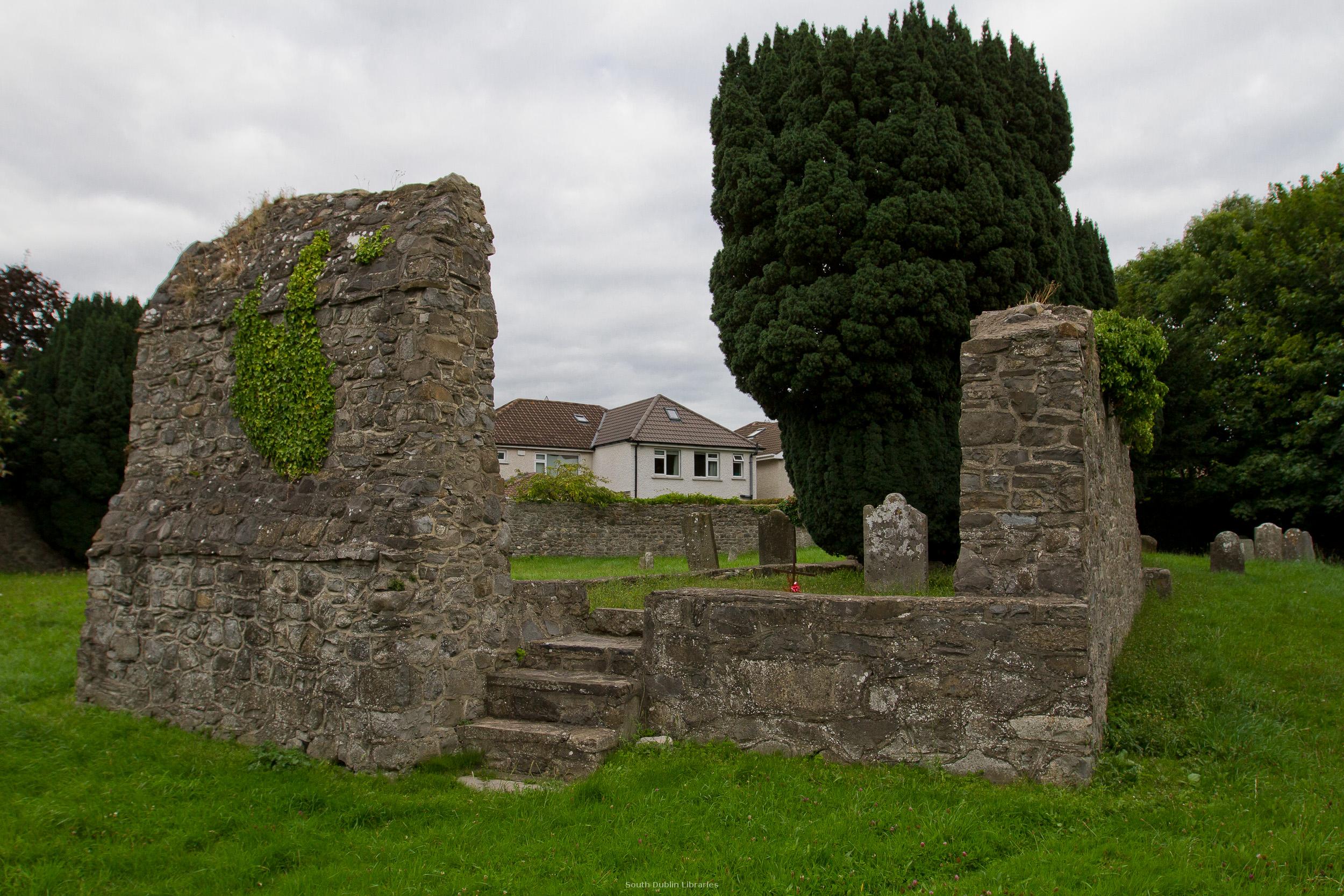 View/Open |
| wm_Templeogue_300dpi-18.jpg | Generated Web Image | 886.99 kB | JPEG | 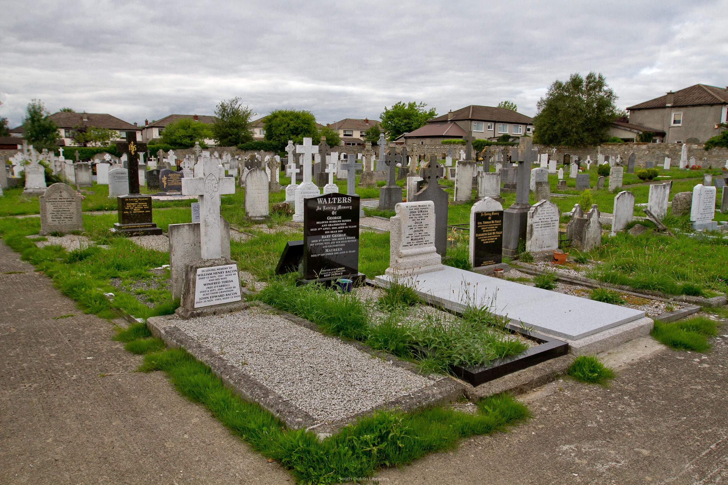 View/Open |
| wm_Templeogue_300dpi-19.jpg | Generated Web Image | 594.41 kB | JPEG | 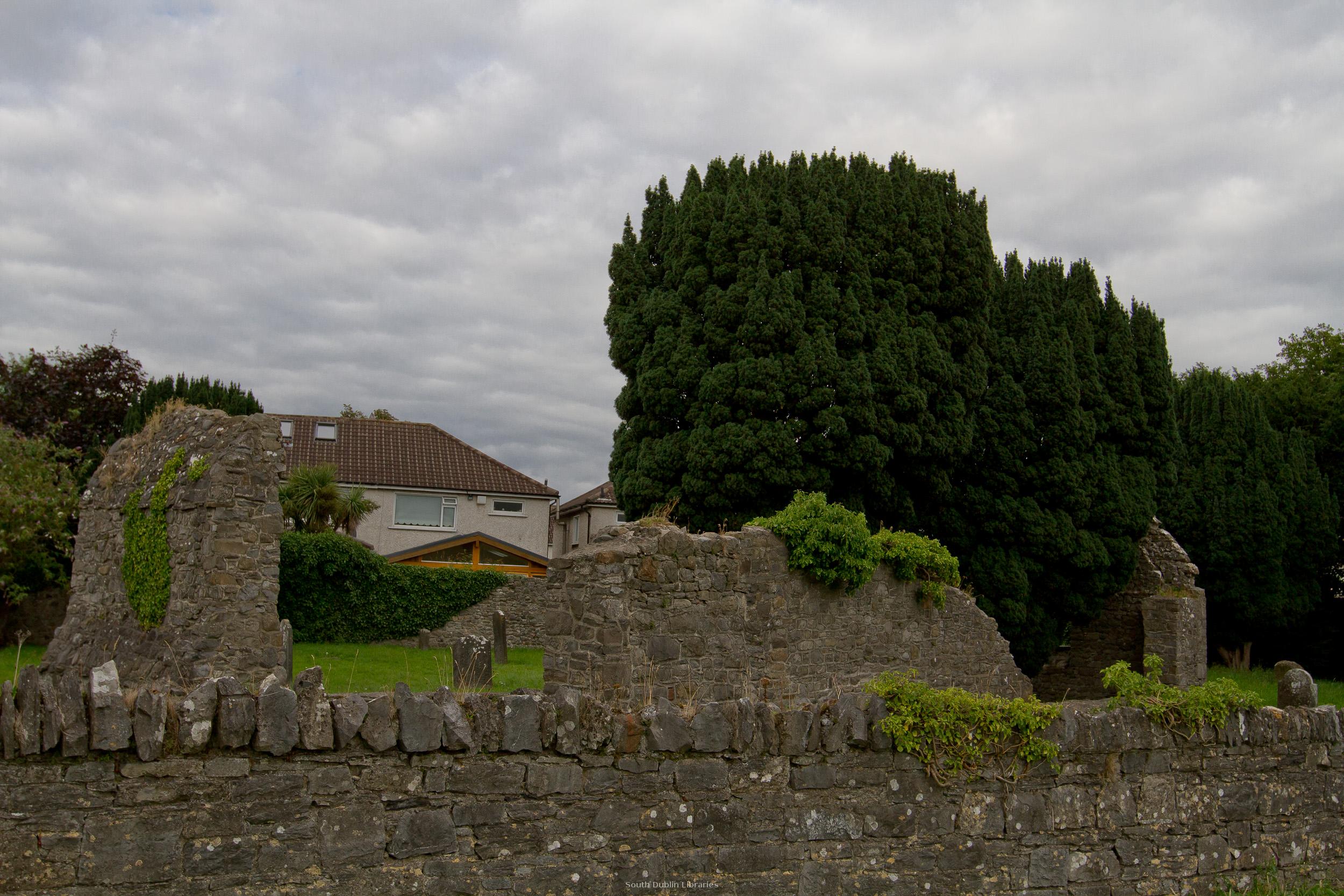 View/Open |
| Stop9_Graveyard.mp3 | Heritage Walk Audio | 2.29 MB | Unknown | View/Open |
This item is protected by original copyright |
Items in Source are protected by copyright, with all rights reserved, unless otherwise indicated.