South Dublin County Libraries
Please use this identifier to cite or link to this item:
https://hdl.handle.net/10599/10986Full metadata record
| DC Field | Value | Language |
|---|---|---|
| dc.contributor.advisor | Fallon, Las | en_IE |
| dc.contributor.author | Purcell, Thomas | en_IE |
| dc.contributor.other | Purcell Family | en_IE |
| dc.date.accessioned | 2014-10-18T03:59:33Z | - |
| dc.date.available | 2014-10-18T03:59:33Z | - |
| dc.date.issued | 1916 | en_IE |
| dc.identifier.other | wm_DSCF4366.jpg | |
| dc.identifier.uri | https://hdl.handle.net/10599/10986 | - |
| dc.description | Captain Purcell's map of affected areas 1916. The fire on Usher's Quay was started by Tom Smart and Peadar Clancy to drive a unit of Dublin Fusiliers out of that strongpoint, from which they had been firing on the Four Courts/Church Street area. Clanwilliam House was destroyed as part of the battle at Mount Street Bridge. | en_IE |
| dc.format | JPEG | en_IE |
| dc.language.iso | English | en_IE |
| dc.subject | Dublin Fire Brigade | en_IE |
| dc.title | Captain Purcell's map of affected areas of Dublin 1916. | en_IE |
| dc.type | Image | en_IE |
| dc.internal.visibility | 1 | en_IE |
| dc.rights.allowmp3download | No | en_IE |
| Appears in Collections: | Dublin Fire Brigade Collection Published Items | |
Files in This Item:
| File | Description | Size | Format | |
|---|---|---|---|---|
| wm_DSCF4366.jpg | Generated Web Image | 294.05 kB | JPEG | 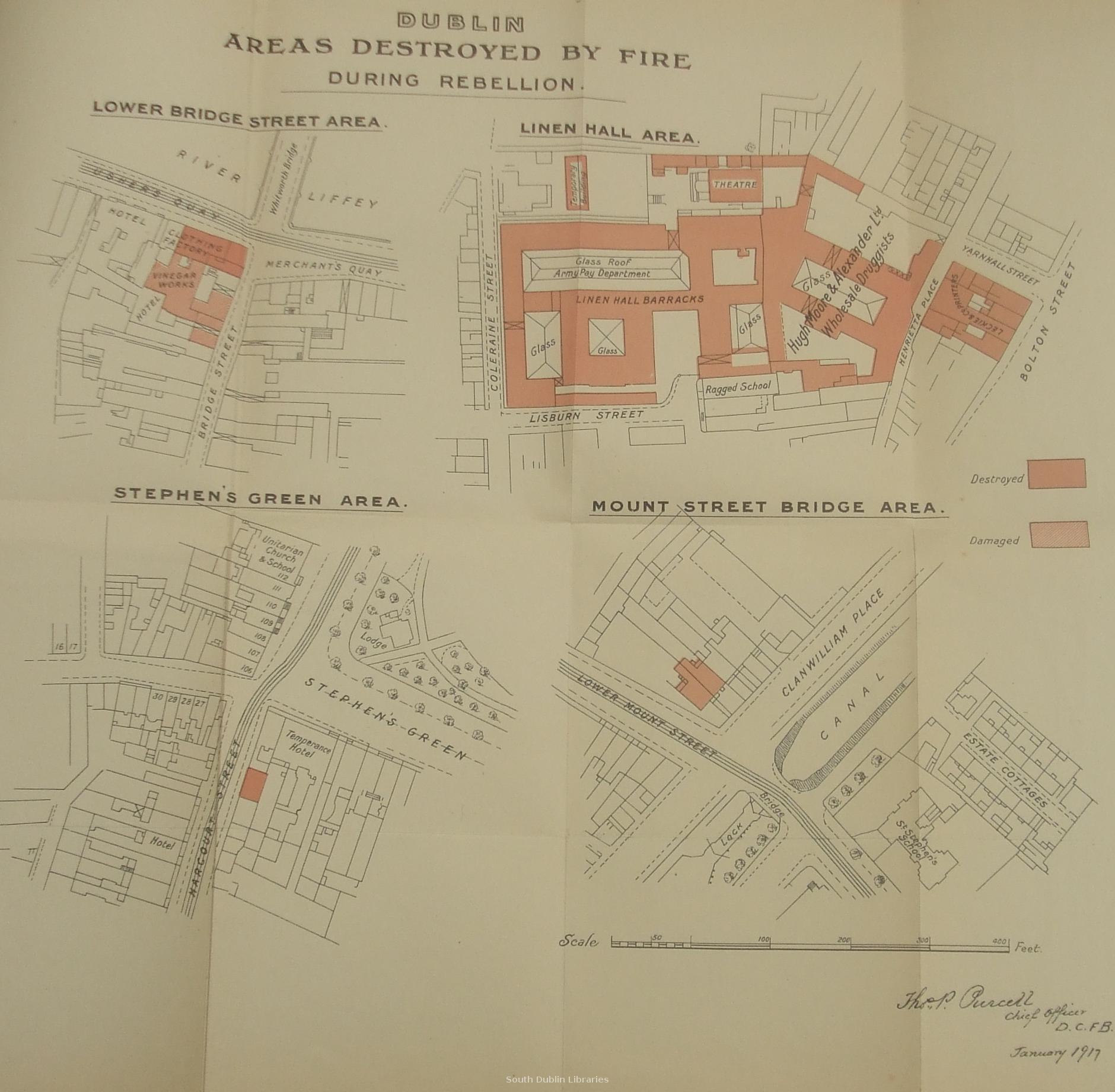 View/Open |
This item is protected by original copyright |
Items in Source are protected by copyright, with all rights reserved, unless otherwise indicated.