South Dublin County Libraries
Please use this identifier to cite or link to this item:
https://hdl.handle.net/10599/12596| Title: | Two aerial photos and a modern day view of Tallaght Village (at top, right) and the area south west. Possibly 1960s |
| Authors: | South Dublin Libraries South Dublin Libraries |
| Keywords: | Tallaght Urban Development |
| Issue Date: | 1968 |
| Description: | Two aerial photos and a modern day view of Tallaght Village (at top, right) and the area south west of it before it was developed. Possibly 1960s |
| URI: | https://hdl.handle.net/10599/12596 |
| Copyright: | Reproduced courtesy of the Irish Air Corps |
| Location: | Click here to view the location in Google Maps |
| Appears in Collections: | Published Items South Dublin Libraries Images |
Files in This Item:
| File | Description | Size | Format | |
|---|---|---|---|---|
| wm_19_Aerial16_Now.jpg | Generated Web Image | 264.93 kB | JPEG | 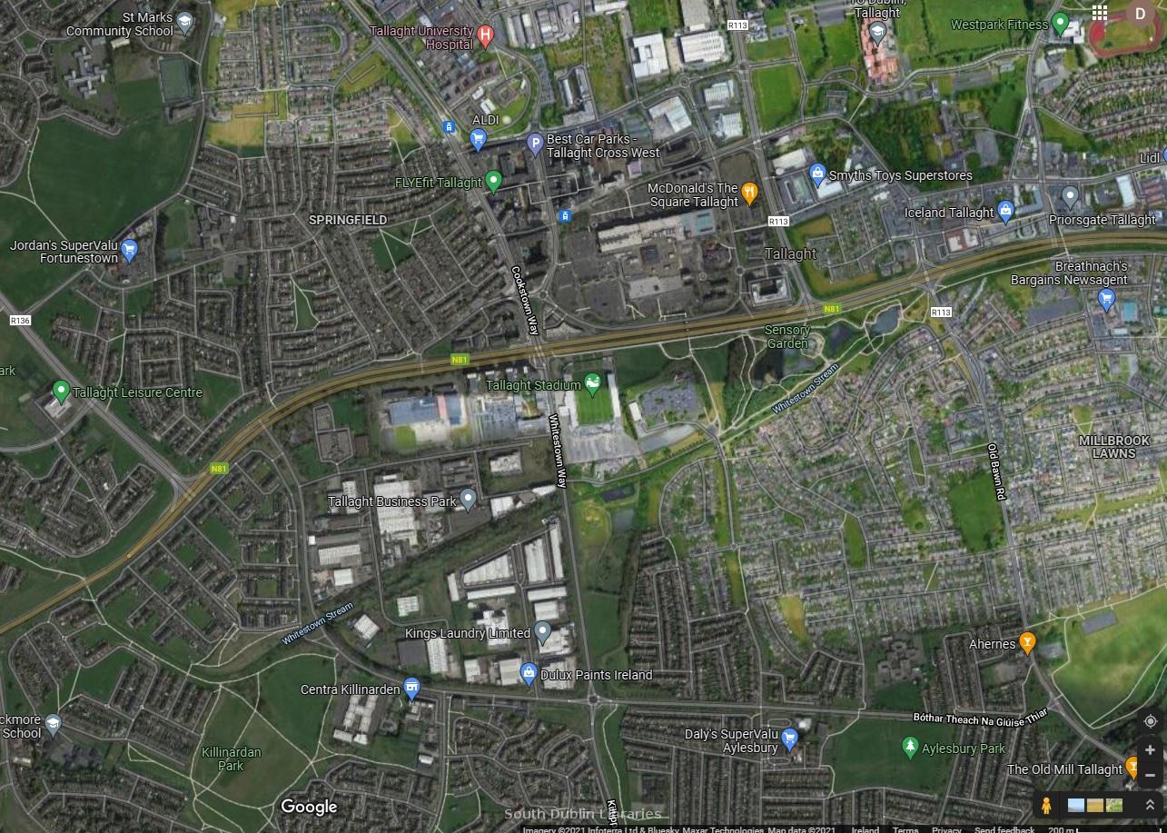 View/Open |
| wm_19_Aerial17.jpg | Generated Web Image | 2.52 MB | JPEG | 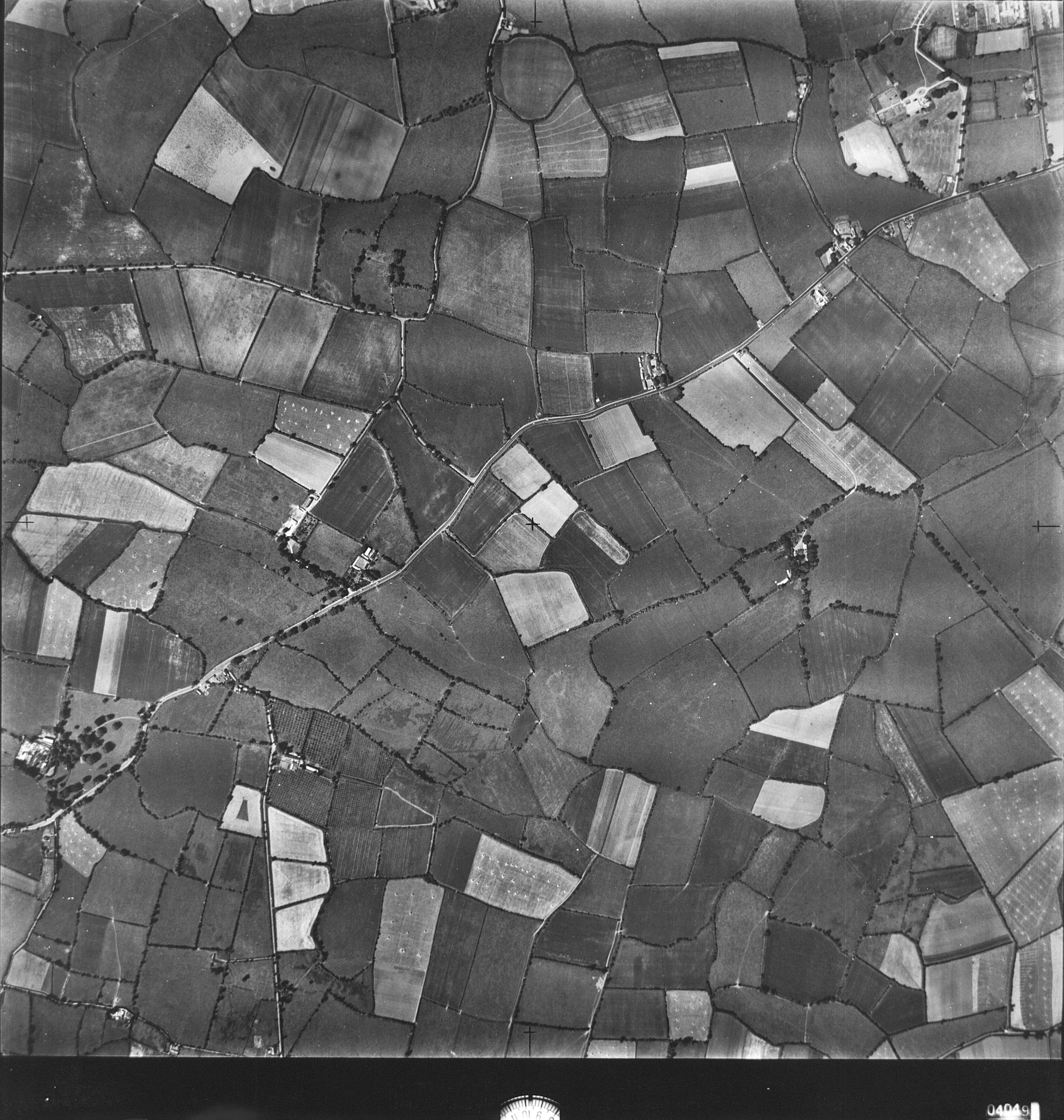 View/Open |
| wm_19_Aerial16.jpg | Generated Web Image | 2.77 MB | JPEG | 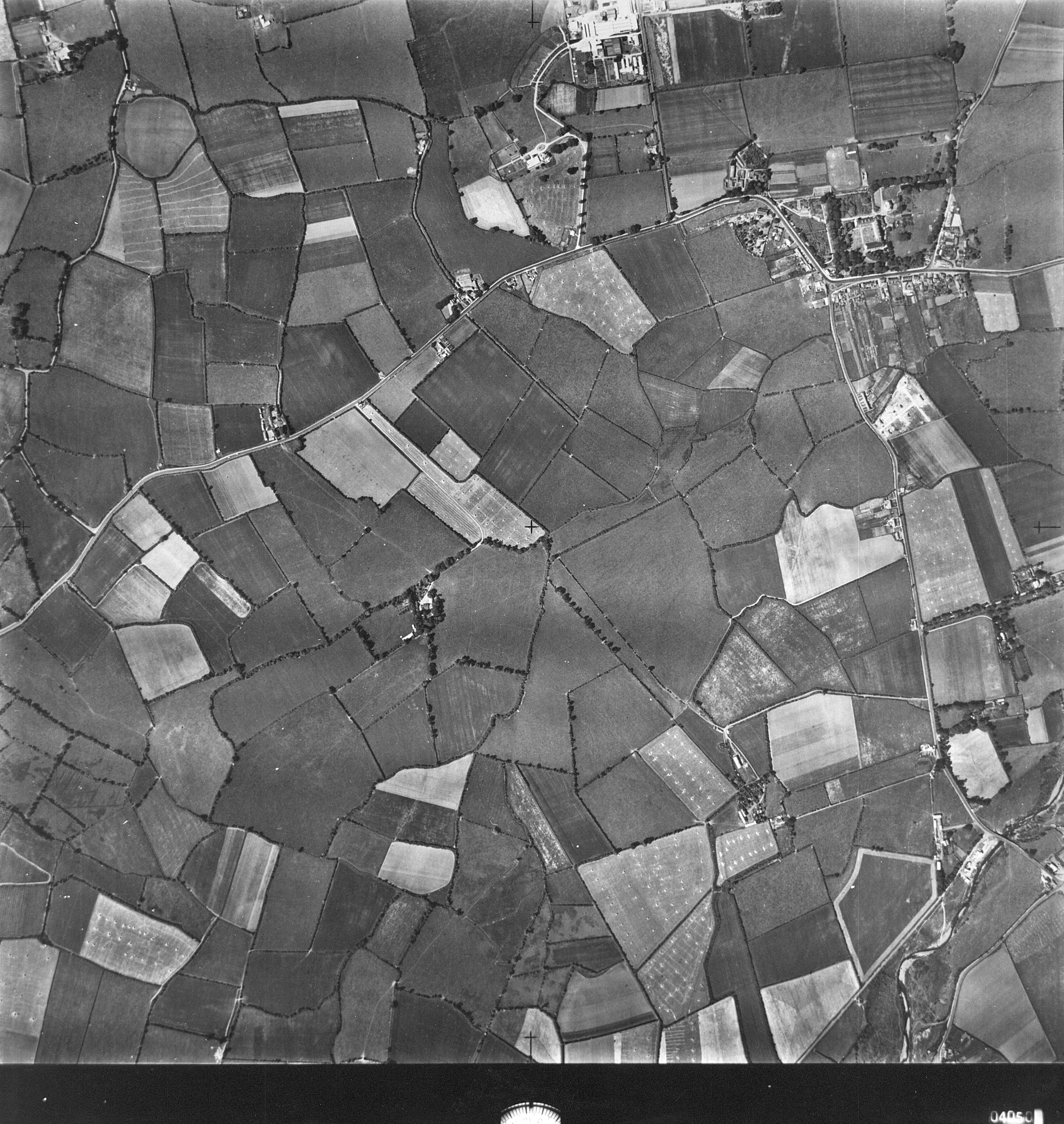 View/Open |
This item is protected by original copyright |
Items in Source are protected by copyright, with all rights reserved, unless otherwise indicated.