South Dublin County Libraries
Please use this identifier to cite or link to this item:
https://hdl.handle.net/10599/12597Full metadata record
| DC Field | Value | Language |
|---|---|---|
| dc.contributor.author | South Dublin Libraries | en_IE |
| dc.contributor.other | South Dublin Libraries | en_IE |
| dc.coverage.spatial | ---Tallaght | en_IE |
| dc.coverage.temporal | 2021-03-24 | en_IE |
| dc.date.accessioned | 2021-10-20T02:00:23Z | - |
| dc.date.available | 2021-10-20T02:00:23Z | - |
| dc.date.issued | 1968 | en_IE |
| dc.identifier.other | wm_1973_Aerial20.jpg wm_1973_Aerial20NowOK.jpg | |
| dc.identifier.uri | https://hdl.handle.net/10599/12597 | - |
| dc.description | Then and Now: Aerial photograph of the area now occupied by Springfield, diagonally across to Dodder Valley Park Tallaght. Modern day view courtesy Google Maps | en_IE |
| dc.format | TIFF | en_IE |
| dc.language.iso | English | en_IE |
| dc.rights | Reproduced courtesy of the Irish Air Corps | en_IE |
| dc.subject | Aerial photograph | en_IE |
| dc.subject | Springfield | en_IE |
| dc.title | Then and Now: Aerial photograph of the area now occupied by Springfield, diagonally across to Dodder Valley Park Tallaght. | en_IE |
| dc.type | Image | en_IE |
| dc.internal.visibility | 1 | en_IE |
| dc.coverage.latitude | 53.28262261916813 | en_IE |
| dc.coverage.longitude | -6.36482861760712 | en_IE |
| dc.rights.allowmp3download | Yes | en_IE |
| Appears in Collections: | Published Items South Dublin Libraries Images | |
Files in This Item:
| File | Description | Size | Format | |
|---|---|---|---|---|
| wm_1973_Aerial20.jpg | Generated Web Image | 2.82 MB | JPEG | 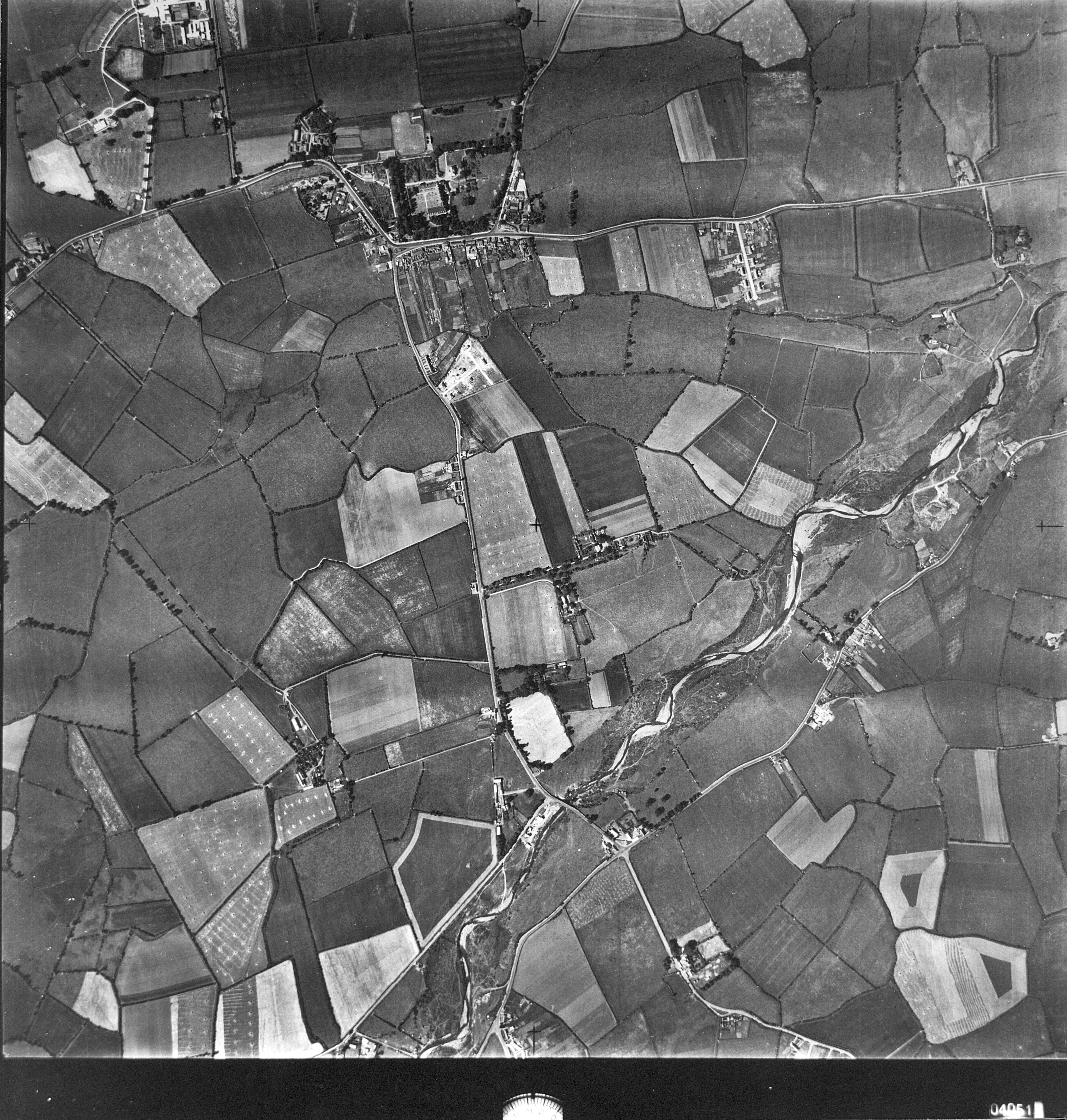 View/Open |
| wm_1973_Aerial20NowOK.jpg | Generated Web Image | 207.73 kB | JPEG | 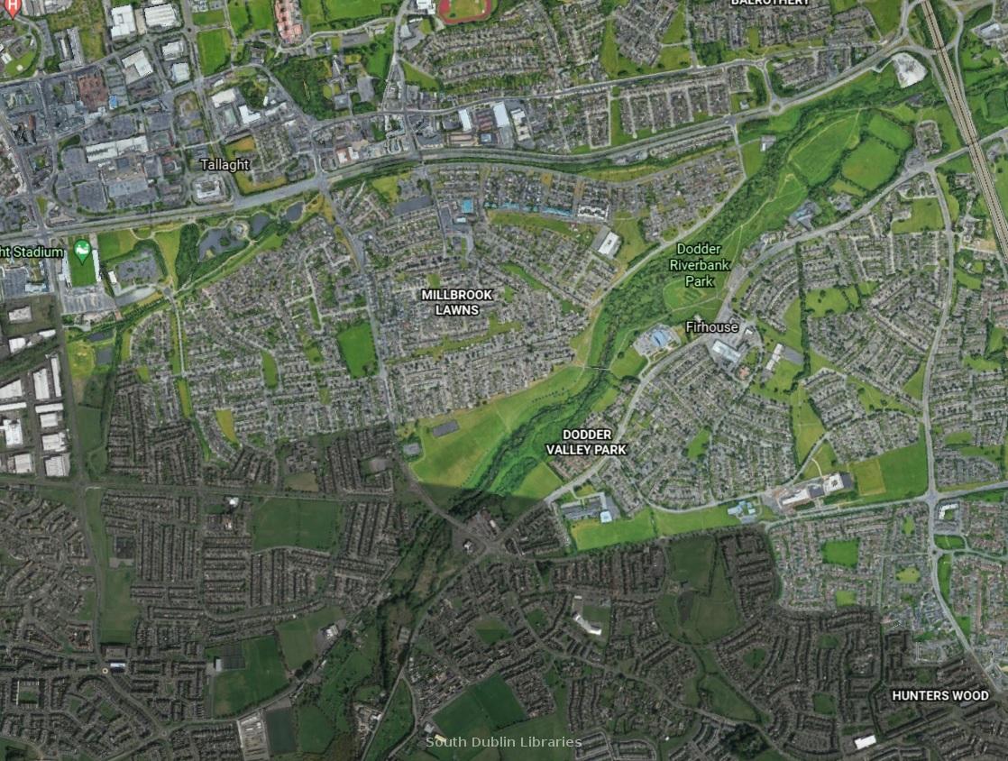 View/Open |
This item is protected by original copyright |
Items in Source are protected by copyright, with all rights reserved, unless otherwise indicated.