South Dublin County Libraries
Please use this identifier to cite or link to this item:
https://hdl.handle.net/10599/4948| Title: | Taylor's map of the environs of Dublin extending 10 to 14 miles from the castle by actual survey on a scale of 2 inches to one mile [Tallaght] |
| Authors: | Taylor, John Courtesy of Andrew Bonar Law |
| Keywords: | map Cookstown Newhall Jobstown House Springfield Upper Kiltalown forge Ballynamangh Old Bawn pond paper mills Killininny Ballycrane Allenstown Lands of Timmins post office Archbishops of Dublin's Palace Balrothery Hills mills sporting hall Moor House Bolbrook Bowlbrook Sallypark Mount Prospect Firhouse Furhouse old church new road |
| Issue Date: | 7-Sep-2009 |
| Publisher: | John Taylor |
| Description: | Portion of John Taylor's map of Dublin, showing Tallaght and surrounding area |
| URI: | https://hdl.handle.net/10599/4948 |
| Appears in Collections: | Maps Published Items |
Files in This Item:
| File | Description | Size | Format | |
|---|---|---|---|---|
| wm_Taylor_Tallaght.jpg | 591.33 kB | JPEG | 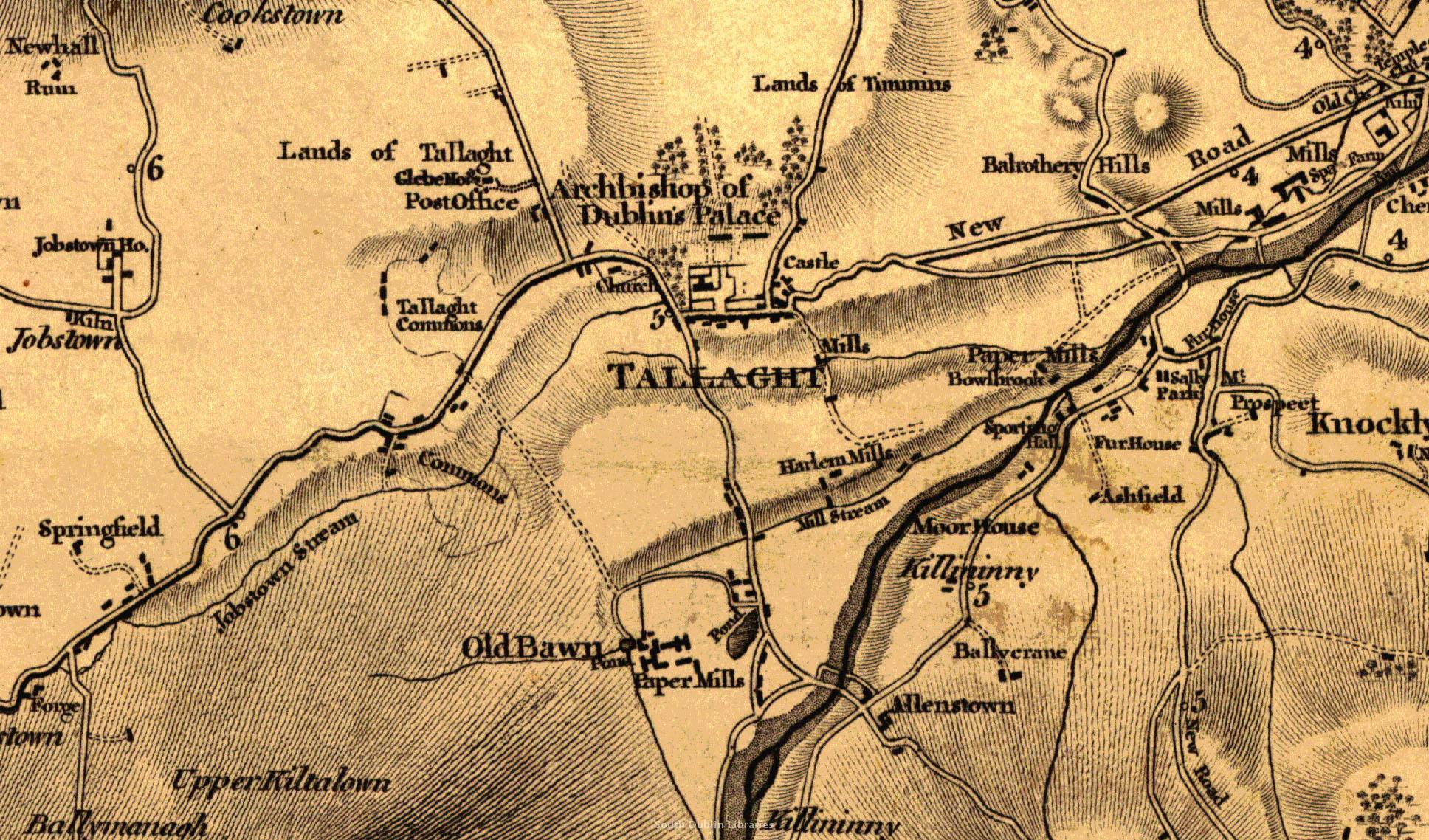 View/Open |
This item is protected by original copyright |
Items in Source are protected by copyright, with all rights reserved, unless otherwise indicated.