South Dublin County Libraries
Please use this identifier to cite or link to this item:
https://hdl.handle.net/10599/4956Full metadata record
| DC Field | Value | Language |
|---|---|---|
| dc.contributor.author | Ordnance Survey | en_IE |
| dc.contributor.other | Courtesy of Andrew Bonar Law | en_IE |
| dc.coverage.spatial | Palmerstown | en_IE |
| dc.coverage.temporal | 1869 | en_IE |
| dc.date.accessioned | 2017-02-21T03:00:19Z | - |
| dc.date.available | 2017-02-21T03:00:19Z | - |
| dc.date.issued | 2009-09-07T16:30:21Z | en_IE |
| dc.identifier.other | 25OS_Palmerstown.tif wm_25OS_Palmerstown.jpg | en_IE |
| dc.identifier.uri | https://hdl.handle.net/10599/4956 | - |
| dc.description | Portion of Parish of Palmerstown, Co.Dublin sheet XVII.8 | en_IE |
| dc.format | .tif | en_IE |
| dc.language.iso | English | en_IE |
| dc.publisher | Ordnance Survey | en_IE |
| dc.subject | map | en_IE |
| dc.subject | Clarkeville Terrace | en_IE |
| dc.subject | police station | en_IE |
| dc.subject | Waterstown | en_IE |
| dc.subject | scutch mill | en_IE |
| dc.subject | iron mill | en_IE |
| dc.subject | Palmerstown Mills | en_IE |
| dc.subject | oil burning house | en_IE |
| dc.subject | national school | en_IE |
| dc.subject | logwood mill | en_IE |
| dc.subject | spinning mill | en_IE |
| dc.subject | Palmerstown Demesne | en_IE |
| dc.subject | Palmerstown House | en_IE |
| dc.subject | quarry | en_IE |
| dc.title | Parish of Palmerstown, Co.Dublin | en_IE |
| dc.type | image | en_IE |
| Appears in Collections: | Maps Published Items | |
Files in This Item:
| File | Description | Size | Format | |
|---|---|---|---|---|
| wm_25OS_Palmerstown.jpg | 3.38 MB | JPEG | 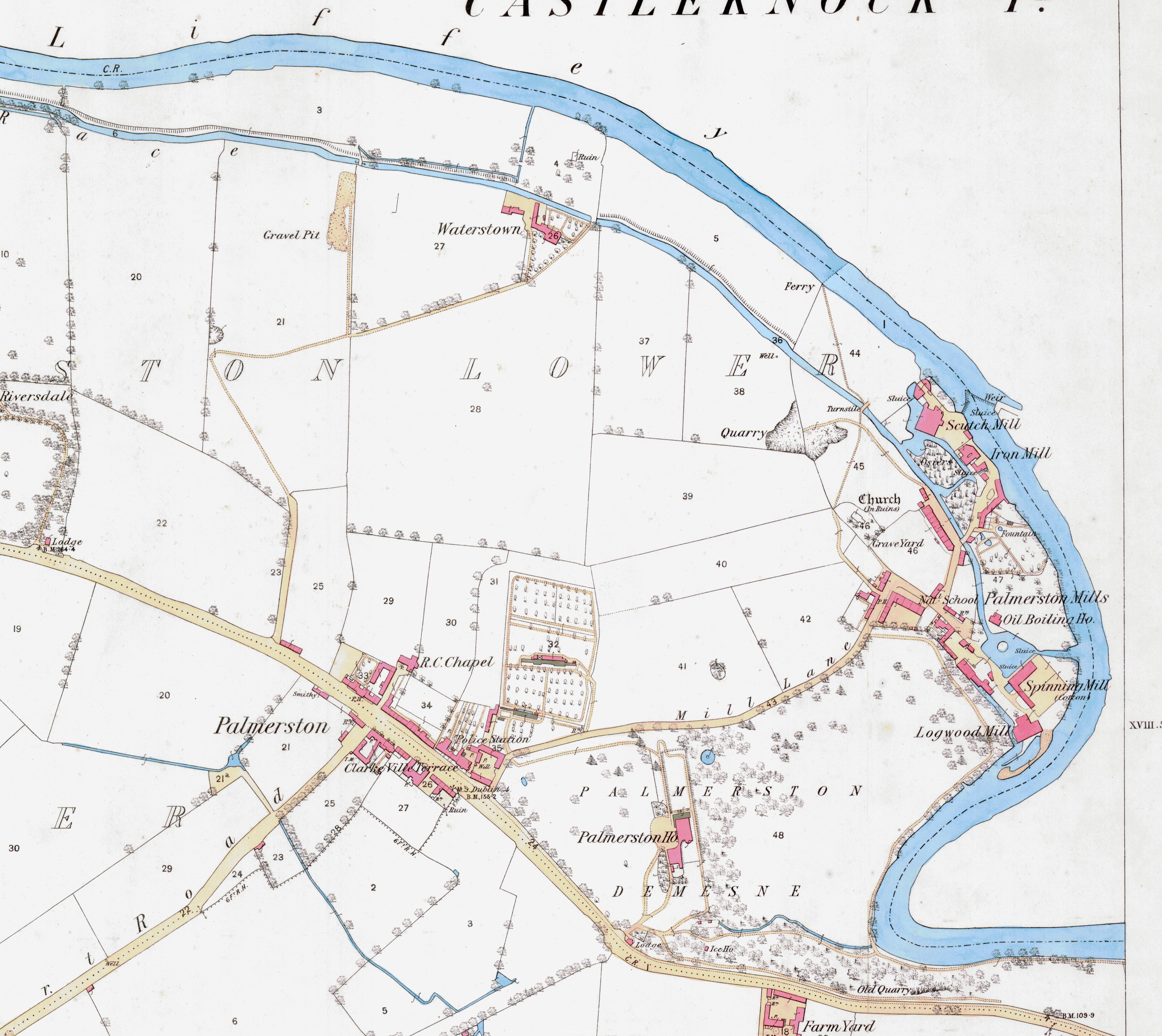 View/Open |
This item is protected by original copyright |
Items in Source are protected by copyright, with all rights reserved, unless otherwise indicated.