South Dublin County Libraries
Please use this identifier to cite or link to this item:
https://hdl.handle.net/10599/7643Full metadata record
| DC Field | Value | Language |
|---|---|---|
| dc.contributor.other | National Inventory of Architectural Heritage | en_IE |
| dc.coverage.spatial | ---Dublin | en_IE |
| dc.coverage.temporal | 1780 | en_IE |
| dc.date.accessioned | 2011-08-25T03:28:36Z | - |
| dc.date.available | 2011-08-25T03:28:36Z | - |
| dc.date.copyright | Reproduced with kind permission of the Department of the Environment, Heritage and Local Government. South Dublin Libraries do not own the reproduction rights to this image. If you wish to reproduce this image see contact details at http://www.buildingsofireland.ie | en_IE |
| dc.date.issued | 2002-01-01 | en_IE |
| dc.identifier.other | wm_11221019_1.jpg | |
| dc.identifier.uri | https://hdl.handle.net/10599/7643 | - |
| dc.description | Surviving section of cobbled military road within Massy's Woods, c.1780. Bridge over the Owendoher with cyclopean stonework leads to best preserved section of road beneath revetment walls, and showing cobbled gutters. Further west the road becomes a forest track and vanishes into woodland beneath modern Killakee Road. | en_IE |
| dc.format | JPEG | en_IE |
| dc.language.iso | English | en_IE |
| dc.publisher | Department of the Environment, Heritage and Local Government | en_IE |
| dc.relation | National Inventory of Architectural Heritage ID: 11221019 | en_IE |
| dc.subject | cobbled military road | en_IE |
| dc.subject | Massy's Woods | en_IE |
| dc.subject | Bridge with cyclopean stonework | en_IE |
| dc.subject | Owendoher river | en_IE |
| dc.subject | revetment walls and cobbled gutters | en_IE |
| dc.subject | Killakee Estate | en_IE |
| dc.title | Military Road, Killakee Road, Cruagh Lane, South Dublin County | en_IE |
| dc.type | Image | en_IE |
| dc.internal.visibility | 1 | en_IE |
| Appears in Collections: | National Inventory of Architectural Heritage Collection Published Items | |
Files in This Item:
| File | Description | Size | Format | |
|---|---|---|---|---|
| wm_11221019_1.jpg | Generated Web Image | 717.25 kB | JPEG | 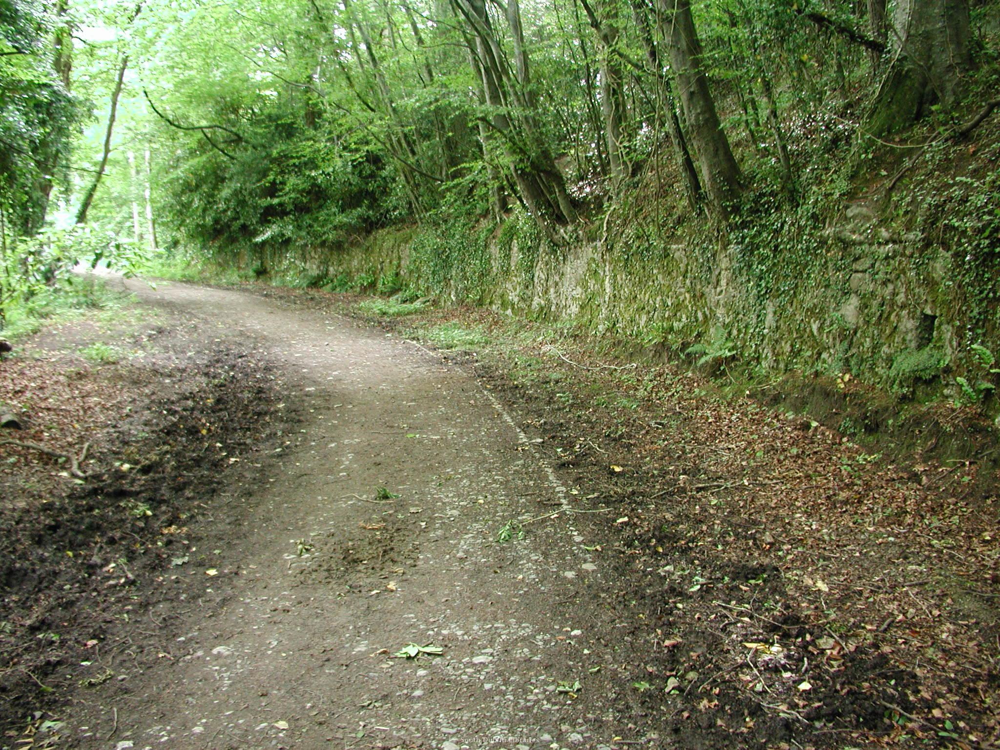 View/Open |
This item is protected by original copyright |
Items in Source are protected by copyright, with all rights reserved, unless otherwise indicated.