South Dublin County Libraries
Please use this identifier to cite or link to this item:
https://hdl.handle.net/10599/9610Full metadata record
| DC Field | Value | Language |
|---|---|---|
| dc.contributor.author | John Walker & Co. London | en_IE |
| dc.contributor.other | Williams, Joe | en_IE |
| dc.coverage.spatial | ---Dublin | en_IE |
| dc.coverage.temporal | c.1910 | en_IE |
| dc.date.accessioned | 2014-12-17T03:02:32Z | - |
| dc.date.available | 2014-12-17T03:02:32Z | - |
| dc.date.issued | 1910 | en_IE |
| dc.identifier.other | wm_Postcard Map Dublin - Wicklow.jpg | |
| dc.identifier.uri | https://hdl.handle.net/10599/9610 | - |
| dc.description | One of John Walker & Company's celebrated international Geographical Series postcards featuring maps engraved by J. Bartholomew & Co. This colour postcard (no. 507) depicts Counties Dublin and Wicklow from Howth Head to below Wicklow Head with an insert photo of the Bank of Ireland, Dublin. | en_IE |
| dc.format | TIFF | en_IE |
| dc.language.iso | English | en_IE |
| dc.publisher | John Walker & Co. London | en_IE |
| dc.subject | John Walker & Co. London | en_IE |
| dc.subject | Geographical Series postcard | en_IE |
| dc.subject | Counties Dublin and Wicklow | en_IE |
| dc.subject | Photo of the Bank of Ireland, Dublin | en_IE |
| dc.title | John Walker & Co. Geographical Series postcard (no. 507) of Counties Dublin and Wicklow. | en_IE |
| dc.type | Image | en_IE |
| dc.internal.visibility | 1 | en_IE |
| Appears in Collections: | Joe Williams Postcard Collection Published Items | |
Files in This Item:
| File | Description | Size | Format | |
|---|---|---|---|---|
| wm_Postcard Map Dublin - Wicklow.jpg | Generated Web Image | 1.64 MB | JPEG | 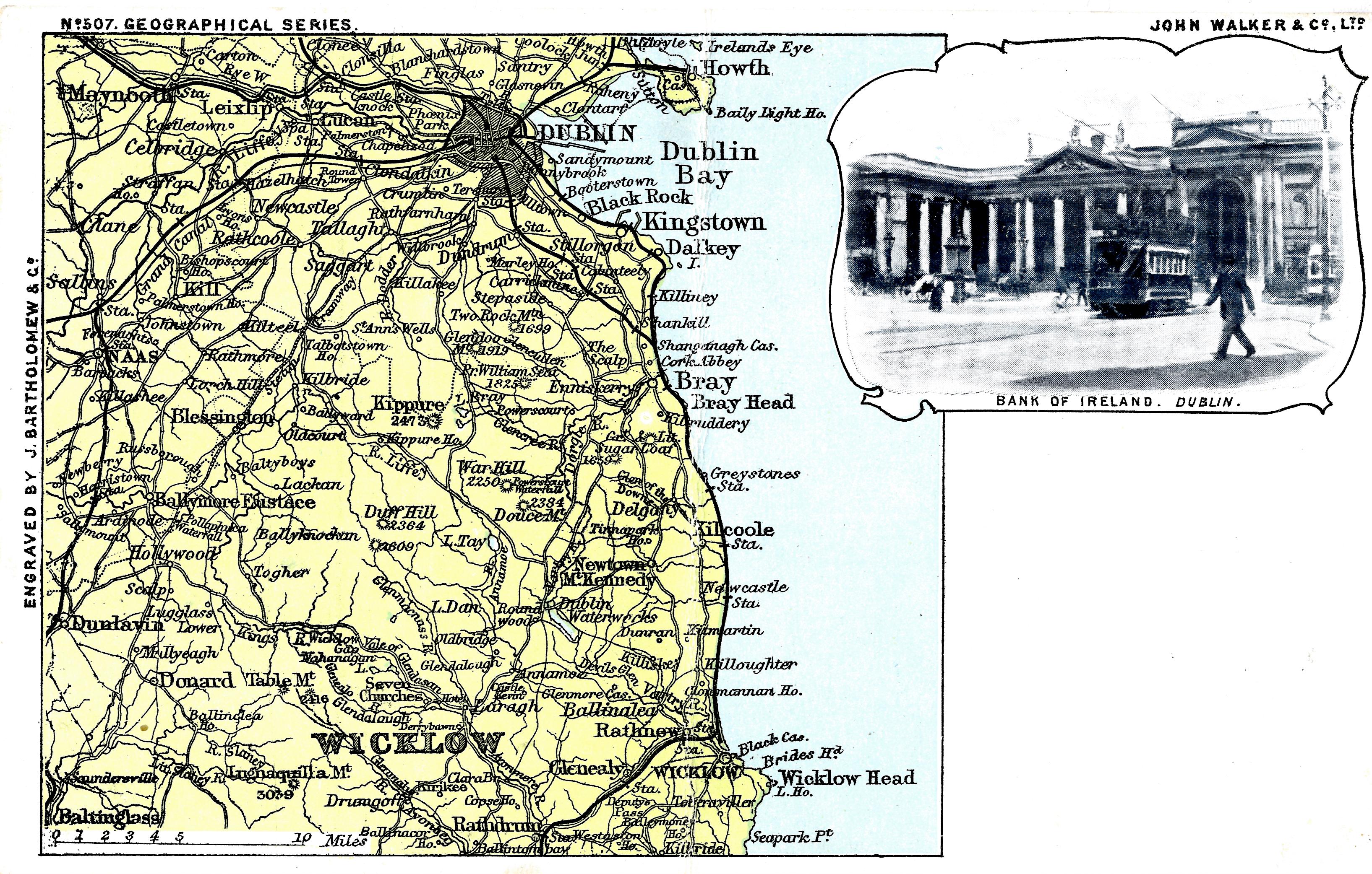 View/Open |
This item is protected by original copyright |
Items in Source are protected by copyright, with all rights reserved, unless otherwise indicated.