South Dublin County Libraries
Please use this identifier to cite or link to this item:
https://hdl.handle.net/10599/10333| Title: | Ordnance Survey Office Map No. 1 of Ballitore County Kildare 1907 -1908 |
| Authors: | Ordnance Survey Office Ireland Cruise, Aidan |
| Keywords: | Ordnance Survey map 1907 - 1908 |
| Issue Date: | 1908 |
| Publisher: | Ordnance Survey Office Ireland c.1908 |
| Description: | A numbered and annotated Ordnance Survey Office map of the centre of the Quaker village of Ballitore, Co. Kildare 1907 - 1908 thought to be related to c.1960 era photographs and survey sheets of property hosted on SOURCE Local Studies website associated with this Quaker collection. |
| URI: | https://hdl.handle.net/10599/10333 |
| Copyright: | Ordnance Survey Ireland |
| Appears in Collections: | Published Items Quaker Maps |
Files in This Item:
| File | Description | Size | Format | |
|---|---|---|---|---|
| wm_10333_Ballitore Village Centre Map 1 (numbered & Annotated).jpg | Generated Web Image | 3.72 MB | JPEG | 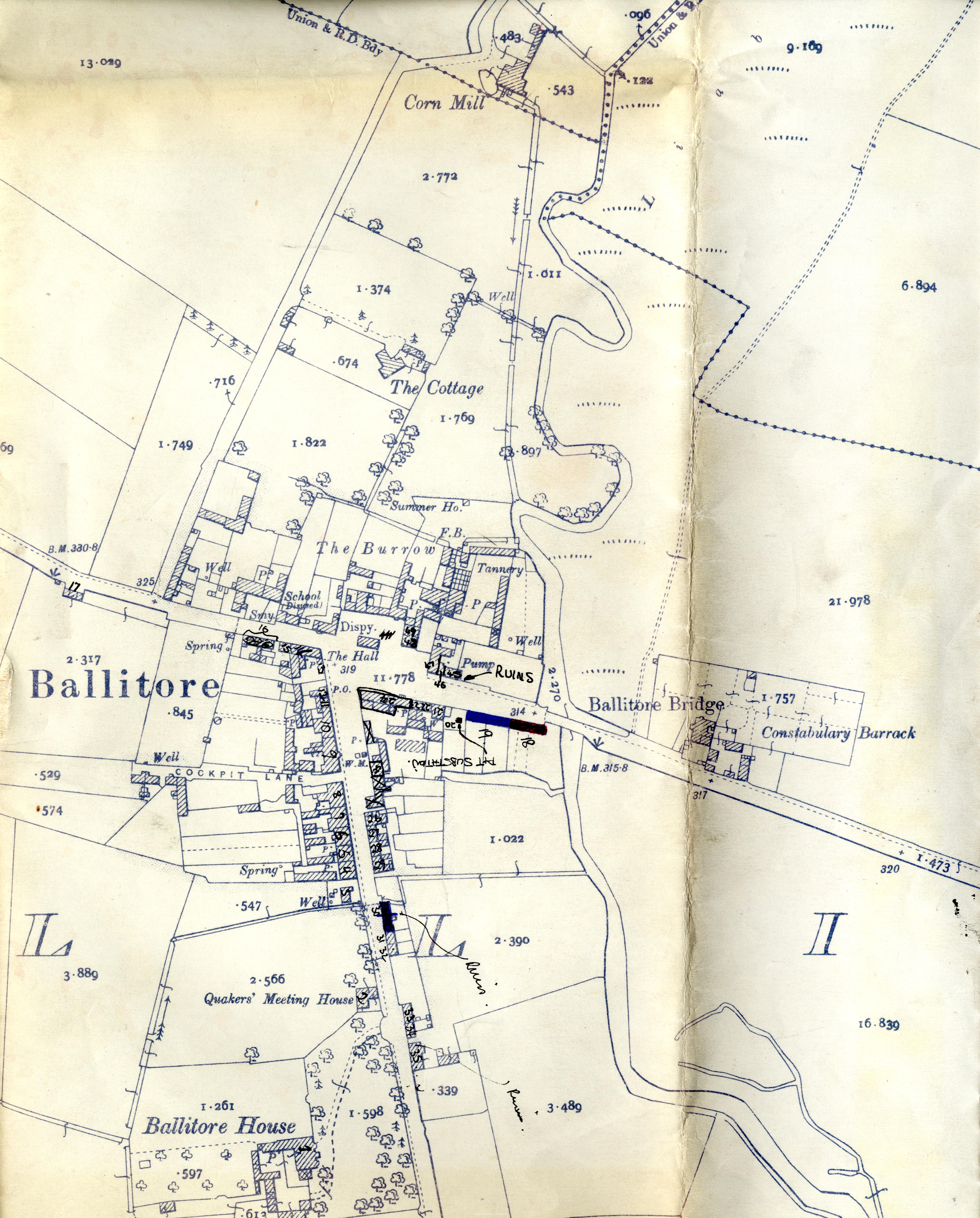 View/Open |
This item is protected by original copyright |
Items in Source are protected by copyright, with all rights reserved, unless otherwise indicated.