South Dublin County Libraries
Please use this identifier to cite or link to this item:
https://hdl.handle.net/10599/10438Full metadata record
| DC Field | Value | Language |
|---|---|---|
| dc.contributor.author | Unknown | |
| dc.contributor.other | Cruise, Aidan | |
| dc.coverage.spatial | ---Wicklow | en_IE |
| dc.coverage.temporal | c.1940 | en_IE |
| dc.date.accessioned | 2022-03-03T03:32:05Z | - |
| dc.date.available | 2022-03-03T03:32:05Z | - |
| dc.date.issued | 1940 | |
| dc.identifier.other | wm_View of Baltyboys Bridge from Burgage Castle.jpg | |
| dc.identifier.uri | https://hdl.handle.net/10599/10438 | - |
| dc.description | A view of the new Baltyboys/Burgage Bridge from inside Burgage Church Tower now a ruin situated on the shores of the Blessington Lakes, Co. Wicklow. The lakes were created through flooding in 1940 following the destruction of 76 houses and the old bridges at Humphreystown, Baltyboys/Burgage and Blessington which were blown up by the Irish Army with more modern replacements constructed between 1938 and 1940 as well as a hydro-electric dam at Poulaphouca Falls. | en_IE |
| dc.format | TIFF | en_IE |
| dc.language.iso | English | en_IE |
| dc.subject | new Baltyboys Bridge | en_IE |
| dc.subject | Burgage Church Tower | en_IE |
| dc.subject | Blessington Lakes, Co. Wicklow | en_IE |
| dc.subject | bridges at Humphreystown, Baltiboys/Burgage and Blessington | en_IE |
| dc.subject | hydro-electric dam at Poulaphouca Falls | en_IE |
| dc.title | View of the new Baltyboys/Burgage Bridge from inside Burgage Church Tower | en_IE |
| dc.type | Image | en_IE |
| dc.internal.visibility | 1 | en_IE |
| Appears in Collections: | Published Items South Dublin Libraries Images | |
Files in This Item:
| File | Description | Size | Format | |
|---|---|---|---|---|
| wm_View of Baltyboys Bridge from Burgage Castle.jpg | Generated Web Image | 6.66 MB | JPEG | 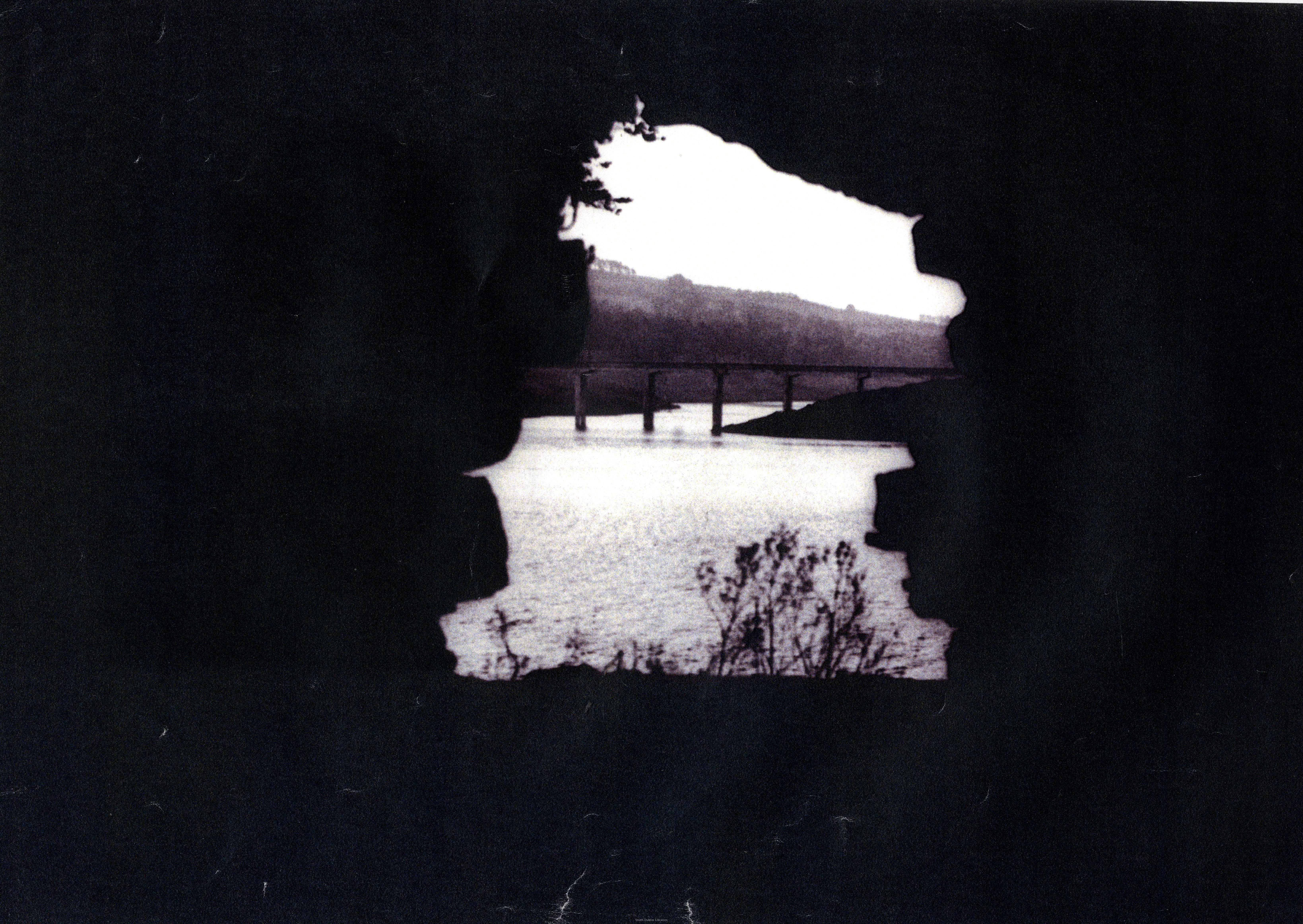 View/Open |
This item is protected by original copyright |
Items in Source are protected by copyright, with all rights reserved, unless otherwise indicated.