South Dublin County Libraries
Please use this identifier to cite or link to this item:
https://hdl.handle.net/10599/12538Full metadata record
| DC Field | Value | Language |
|---|---|---|
| dc.contributor.author | South Dublin Libraries | en_IE |
| dc.coverage.spatial | ---Tallaght | en_IE |
| dc.coverage.temporal | 2021-08-23 | en_IE |
| dc.date.accessioned | 2021-10-20T02:00:21Z | - |
| dc.date.available | 2021-10-20T02:00:21Z | - |
| dc.date.issued | 1995 | en_IE |
| dc.identifier.other | wm_Aerial02.jpg wm_Aerial02_now.jpg | |
| dc.identifier.uri | https://hdl.handle.net/10599/12538 | - |
| dc.description | Aerial view of Tallaght including part of Roadstone Quarry, Oscar Park, St. Anne's and St. Mark's schools. Also the site of Katharine Tynan Road. Current view from Google Earth for comparison. | en_IE |
| dc.format | TIFF | en_IE |
| dc.language.iso | English | en_IE |
| dc.rights | Reproduced courtesy of the Irish Air Corps | en_IE |
| dc.subject | St. Anne's School | en_IE |
| dc.subject | Bothar Katharine Tynan | en_IE |
| dc.subject | Roadstone Quarry | en_IE |
| dc.title | 1995 Aerial view of Tallaght including part of Roadstone Quarry and Oscar Park | en_IE |
| dc.type | Image | en_IE |
| dc.internal.visibility | 1 | en_IE |
| dc.coverage.latitude | 53.29445060677984 | en_IE |
| dc.coverage.longitude | -6.390719836752246 | en_IE |
| dc.rights.allowmp3download | Yes | en_IE |
| Appears in Collections: | Published Items South Dublin Libraries Images | |
Files in This Item:
| File | Description | Size | Format | |
|---|---|---|---|---|
| wm_Aerial02.jpg | Generated Web Image | 2.48 MB | JPEG |  View/Open |
| wm_Aerial02_now.jpg | Generated Web Image | 789.32 kB | JPEG | 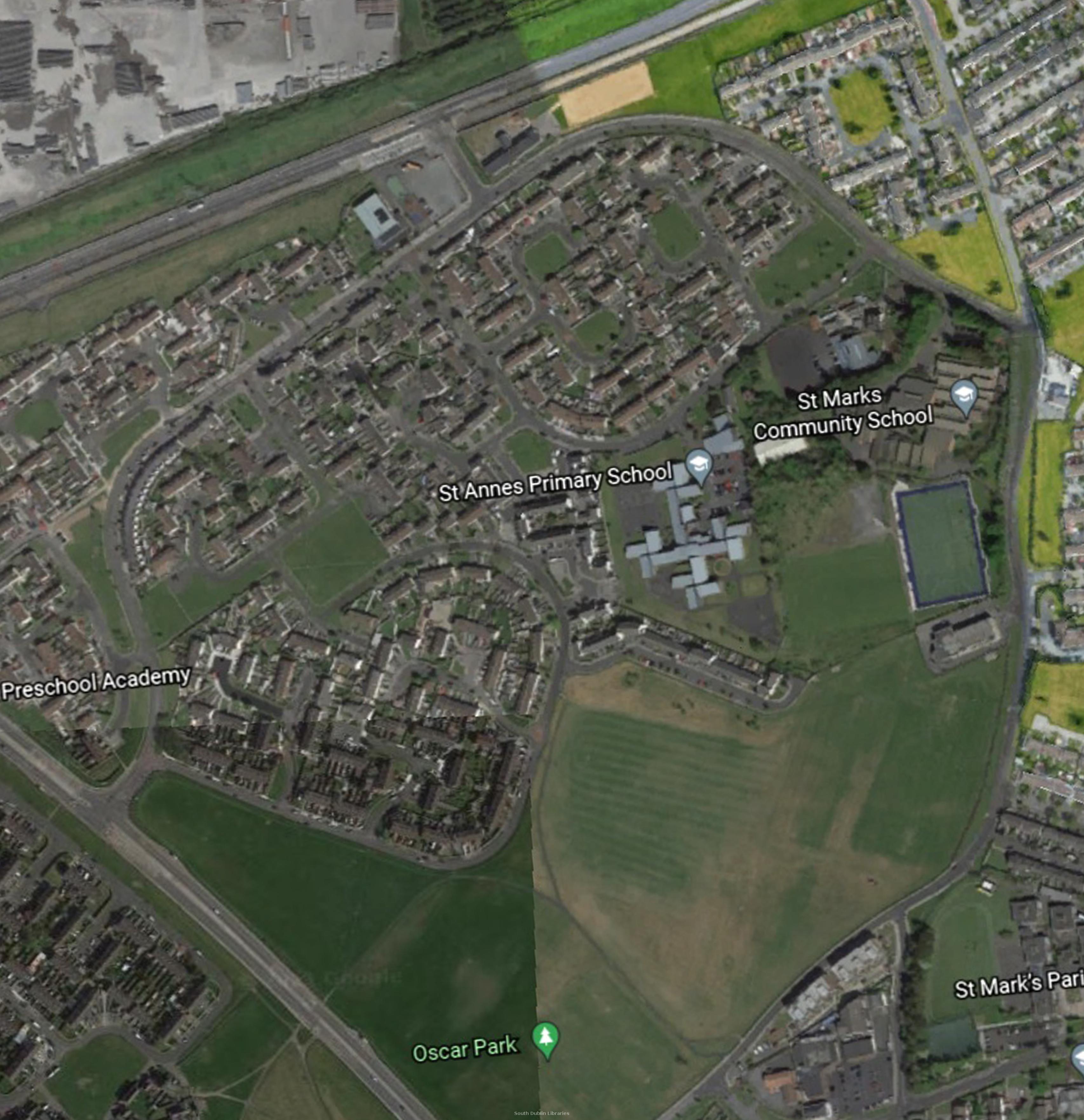 View/Open |
This item is protected by original copyright |
Items in Source are protected by copyright, with all rights reserved, unless otherwise indicated.