South Dublin County Libraries
Please use this identifier to cite or link to this item:
https://hdl.handle.net/10599/12581Full metadata record
| DC Field | Value | Language |
|---|---|---|
| dc.contributor.author | South Dublin Libraries | en_IE |
| dc.contributor.other | Unknown | en_IE |
| dc.coverage.spatial | ---Tallaght | en_IE |
| dc.coverage.temporal | 2021-22-09 | en_IE |
| dc.date.accessioned | 2021-10-20T02:00:25Z | - |
| dc.date.available | 2021-10-20T02:00:25Z | - |
| dc.date.issued | 1995 | en_IE |
| dc.identifier.other | wm_Aerial06.jpg wm_Aerial06_Now.jpg | |
| dc.identifier.uri | https://hdl.handle.net/10599/12581 | - |
| dc.description | Aerial view of Tallaght including St. Dominic's, Scoil Santain and part of Dodder Valley Park. Current view from Google Earth for comparison. | en_IE |
| dc.format | TIFF | en_IE |
| dc.language.iso | English | en_IE |
| dc.rights | Reproduced courtesy of the Irish Air Corps | en_IE |
| dc.subject | Aerial Views of Tallaght | en_IE |
| dc.subject | Urban Development | en_IE |
| dc.title | Mid-90s Aerial view of Tallaght including St. Dominic's, Scoil Santain and part of Dodder Valley Park | en_IE |
| dc.type | Image | en_IE |
| dc.internal.visibility | 1 | en_IE |
| dc.rights.allowmp3download | Yes | en_IE |
| Appears in Collections: | Published Items South Dublin Libraries Images | |
Files in This Item:
| File | Description | Size | Format | |
|---|---|---|---|---|
| wm_Aerial06.jpg | Generated Web Image | 3.46 MB | JPEG | 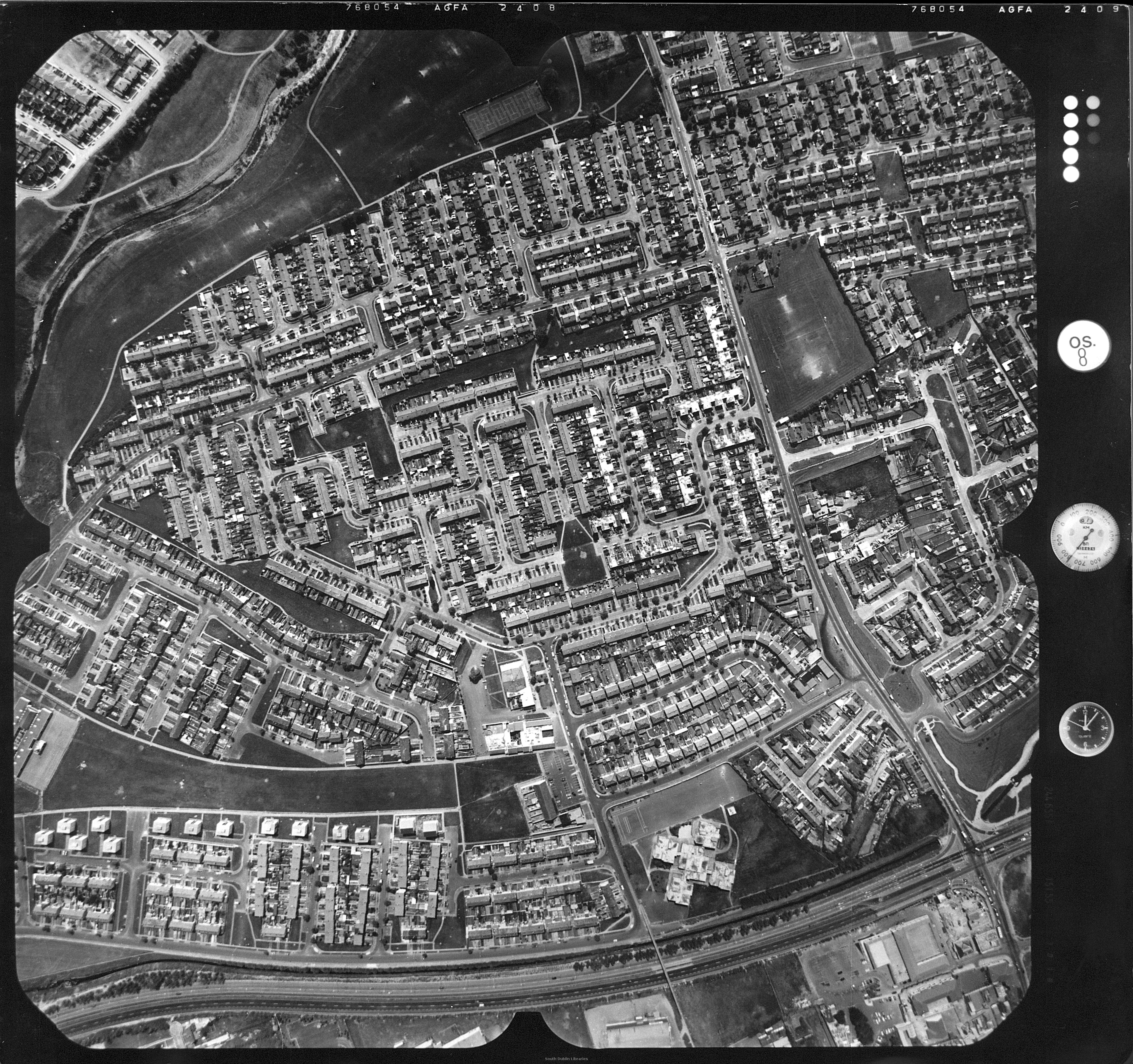 View/Open |
| wm_Aerial06_Now.jpg | Generated Web Image | 254.57 kB | JPEG | 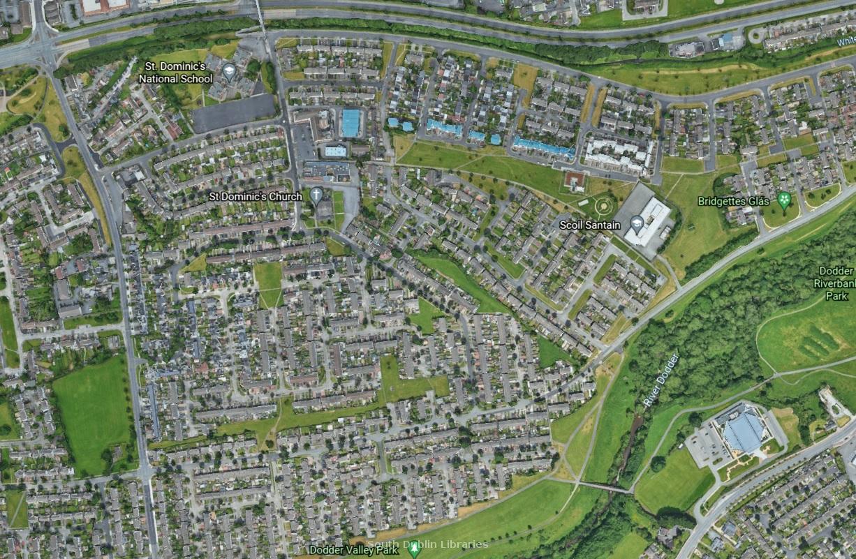 View/Open |
This item is protected by original copyright |
Items in Source are protected by copyright, with all rights reserved, unless otherwise indicated.