South Dublin County Libraries
Please use this identifier to cite or link to this item:
https://hdl.handle.net/10599/12594Full metadata record
| DC Field | Value | Language |
|---|---|---|
| dc.contributor.author | South Dublin Libraries | en_IE |
| dc.contributor.other | South Dublin Libraries | en_IE |
| dc.coverage.spatial | ---Tallaght | en_IE |
| dc.coverage.temporal | 2021-03-24 | en_IE |
| dc.date.accessioned | 2021-10-20T02:00:22Z | - |
| dc.date.available | 2021-10-20T02:00:22Z | - |
| dc.date.issued | 1995 | en_IE |
| dc.identifier.other | wm_Aerial26.jpg wm_Aerial26_Now.jpg | |
| dc.identifier.uri | https://hdl.handle.net/10599/12594 | - |
| dc.description | Then and Now: Aerial photograph of Tallaght from mid 90s showing the area between the Square Industrial Complex and TU Tallaght | en_IE |
| dc.format | TIFF | en_IE |
| dc.language.iso | English | en_IE |
| dc.rights | Reproduced courtesy of the Irish Air Corps | en_IE |
| dc.subject | Tallaght Institute of Technology | en_IE |
| dc.subject | Aerial Photograph | en_IE |
| dc.title | Then and Now: Aerial photograph of Tallaght from mid 90s showing the area between the Square Industrial Complex and TU Tallaght | en_IE |
| dc.type | Image | en_IE |
| dc.internal.visibility | 1 | en_IE |
| dc.coverage.latitude | 53.290439080958194 | en_IE |
| dc.coverage.longitude | -6.367382930802346 | en_IE |
| dc.rights.allowmp3download | Yes | en_IE |
| Appears in Collections: | Published Items South Dublin Libraries Images | |
Files in This Item:
| File | Description | Size | Format | |
|---|---|---|---|---|
| wm_Aerial26.jpg | Generated Web Image | 2.59 MB | JPEG | 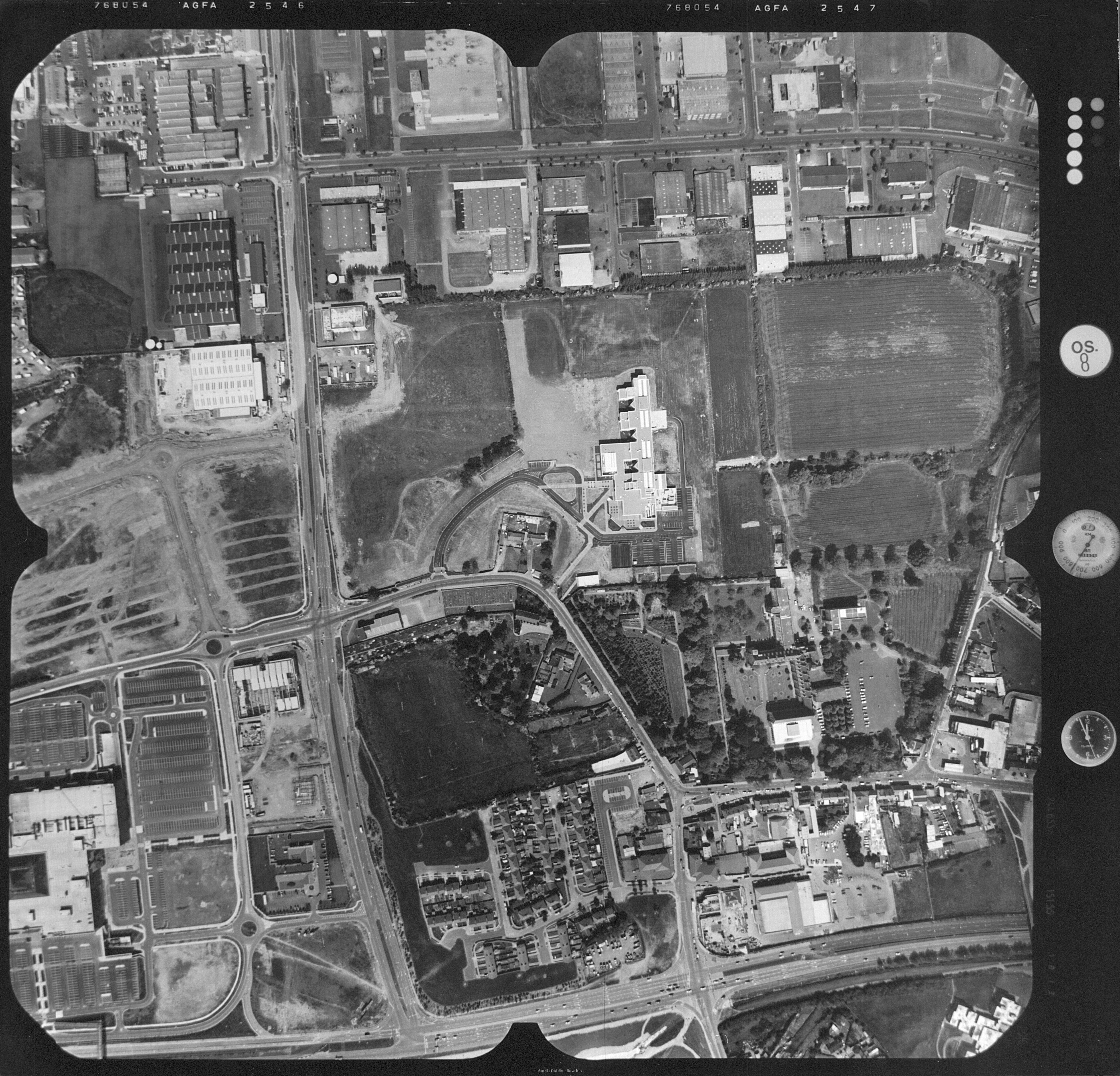 View/Open |
| wm_Aerial26_Now.jpg | Generated Web Image | 228.75 kB | JPEG | 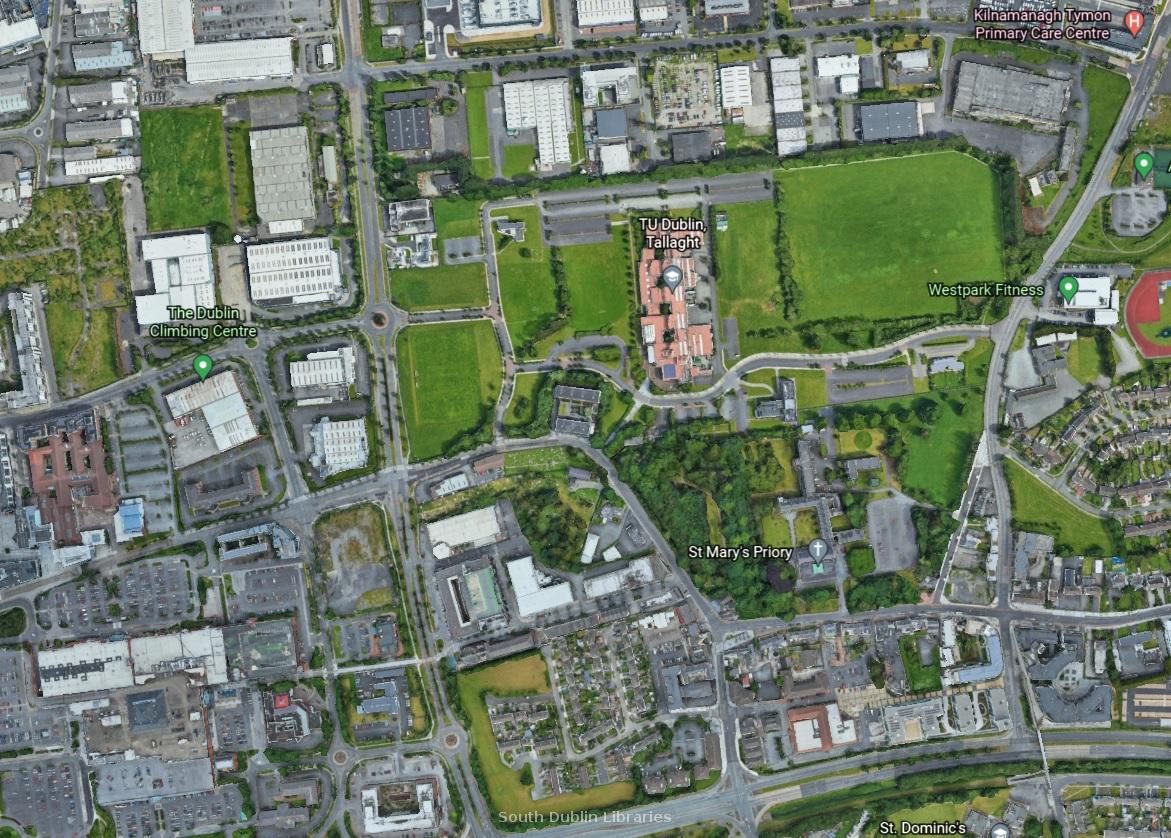 View/Open |
This item is protected by original copyright |
Items in Source are protected by copyright, with all rights reserved, unless otherwise indicated.