South Dublin County Libraries
Please use this identifier to cite or link to this item:
https://hdl.handle.net/10599/12596Full metadata record
| DC Field | Value | Language |
|---|---|---|
| dc.contributor.author | South Dublin Libraries | |
| dc.contributor.other | South Dublin Libraries | |
| dc.coverage.spatial | ---Tallaght | en_IE |
| dc.coverage.temporal | 2021-03-24 | en_IE |
| dc.date.accessioned | 2022-11-30T03:30:23Z | - |
| dc.date.available | 2022-11-30T03:30:23Z | - |
| dc.date.issued | 1968 | |
| dc.identifier.other | wm_19_Aerial17.jpg wm_19_Aerial16_Now.jpg wm_19_Aerial16.jpg | |
| dc.identifier.uri | https://hdl.handle.net/10599/12596 | - |
| dc.description | Two aerial photos and a modern day view of Tallaght Village (at top, right) and the area south west of it before it was developed. Possibly 1960s | en_IE |
| dc.format | JPEG | en_IE |
| dc.language.iso | English | en_IE |
| dc.rights | Reproduced courtesy of the Irish Air Corps | en_IE |
| dc.subject | Tallaght Urban Development | en_IE |
| dc.title | Two aerial photos and a modern day view of Tallaght Village (at top, right) and the area south west. Possibly 1960s | en_IE |
| dc.type | Image | en_IE |
| dc.internal.visibility | 1 | en_IE |
| dc.coverage.latitude | 53.28330152275629 | en_IE |
| dc.coverage.longitude | -6.386426378486225 | en_IE |
| dc.rights.allowmp3download | Yes | en_IE |
| Appears in Collections: | Published Items South Dublin Libraries Images | |
Files in This Item:
| File | Description | Size | Format | |
|---|---|---|---|---|
| wm_19_Aerial16_Now.jpg | Generated Web Image | 264.93 kB | JPEG | 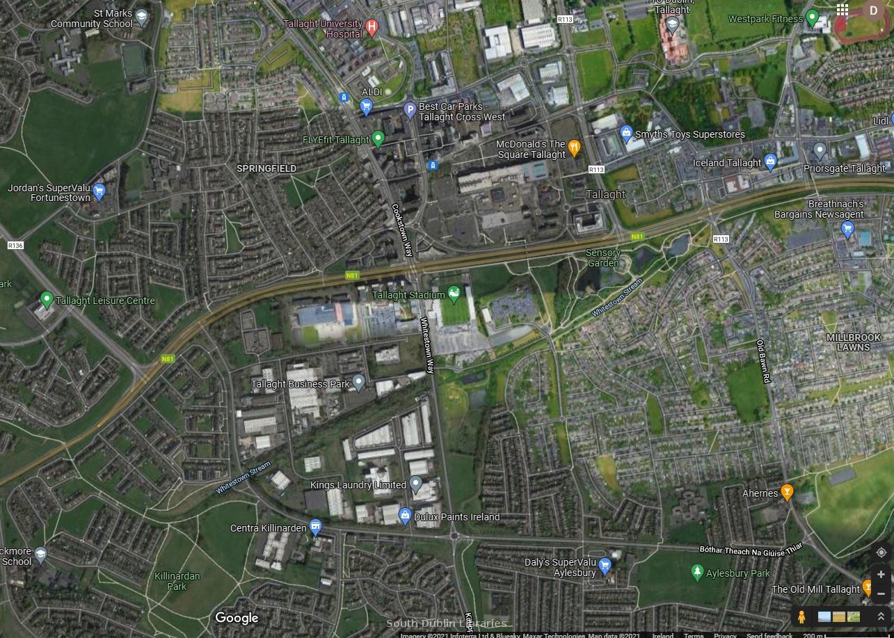 View/Open |
| wm_19_Aerial17.jpg | Generated Web Image | 2.52 MB | JPEG | 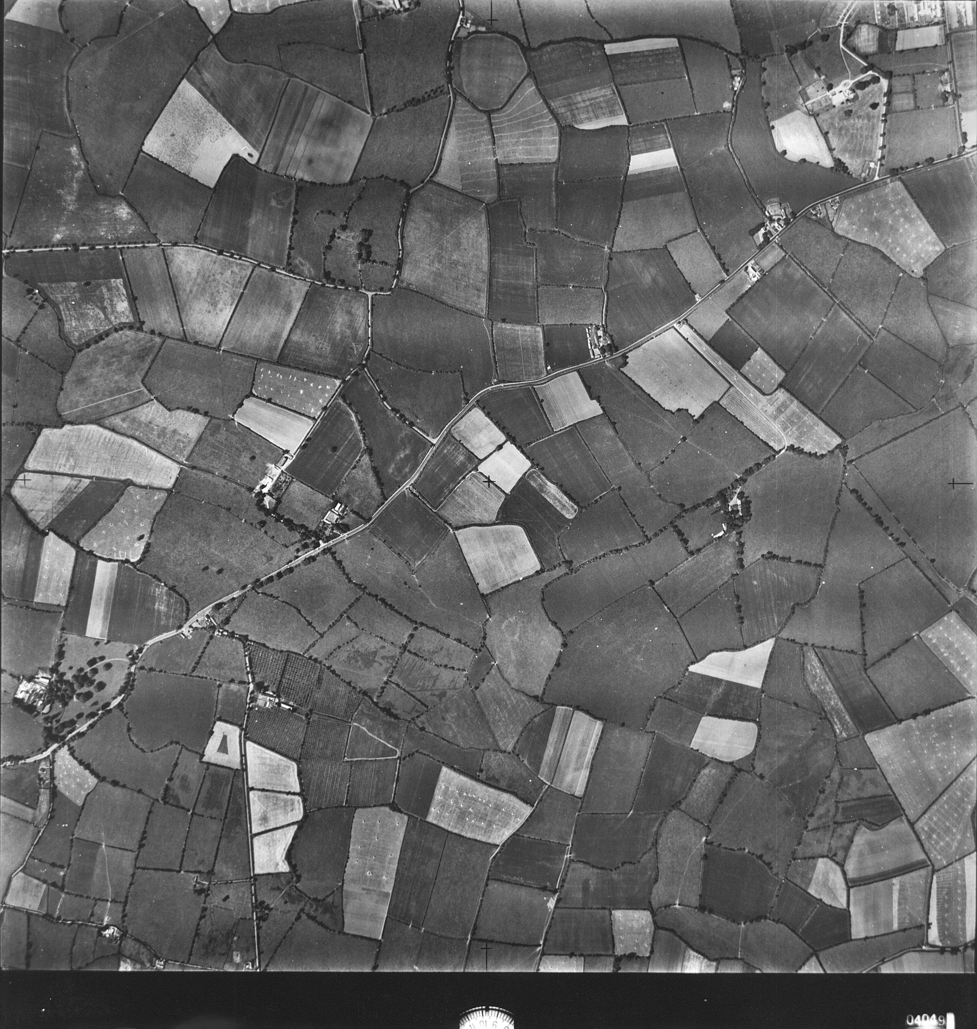 View/Open |
| wm_19_Aerial16.jpg | Generated Web Image | 2.77 MB | JPEG | 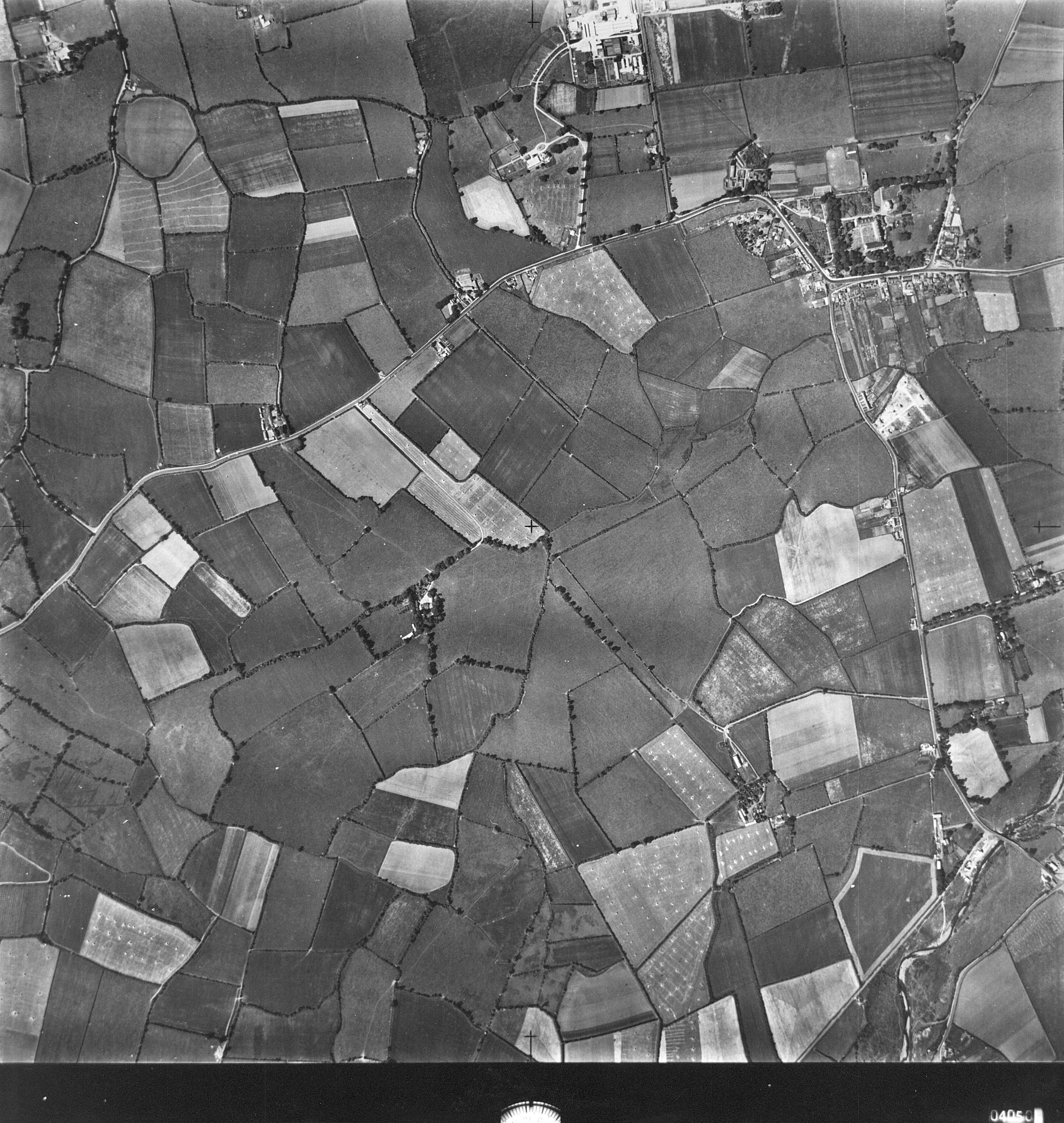 View/Open |
This item is protected by original copyright |
Items in Source are protected by copyright, with all rights reserved, unless otherwise indicated.