South Dublin County Libraries
Please use this identifier to cite or link to this item:
https://hdl.handle.net/10599/4943Full metadata record
| DC Field | Value | Language |
|---|---|---|
| dc.contributor.author | Ordnance Survey | en_IE |
| dc.contributor.other | Courtesy of Andrew Bonar Law | en_IE |
| dc.coverage.spatial | Rathcoole | en_IE |
| dc.coverage.temporal | 1865 | en_IE |
| dc.date.accessioned | 2010-04-22T15:34:19Z | - |
| dc.date.available | 2010-04-22T15:34:19Z | - |
| dc.date.issued | 2009-09-07T16:30:11Z | en_IE |
| dc.identifier.other | wm_25OS_Rathcoole.jpg | |
| dc.identifier.uri | https://hdl.handle.net/10599/4943 | - |
| dc.description | Portion of Parish of Rathcoole, Co. Dublin, comprised of sheets XXI.9 and XXI.10 (Scale 1:2,500) | en_IE |
| dc.format | .tif | en_IE |
| dc.language.iso | English | en_IE |
| dc.publisher | Ordnance Survey | en_IE |
| dc.subject | map | en_IE |
| dc.subject | pound | en_IE |
| dc.subject | St. Bridget's Well | en_IE |
| dc.subject | Rathcoole Lodge | en_IE |
| dc.subject | blacksmith | en_IE |
| dc.subject | Glebe | en_IE |
| dc.subject | Rathcoole House | en_IE |
| dc.title | Parish of Rathcoole, Co. Dublin | en_IE |
| dc.type | image | en_IE |
| Appears in Collections: | Maps Published Items | |
Files in This Item:
| File | Description | Size | Format | |
|---|---|---|---|---|
| wm_25OS_Rathcoole.jpg | 1.39 MB | JPEG | 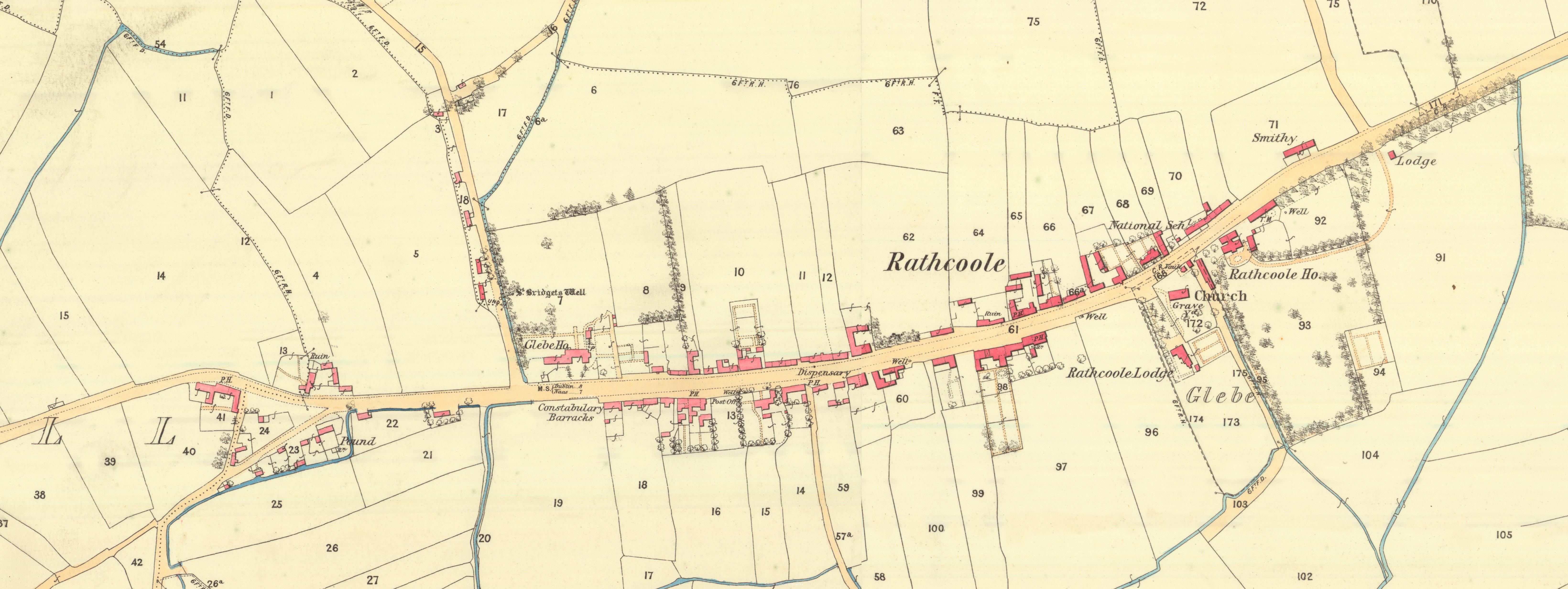 View/Open |
This item is protected by original copyright |
Items in Source are protected by copyright, with all rights reserved, unless otherwise indicated.