South Dublin County Libraries
Please use this identifier to cite or link to this item:
https://hdl.handle.net/10599/4948Full metadata record
| DC Field | Value | Language |
|---|---|---|
| dc.contributor.author | Taylor, John | en_IE |
| dc.contributor.other | Courtesy of Andrew Bonar Law | en_IE |
| dc.coverage.spatial | Tallaght, Old Bawn, Tymon, Jobstown | en_IE |
| dc.coverage.temporal | 1816 | en_IE |
| dc.date.accessioned | 2010-02-23T12:45:10Z | - |
| dc.date.available | 2010-02-23T12:45:10Z | - |
| dc.date.issued | 2009-09-07T16:30:13Z | en_IE |
| dc.identifier.other | wm_Taylor_Tallaght.jpg | |
| dc.identifier.uri | https://hdl.handle.net/10599/4948 | - |
| dc.description | Portion of John Taylor's map of Dublin, showing Tallaght and surrounding area | en_IE |
| dc.format | .jpg | en_IE |
| dc.language.iso | English | en_IE |
| dc.publisher | John Taylor | en_IE |
| dc.subject | map | en_IE |
| dc.subject | Cookstown | en_IE |
| dc.subject | Newhall | en_IE |
| dc.subject | Jobstown House | en_IE |
| dc.subject | Springfield | en_IE |
| dc.subject | Upper Kiltalown | en_IE |
| dc.subject | forge | en_IE |
| dc.subject | Ballynamangh | en_IE |
| dc.subject | Old Bawn | en_IE |
| dc.subject | pond | en_IE |
| dc.subject | paper mills | en_IE |
| dc.subject | Killininny | en_IE |
| dc.subject | Ballycrane | en_IE |
| dc.subject | Allenstown | en_IE |
| dc.subject | Lands of Timmins | en_IE |
| dc.subject | post office | en_IE |
| dc.subject | Archbishops of Dublin's Palace | en_IE |
| dc.subject | Balrothery Hills | en_IE |
| dc.subject | mills | en_IE |
| dc.subject | sporting hall | en_IE |
| dc.subject | Moor House | en_IE |
| dc.subject | Bolbrook | en_IE |
| dc.subject | Bowlbrook | en_IE |
| dc.subject | Sallypark | en_IE |
| dc.subject | Mount Prospect | en_IE |
| dc.subject | Firhouse | en_IE |
| dc.subject | Furhouse | en_IE |
| dc.subject | old church | en_IE |
| dc.subject | new road | en_IE |
| dc.title | Taylor's map of the environs of Dublin extending 10 to 14 miles from the castle by actual survey on a scale of 2 inches to one mile [Tallaght] | en_IE |
| dc.type | image | en_IE |
| Appears in Collections: | Maps Published Items | |
Files in This Item:
| File | Description | Size | Format | |
|---|---|---|---|---|
| wm_Taylor_Tallaght.jpg | 591.33 kB | JPEG | 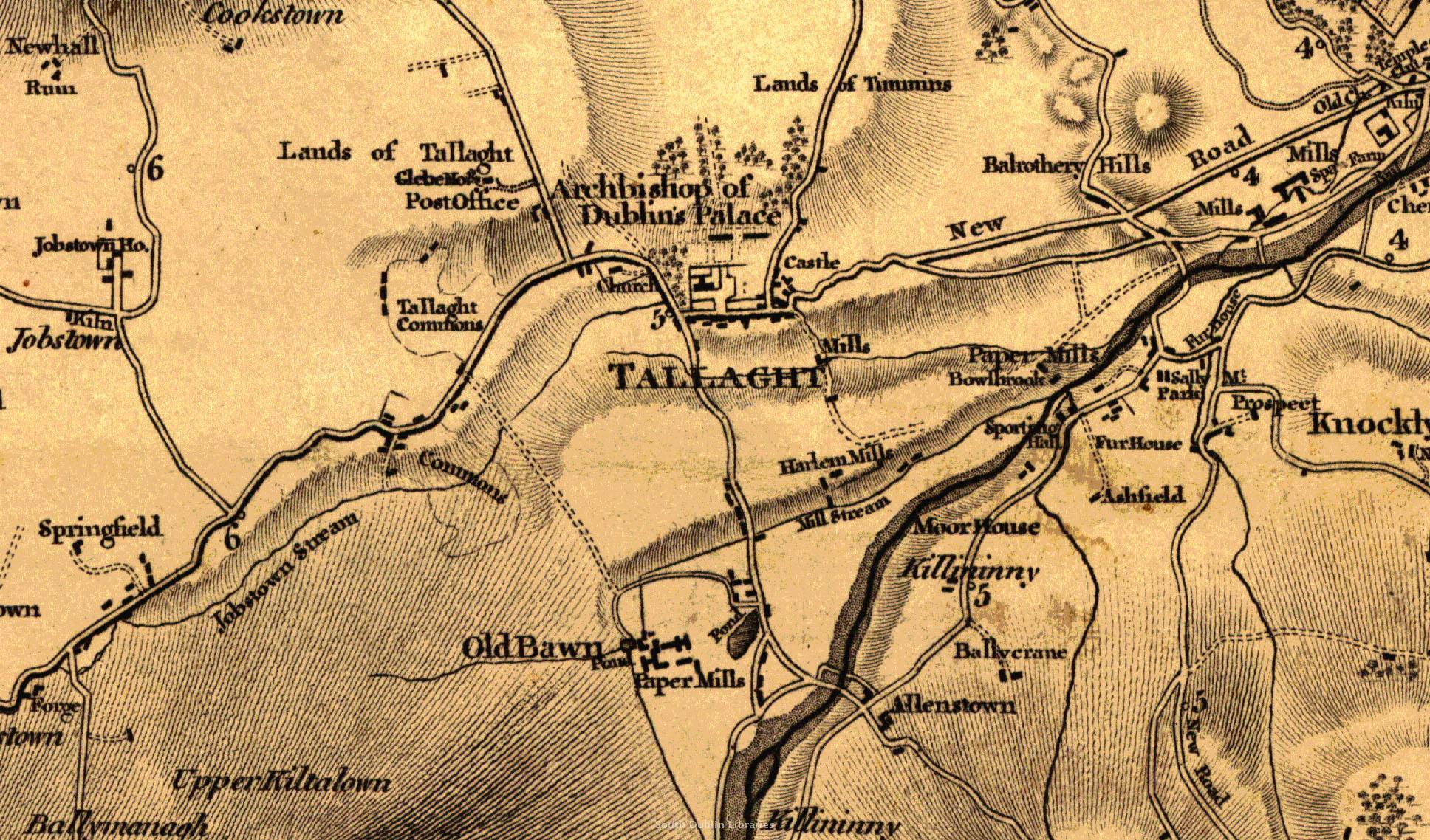 View/Open |
This item is protected by original copyright |
Items in Source are protected by copyright, with all rights reserved, unless otherwise indicated.