South Dublin County Libraries
Please use this identifier to cite or link to this item:
https://hdl.handle.net/10599/4950Full metadata record
| DC Field | Value | Language |
|---|---|---|
| dc.contributor.author | Taylor, John | en_IE |
| dc.contributor.other | Courtesy of Andrew Bonar Law | en_IE |
| dc.coverage.spatial | Rathcoole | en_IE |
| dc.coverage.temporal | 1816 | en_IE |
| dc.date.accessioned | 2010-02-23T12:36:21Z | - |
| dc.date.available | 2010-02-23T12:36:21Z | - |
| dc.date.issued | 2009-09-07T16:30:14Z | en_IE |
| dc.identifier.other | wm_Taylor_Rathcoole.jpg | |
| dc.identifier.uri | https://hdl.handle.net/10599/4950 | - |
| dc.description | Portion of John Taylor's map of Dublin, showing Rathcoole and surrounding area | en_IE |
| dc.format | .jpg | en_IE |
| dc.language.iso | English | en_IE |
| dc.publisher | John Taylor | en_IE |
| dc.subject | map | en_IE |
| dc.subject | Rathcreedan | en_IE |
| dc.subject | the Commons | en_IE |
| dc.subject | Charter School | en_IE |
| dc.subject | Tootens Hill | en_IE |
| dc.subject | Athgoe Hill | en_IE |
| dc.subject | Colmanstown | en_IE |
| dc.subject | mill | en_IE |
| dc.subject | church | en_IE |
| dc.subject | college | en_IE |
| dc.subject | Claytons Park | en_IE |
| dc.subject | Broadfield | en_IE |
| dc.subject | Windmill Stump | en_IE |
| dc.subject | Rathcoole Hill | en_IE |
| dc.subject | castle | en_IE |
| dc.subject | Coolmind | en_IE |
| dc.subject | en_IE | |
| dc.title | Taylor's map of the environs of Dublin extending 10 to 14 miles from the castle by actual survey on a scale of 2 inches to one mile [Rathcoole] | en_IE |
| dc.type | image | en_IE |
| Appears in Collections: | Maps Published Items | |
Files in This Item:
| File | Description | Size | Format | |
|---|---|---|---|---|
| wm_Taylor_Rathcoole.jpg | 505.8 kB | JPEG | 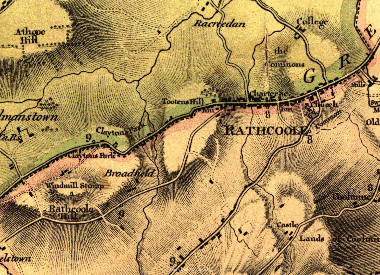 View/Open |
This item is protected by original copyright |
Items in Source are protected by copyright, with all rights reserved, unless otherwise indicated.