South Dublin County Libraries
Please use this identifier to cite or link to this item:
https://hdl.handle.net/10599/4963Full metadata record
| DC Field | Value | Language |
|---|---|---|
| dc.contributor.author | Duncan, William | en_IE |
| dc.coverage.spatial | Palmerstown, Palmerston, Quarryvale, Irishtown, Peamount, Airfield, Astagob, Knockmaroon Hill, Larkfield | en_IE |
| dc.coverage.temporal | 1821 | en_IE |
| dc.date.accessioned | 2017-02-21T03:01:21Z | - |
| dc.date.available | 2017-02-21T03:01:21Z | - |
| dc.date.issued | 2009-09-07T16:32:32Z | en_IE |
| dc.identifier.other | wm_Duncan_Palmerstown.jpg | en_IE |
| dc.identifier.uri | https://hdl.handle.net/10599/4963 | - |
| dc.description | Portion of William Duncan's Map of the County of Dublin, 1821, showing Palmerstown Village and surrounding area | en_IE |
| dc.format | .jpg | en_IE |
| dc.language.iso | English | en_IE |
| dc.subject | map | en_IE |
| dc.subject | Mardike Mills | en_IE |
| dc.subject | Red Mills | en_IE |
| dc.subject | Mount Sackville | en_IE |
| dc.subject | Farmley | en_IE |
| dc.subject | Mount Hybla | en_IE |
| dc.subject | Palmerstown | en_IE |
| dc.title | Maps of the County of Dublin [Palmerstown] | en_IE |
| dc.type | image | en_IE |
| Appears in Collections: | Maps Published Items | |
Files in This Item:
| File | Description | Size | Format | |
|---|---|---|---|---|
| wm_Duncan_Palmerstown.jpg | 406.84 kB | JPEG | 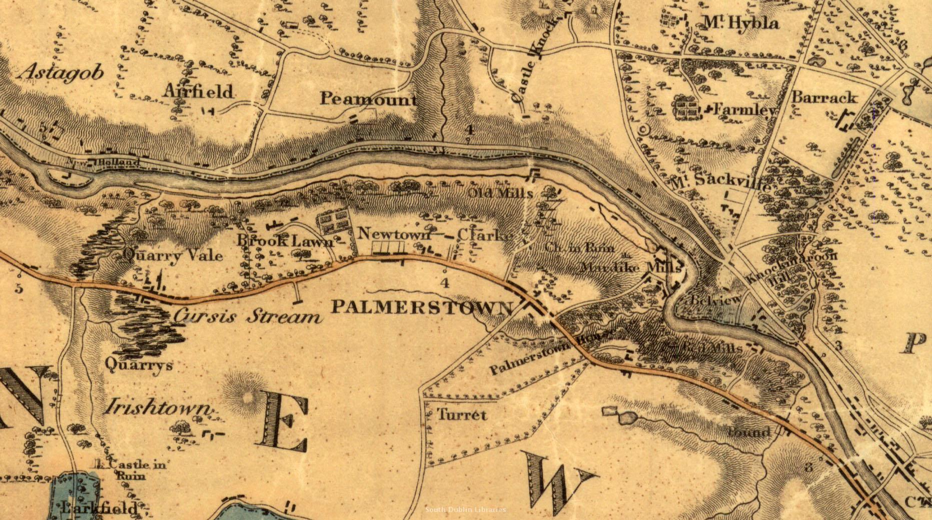 View/Open |
This item is protected by original copyright |
Items in Source are protected by copyright, with all rights reserved, unless otherwise indicated.