South Dublin County Libraries
Please use this identifier to cite or link to this item:
https://hdl.handle.net/10599/5036Full metadata record
| DC Field | Value | Language |
|---|---|---|
| dc.contributor.author | Ordnance Survey | en_IE |
| dc.contributor.other | Courtesy of Andrew Bonar Law | en_IE |
| dc.coverage.spatial | Saggart | en_IE |
| dc.coverage.temporal | 1870 | en_IE |
| dc.date.accessioned | 2011-03-29T02:01:29Z | - |
| dc.date.available | 2011-03-29T02:01:29Z | - |
| dc.date.issued | 2009-09-07T17:21:47Z | en_IE |
| dc.identifier.other | wm_25OS_Saggart.jpg | |
| dc.identifier.uri | https://hdl.handle.net/10599/5036 | - |
| dc.description | Portion of Parish of Saggart, Co. Dublin sheet XVI.1 (Scale 1:2,500) | en_IE |
| dc.format | .tif | en_IE |
| dc.language.iso | English | en_IE |
| dc.publisher | Ordnance Survey | en_IE |
| dc.subject | map | en_IE |
| dc.subject | Saggart House | en_IE |
| dc.subject | parochial house | en_IE |
| dc.subject | graveyard | en_IE |
| dc.subject | post office | en_IE |
| dc.subject | well | en_IE |
| dc.subject | Swiftbrook | en_IE |
| dc.subject | paper mill | en_IE |
| dc.subject | gasometer | en_IE |
| dc.subject | mill pond | en_IE |
| dc.subject | Moneyatta Commons | en_IE |
| dc.subject | Fair Green | en_IE |
| dc.subject | National School | en_IE |
| dc.subject | summer house | en_IE |
| dc.title | Parish of Saggart, Co. Dublin sheet XVI.1 | en_IE |
| dc.type | image | en_IE |
| Appears in Collections: | Maps Published Items | |
Files in This Item:
| File | Description | Size | Format | |
|---|---|---|---|---|
| wm_25OS_Saggart.jpg | 2.24 MB | JPEG | 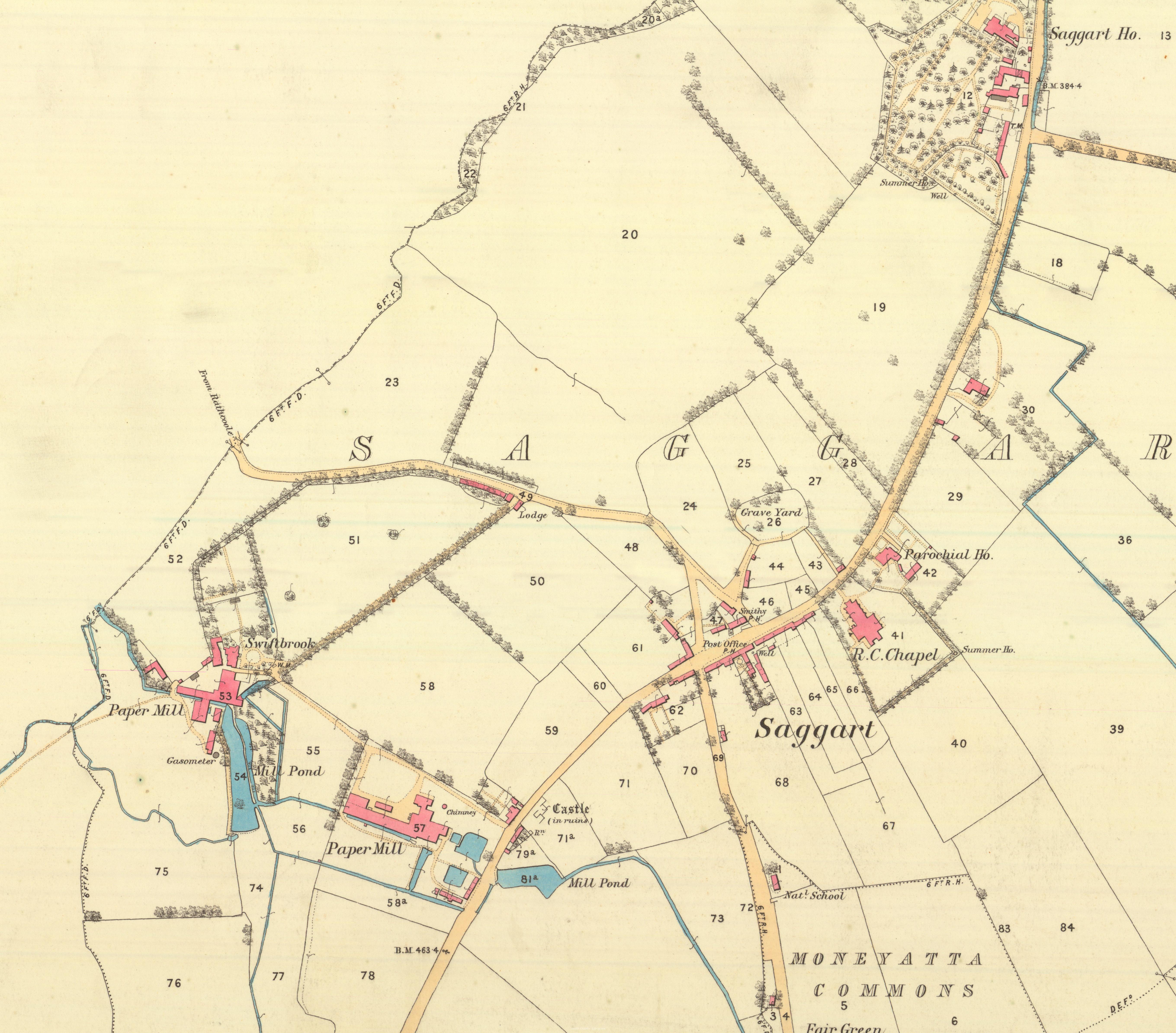 View/Open |
This item is protected by original copyright |
Items in Source are protected by copyright, with all rights reserved, unless otherwise indicated.