South Dublin County Libraries
Please use this identifier to cite or link to this item:
https://hdl.handle.net/10599/7353Full metadata record
| DC Field | Value | Language |
|---|---|---|
| dc.contributor.other | National Inventory of Architectural Heritage | en_IE |
| dc.coverage.spatial | ---Firhouse | en_IE |
| dc.coverage.temporal | 1775 | en_IE |
| dc.date.accessioned | 2011-08-11T02:00:59Z | - |
| dc.date.available | 2011-08-11T02:00:59Z | - |
| dc.date.copyright | Reproduced with kind permission of the Department of the Environment, Heritage and Local Government. South Dublin Libraries do not own the reproduction rights to this image. If you wish to reproduce this image see contact details at http://www.buildingsofireland.ie | en_IE |
| dc.date.issued | 2002-01-01 | en_IE |
| dc.identifier.other | wm_11215019_1.jpg | |
| dc.identifier.uri | https://hdl.handle.net/10599/7353 | - |
| dc.description | Weir set diagonally in River Dodder, c. 1775. Approximately 80 metres long set in three main stages from weir pool down to river, with an approximate drop of 10 metres. Group of sluice gates to weir and vicinity. | en_IE |
| dc.format | JPEG | en_IE |
| dc.language.iso | English | en_IE |
| dc.publisher | Department of the Environment, Heritage and Local Government | en_IE |
| dc.relation | National Inventory of Architectural Heritage ID: 11215019 | en_IE |
| dc.subject | Weir | en_IE |
| dc.subject | sluice gates | en_IE |
| dc.subject | lade | en_IE |
| dc.title | Firhouse Weir, Firhouse Road, Dublin, South Dublin County | en_IE |
| dc.type | Image | en_IE |
| dc.internal.visibility | 1 | en_IE |
| Appears in Collections: | National Inventory of Architectural Heritage Collection Published Items | |
Files in This Item:
| File | Description | Size | Format | |
|---|---|---|---|---|
| wm_11215019_1.jpg | Generated Web Image | 528.22 kB | JPEG | 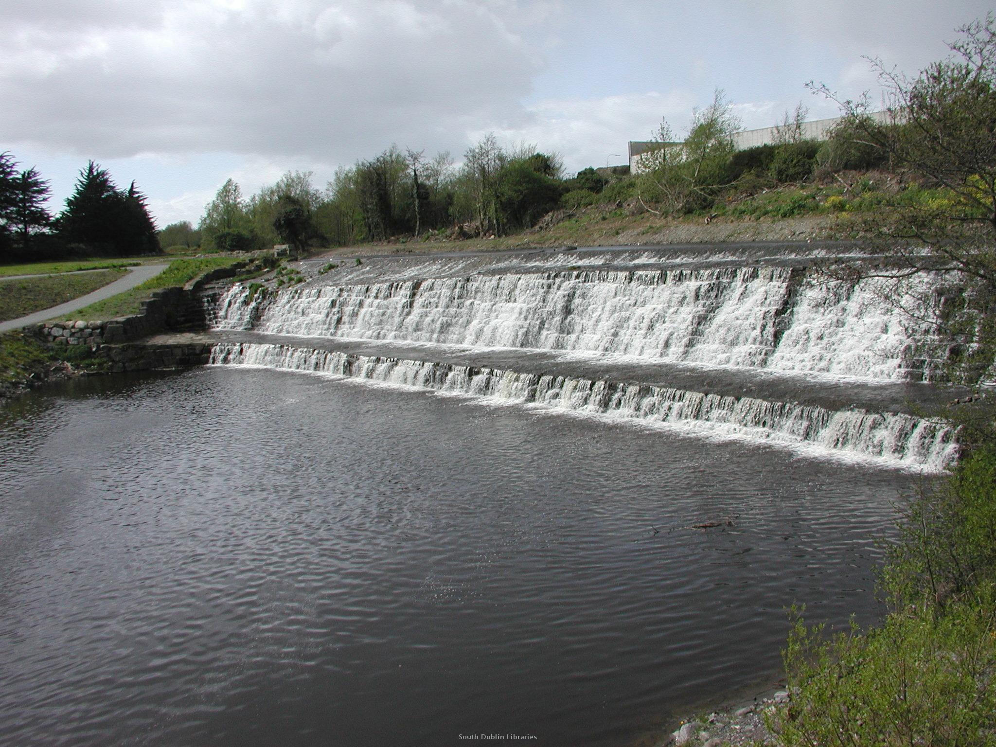 View/Open |
This item is protected by original copyright |
Items in Source are protected by copyright, with all rights reserved, unless otherwise indicated.