South Dublin County Libraries
Please use this identifier to cite or link to this item:
https://hdl.handle.net/10599/4949Full metadata record
| DC Field | Value | Language |
|---|---|---|
| dc.contributor.author | Rocque, John | en_IE |
| dc.contributor.other | Courtesy of Andrew Bonar Law | en_IE |
| dc.coverage.spatial | Newcastle | en_IE |
| dc.coverage.temporal | 1760 | en_IE |
| dc.date.accessioned | 2010-02-23T12:43:21Z | - |
| dc.date.available | 2010-02-23T12:43:21Z | - |
| dc.date.issued | 2009-09-07T16:30:13Z | en_IE |
| dc.identifier.other | wm_Rocque_Newcastle.jpg | |
| dc.identifier.uri | https://hdl.handle.net/10599/4949 | - |
| dc.description | Portion of John Rocque's map of County Dublin, 1760, showing Newcastle Village and the surrounding area. | en_IE |
| dc.format | .jpg | en_IE |
| dc.language.iso | English | en_IE |
| dc.subject | map | en_IE |
| dc.subject | New Park | en_IE |
| dc.subject | church | en_IE |
| dc.subject | Hazelhatch | en_IE |
| dc.subject | Newcastle House | en_IE |
| dc.subject | Bally McKelly | en_IE |
| dc.subject | Ragheredan | en_IE |
| dc.subject | lime kiln | en_IE |
| dc.title | An actual survey of the county of Dublin on the same scale as those of Middlesex, Oxford, Barks and Buckinghamshire by John Rocque [Newcastle] | en_IE |
| dc.type | image | en_IE |
| Appears in Collections: | Maps Published Items | |
Files in This Item:
| File | Description | Size | Format | |
|---|---|---|---|---|
| wm_Rocque_Newcastle.jpg | 346.02 kB | JPEG | 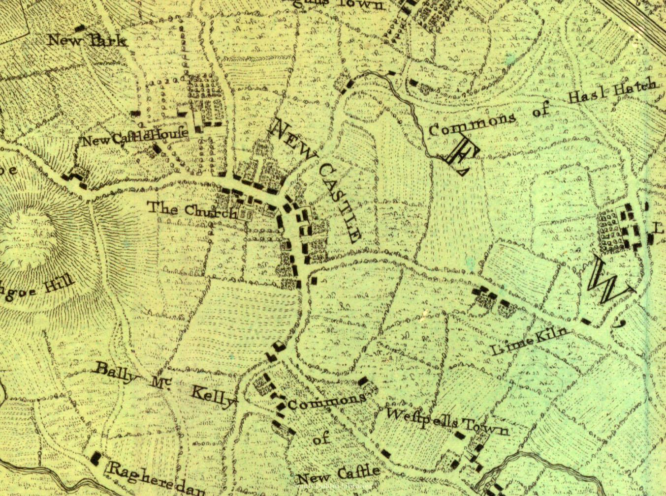 View/Open |
This item is protected by original copyright |
Items in Source are protected by copyright, with all rights reserved, unless otherwise indicated.