South Dublin County Libraries
Please use this identifier to cite or link to this item:
https://hdl.handle.net/10599/12189Full metadata record
| DC Field | Value | Language |
|---|---|---|
| dc.contributor.advisor | Lefroy, Laetitia | en_IE |
| dc.contributor.other | Lefroy, Laetitia | en_IE |
| dc.coverage.spatial | ---Clondalkin | en_IE |
| dc.coverage.temporal | 2018-02-16 | en_IE |
| dc.date.accessioned | 2020-09-08T02:00:17Z | - |
| dc.date.available | 2020-09-08T02:00:17Z | - |
| dc.date.issued | 1961-04-10 | en_IE |
| dc.identifier.other | Map2.tif Today.jpg wm_Map2.jpg wm_Today.jpg | en_IE |
| dc.identifier.uri | https://hdl.handle.net/10599/12189 | - |
| dc.description | Map showing lands at Corkagh as they appeared prior to their compulsory acquisition by Dublin County Council for Naas Road improvements. Of interest are townlands of Buckandhounds and Bedlesshill, and Rockfields house. Modern map included for comparison | en_IE |
| dc.format | TIFF | en_IE |
| dc.language.iso | English | en_IE |
| dc.rights | South Dublin Libraries Local Studies. | en_IE |
| dc.subject | Corkagh | en_IE |
| dc.subject | Clondalkin | en_IE |
| dc.subject | Corkagh estate | en_IE |
| dc.subject | Map | en_IE |
| dc.title | Map showing lands at Corkagh as they appeared prior to their compulsory acquisition by Dublin County Council | en_IE |
| dc.type | Image | en_IE |
| dc.internal.visibility | 1 | en_IE |
| dc.coverage.latitude | 53.310285 | en_IE |
| dc.coverage.longitude | -6.403020 | en_IE |
| dc.rights.allowmp3download | Yes | en_IE |
| Appears in Collections: | Documents Published Items | |
Files in This Item:
| File | Description | Size | Format | |
|---|---|---|---|---|
| wm_Today.jpg | Map of area today | 25.81 kB | JPEG | 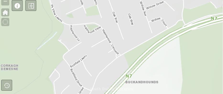 View/Open |
| wm_Map2.jpg | Map | 1.04 MB | JPEG | 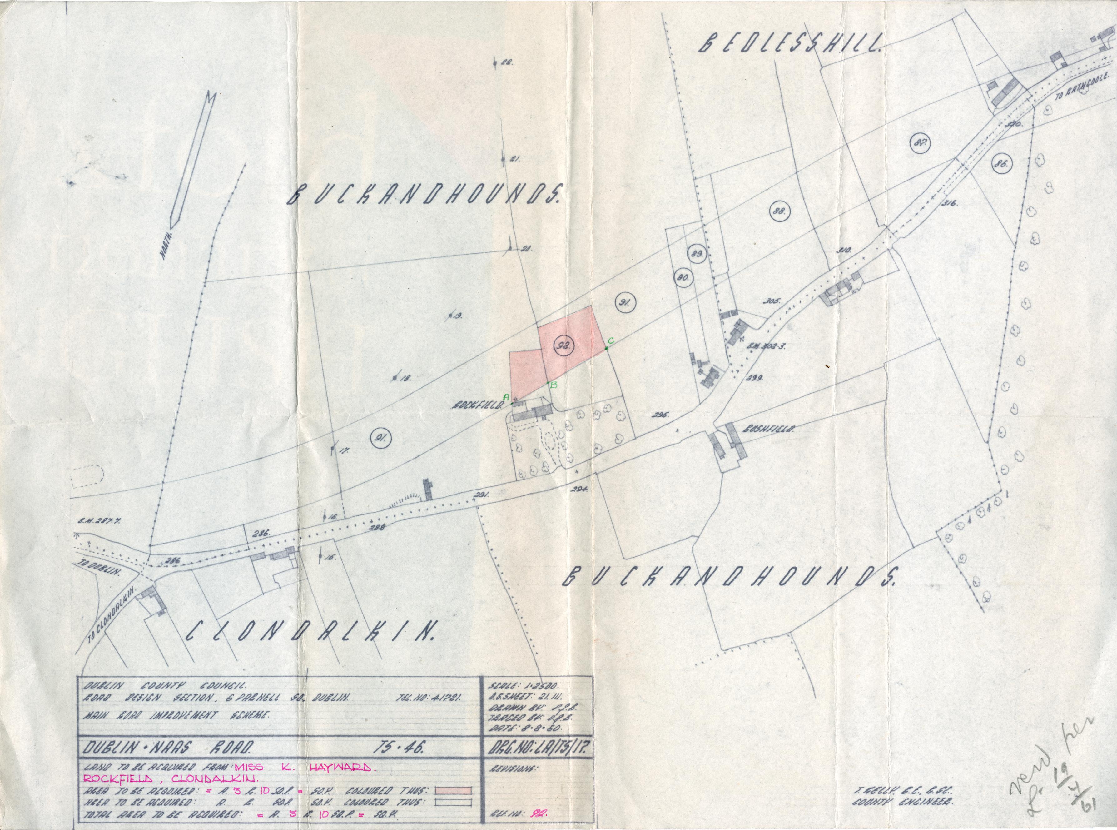 View/Open |
This item is protected by original copyright |
Items in Source are protected by copyright, with all rights reserved, unless otherwise indicated.