South Dublin County Libraries
Úsáid le do thoil an t-aitheantóir seo chun an mhír seo a lua nó a nascadh:
https://hdl.handle.net/10599/12537| Teideal: | Mid-1990s aerial view of the area surrounding the unbuilt Tallaght Hospital |
| Údair: | South Dublin Libraries |
| Eochairfhocail: | Tallaght Hospital Aerial view |
| Dáta Eisithe: | 1995 |
| Cur Síos: | Mid-1990s aerial view of the area surrounding the yet unbuilt Tallaght Hospital. Google Earth view for comparison. Hospital site visible along with portions of St. Mark's parish |
| URI: | https://hdl.handle.net/10599/12537 |
| Copyright: | Reproduced courtesy of the Irish Air Corps |
| Location: | Click here to view the location in Google Maps |
| Tá sé i mBailiúcháin: | Published Items South Dublin Libraries Images |
Comhaid sa Mhír seo:
| Comhad | Cur Síos | Méid | Formáid | |
|---|---|---|---|---|
| wm_Aerial01.jpg | Generated Web Image | 2.73 MB | JPEG | 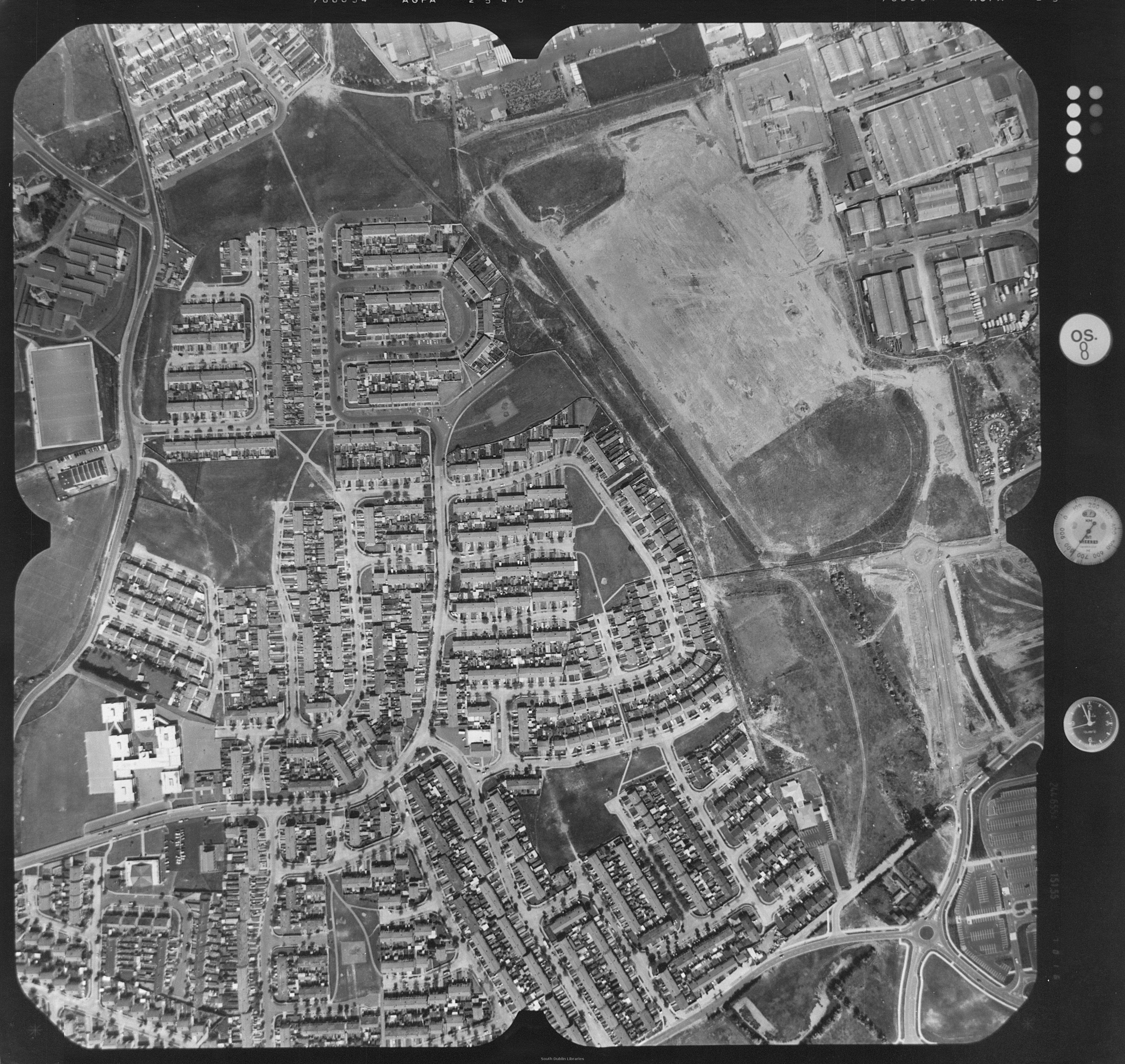 Féach/Oscail |
| wm_Aerial01_Now.jpg | Generated Web Image | 1.32 MB | JPEG | 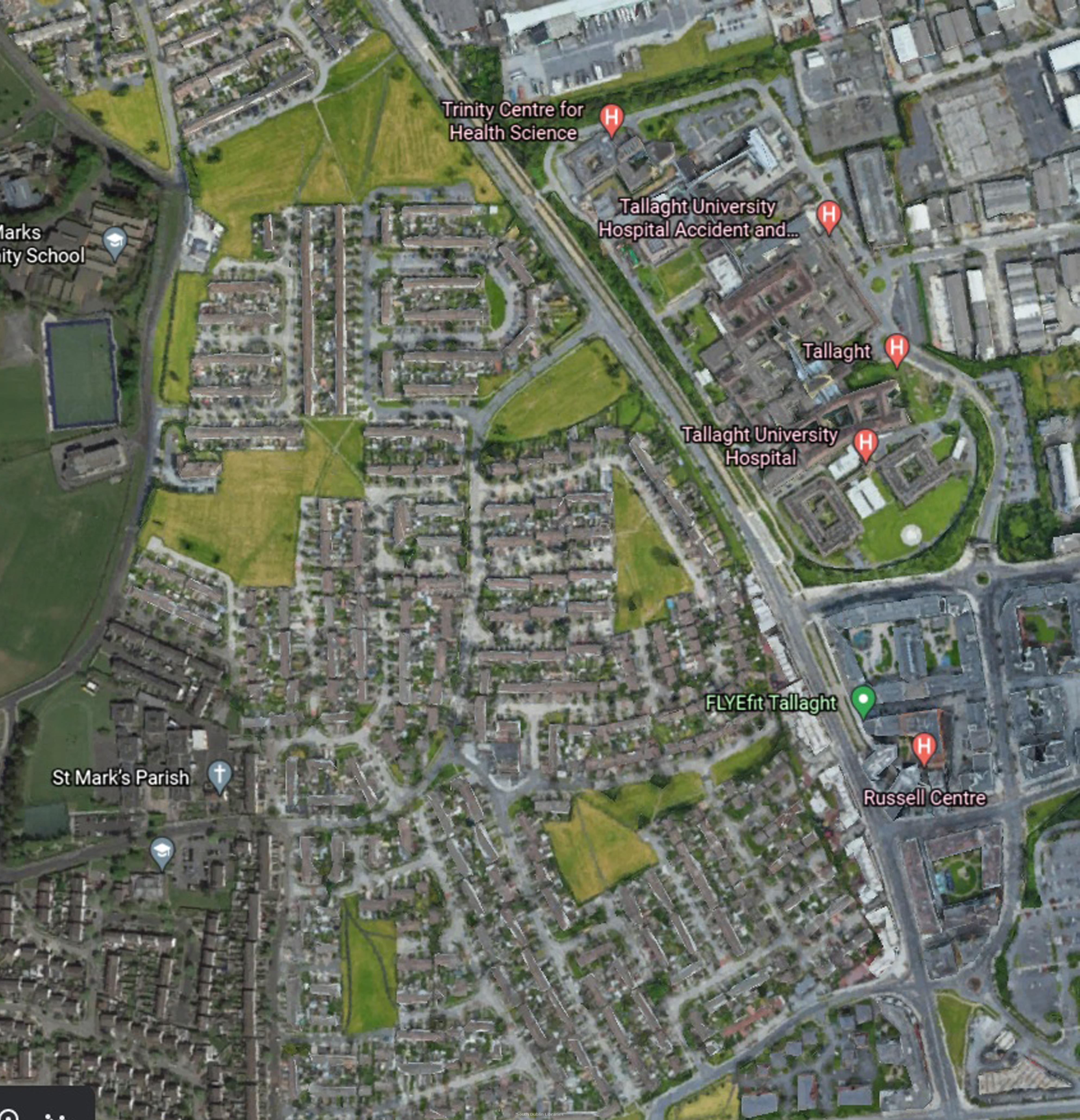 Féach/Oscail |
Tá cosaint chóipchirt bunaidh ag an mír seo |
Tá cosaint cóipchirt ag míreanna in Source, agus tá gach ceart ar cosaint, mura ndeirtear a mhalairt.