South Dublin County Libraries
Úsáid le do thoil an t-aitheantóir seo chun an mhír seo a lua nó a nascadh:
https://hdl.handle.net/10599/4529| Teideal: | Aerial view of Tallaght Hill |
| Údair: | Unknown |
| Eochairfhocail: | landscape ring fort aerial photograph archaeological site stone circle megalith |
| Dáta Eisithe: | 7-Meá-2009 |
| Foilsitheoir: | South Dublin County Council |
| Cur Síos: | Among the sites included in this view, obscured by vegetation, are partly destroyed megalith and stone circle, standing stones and multivallate Ring Fort known as Raheendhu |
| URI: | https://hdl.handle.net/10599/4529 |
| Copyright: | Blackrock Education Centre, Kill Avenue, Dún Laoghaire, County Dublin, Ireland, 353 (0)1 2365000 |
| Tá sé i mBailiúcháin: | Published Items Tallaght Historical Society Collection |
Comhaid sa Mhír seo:
| Comhad | Cur Síos | Méid | Formáid | |
|---|---|---|---|---|
| wm_1464.jpg | 427.68 kB | JPEG | 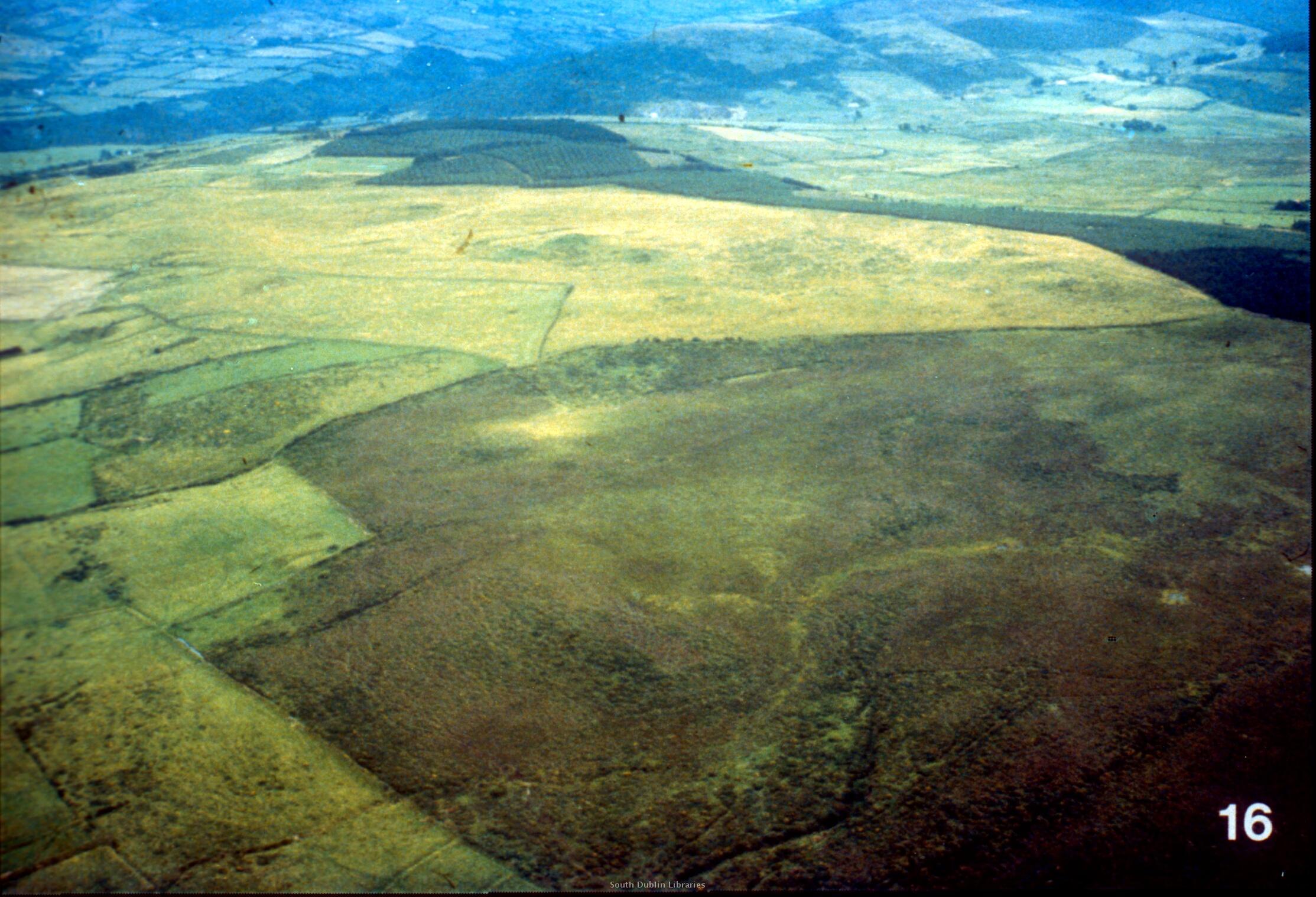 Féach/Oscail |
Tá cosaint chóipchirt bunaidh ag an mír seo |
Tá cosaint cóipchirt ag míreanna in Source, agus tá gach ceart ar cosaint, mura ndeirtear a mhalairt.