South Dublin County Libraries
Úsáid le do thoil an t-aitheantóir seo chun an mhír seo a lua nó a nascadh:
https://hdl.handle.net/10599/4954| Teideal: | Taylor's map of the environs of Dublin extending 10 to 14 miles from the castle by actual survey on a scale of 2 inches to one mile [Templeogue] |
| Údair: | Taylor, John Courtesy of Andrew Bonar Law |
| Eochairfhocail: | map City and Liberty mills Will Farm Terenure House Gayfield Willington Cypress Grove Butterfield Lane Balrothery Hills Cherry tree Lands of Ballyroan Paper Mills Bowlbrook Bolbrook Firhouse Furhouse sporting hall Sally Park kiln New Bawn Old Orchard Washington Lodge Cherrytree Kilvere House Templeogue Bridge Templeogue church |
| Dáta Eisithe: | 7-Meá-2009 |
| Foilsitheoir: | John Taylor |
| Cur Síos: | Portion of John Taylor's map of Dublin, showing Tallaght and surrounding area |
| URI: | https://hdl.handle.net/10599/4954 |
| Tá sé i mBailiúcháin: | Maps Published Items |
Comhaid sa Mhír seo:
| Comhad | Cur Síos | Méid | Formáid | |
|---|---|---|---|---|
| wm_Taylor_Templeogue.jpg | 467.91 kB | JPEG | 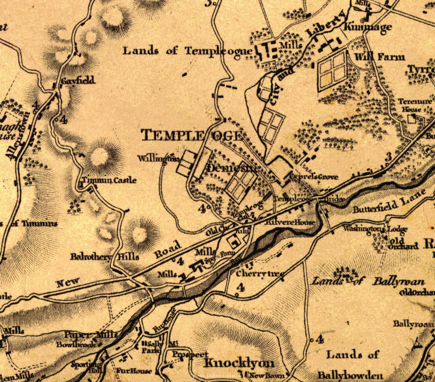 Féach/Oscail |
Tá cosaint chóipchirt bunaidh ag an mír seo |
Tá cosaint cóipchirt ag míreanna in Source, agus tá gach ceart ar cosaint, mura ndeirtear a mhalairt.