South Dublin County Libraries
Úsáid le do thoil an t-aitheantóir seo chun an mhír seo a lua nó a nascadh:
https://hdl.handle.net/10599/4958| Teideal: | An actual survey of the county of Dublin on the same scale as those of Middlesex, Oxford, Barks and Buckinghamshire by John Rocque [Tallaght] |
| Údair: | Rocque, John Courtesy of Andrew Bonar Law |
| Eochairfhocail: | map church Garronstown. Archbishop's place Little Ballymount Killyman Spring |
| Dáta Eisithe: | 7-Meá-2009 |
| Cur Síos: | Portion of John Rocque's map of County Dublin, 1760, showing Tallaght Village and the surrounding area. |
| URI: | https://hdl.handle.net/10599/4958 |
| Tá sé i mBailiúcháin: | Maps Published Items |
Comhaid sa Mhír seo:
| Comhad | Cur Síos | Méid | Formáid | |
|---|---|---|---|---|
| wm_Rocque_Tallaght.jpg | 441.38 kB | JPEG | 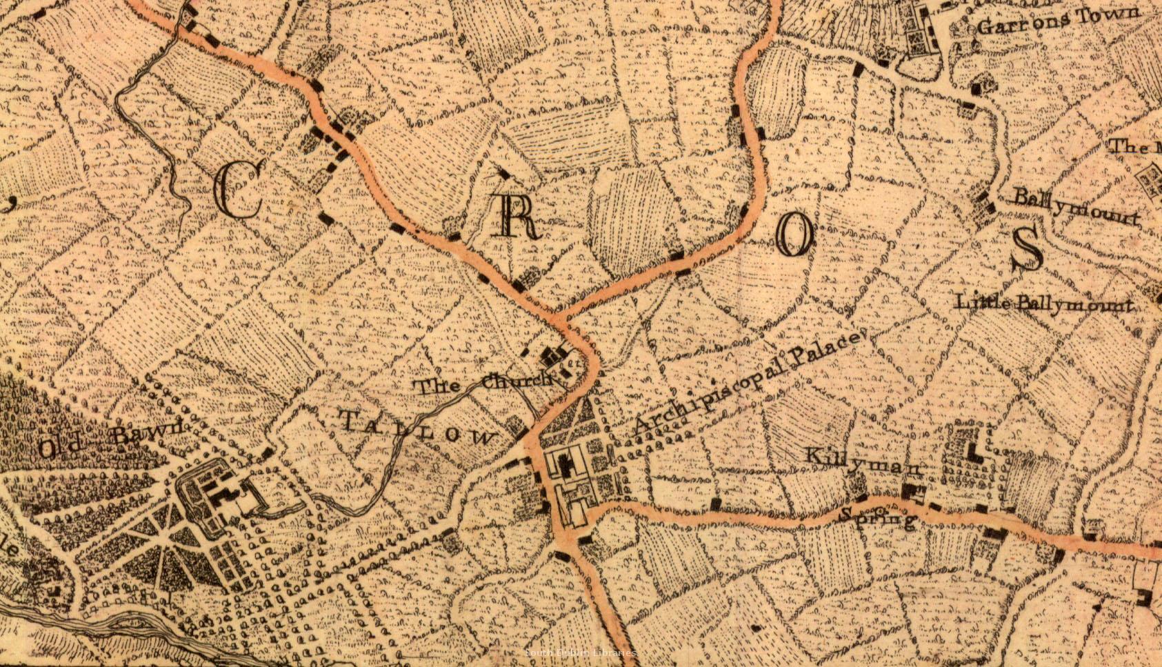 Féach/Oscail |
Tá cosaint chóipchirt bunaidh ag an mír seo |
Tá cosaint cóipchirt ag míreanna in Source, agus tá gach ceart ar cosaint, mura ndeirtear a mhalairt.