South Dublin County Libraries
Please use this identifier to cite or link to this item:
https://hdl.handle.net/10599/4964| Title: | Parish of Clondalkin County Dublin |
| Authors: | Ordnance Survey Courtesy of Andrew Bonar Law |
| Keywords: | map Clondalkin House Sallypark Paper Mill Glebe House Mill Pond Round Tower Orchard House Betty Fort Moyle Park House Presentation Convent Brickfield Gasometer sand pit constabulary barracks dispensary |
| Issue Date: | 7-Sep-2009 |
| Publisher: | Ordnance Survey |
| Description: | Map of Clondalkin, comprised of joined sheets XVII.15, XVII.16, XXI.3 and XXI.4. (Scale 1:2,500) |
| URI: | https://hdl.handle.net/10599/4964 |
| Appears in Collections: | Maps Published Items |
Files in This Item:
| File | Description | Size | Format | |
|---|---|---|---|---|
| wm_25OS_Clondalkin.jpg | 2.2 MB | JPEG | 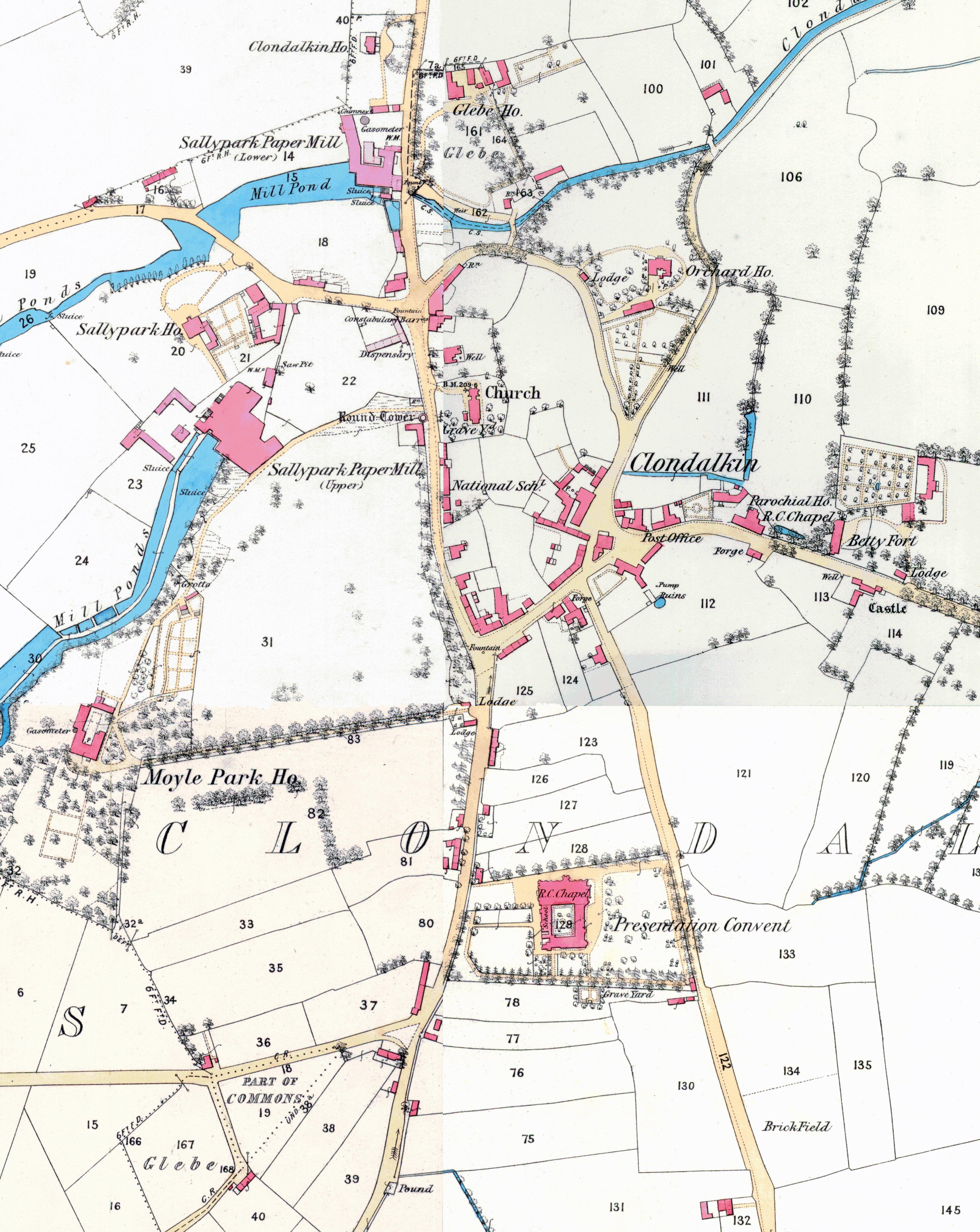 View/Open |
This item is protected by original copyright |
Items in Source are protected by copyright, with all rights reserved, unless otherwise indicated.