South Dublin County Libraries
Please use this identifier to cite or link to this item:
https://hdl.handle.net/10599/4969Full metadata record
| DC Field | Value | Language |
|---|---|---|
| dc.contributor.author | Ordnance Survey | en_IE |
| dc.contributor.other | Courtesy of Andrew Bonar Law | en_IE |
| dc.coverage.spatial | Rathfarnham | en_IE |
| dc.coverage.temporal | 1864 | en_IE |
| dc.date.accessioned | 2010-04-22T15:55:15Z | - |
| dc.date.available | 2010-04-22T15:55:15Z | - |
| dc.date.issued | 2009-09-07T16:32:36Z | en_IE |
| dc.identifier.other | wm_25OS_Rathfarnham.jpg | |
| dc.identifier.uri | https://hdl.handle.net/10599/4969 | - |
| dc.description | Portion of the Parish of Rathfarnham, comprised of sheets XII.6 and XII.7. Surveyed in 1864 by Captain Martin R.E. and zincographed in 1865 under the direction of Captain Wilkinson R.E. at the Ordnance Survey Office, Phoenix Park. Colonel Sir H. James R.E. F.R.S. M.R.I.A. &c. Superintendent of the Ordnance Survey. (Scale 1:2,500) | en_IE |
| dc.format | .tif | en_IE |
| dc.language.iso | English | en_IE |
| dc.publisher | Ordnance Survey | en_IE |
| dc.subject | map | en_IE |
| dc.subject | Ashfield | en_IE |
| dc.subject | graveyard | en_IE |
| dc.subject | pigeon house | en_IE |
| dc.subject | parochial school | en_IE |
| dc.subject | Rathfarnham Castle | en_IE |
| dc.subject | Constabulary Barracks | en_IE |
| dc.subject | mill pond | en_IE |
| dc.subject | Yellow House | en_IE |
| dc.subject | sluice | en_IE |
| dc.subject | saw mill. | en_IE |
| dc.title | Parish of Rathfarnham, Co. Dublin | en_IE |
| dc.type | image | en_IE |
| Appears in Collections: | Maps Published Items | |
Files in This Item:
| File | Description | Size | Format | |
|---|---|---|---|---|
| wm_25OS_Rathfarnham.jpg | 1.09 MB | JPEG | 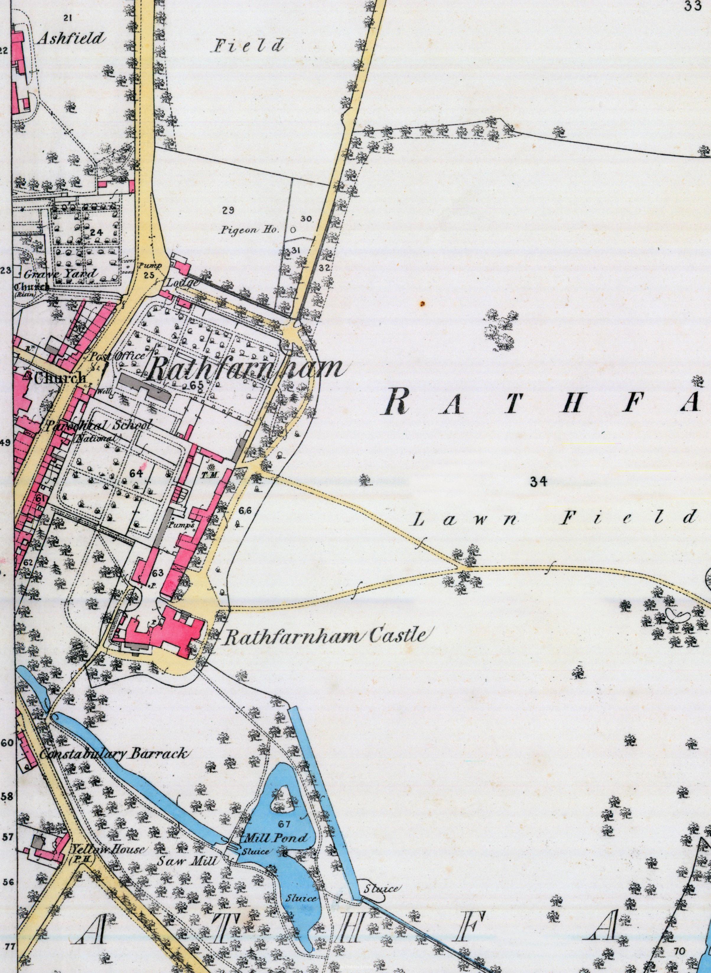 View/Open |
This item is protected by original copyright |
Items in Source are protected by copyright, with all rights reserved, unless otherwise indicated.