South Dublin County Libraries
Úsáid le do thoil an t-aitheantóir seo chun an mhír seo a lua nó a nascadh:
https://hdl.handle.net/10599/4969| Teideal: | Parish of Rathfarnham, Co. Dublin |
| Údair: | Ordnance Survey Courtesy of Andrew Bonar Law |
| Eochairfhocail: | map Ashfield graveyard pigeon house parochial school Rathfarnham Castle Constabulary Barracks mill pond Yellow House sluice saw mill. |
| Dáta Eisithe: | 7-Meá-2009 |
| Foilsitheoir: | Ordnance Survey |
| Cur Síos: | Portion of the Parish of Rathfarnham, comprised of sheets XII.6 and XII.7. Surveyed in 1864 by Captain Martin R.E. and zincographed in 1865 under the direction of Captain Wilkinson R.E. at the Ordnance Survey Office, Phoenix Park. Colonel Sir H. James R.E. F.R.S. M.R.I.A. &c. Superintendent of the Ordnance Survey. (Scale 1:2,500) |
| URI: | https://hdl.handle.net/10599/4969 |
| Tá sé i mBailiúcháin: | Maps Published Items |
Comhaid sa Mhír seo:
| Comhad | Cur Síos | Méid | Formáid | |
|---|---|---|---|---|
| wm_25OS_Rathfarnham.jpg | 1.09 MB | JPEG | 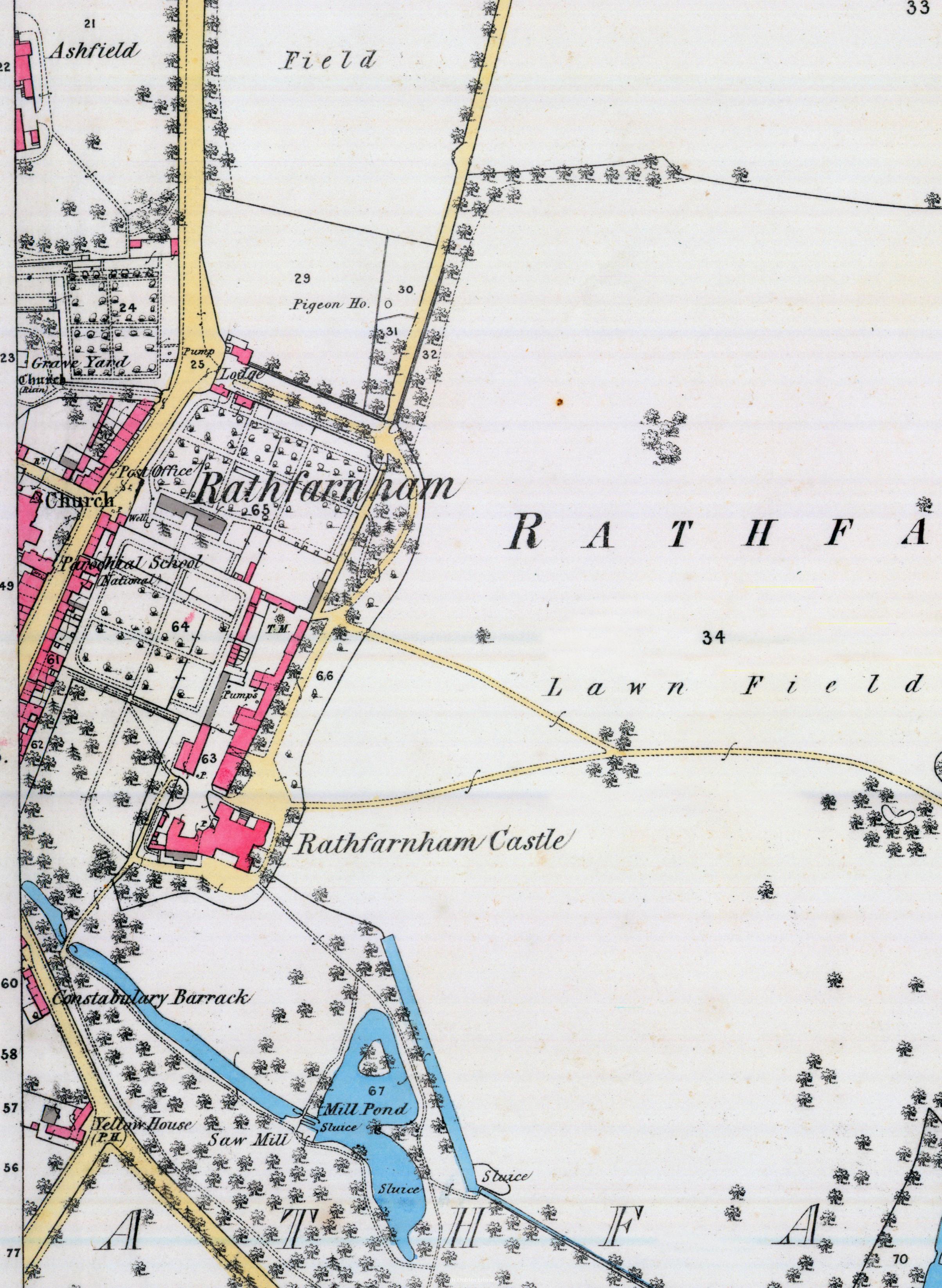 Féach/Oscail |
Tá cosaint chóipchirt bunaidh ag an mír seo |
Tá cosaint cóipchirt ag míreanna in Source, agus tá gach ceart ar cosaint, mura ndeirtear a mhalairt.