South Dublin County Libraries
Please use this identifier to cite or link to this item:
https://hdl.handle.net/10599/8878Full metadata record
| DC Field | Value | Language |
|---|---|---|
| dc.contributor.author | Rocque, John | en_IE |
| dc.coverage.spatial | ---Dublin | en_IE |
| dc.coverage.spatial | ---Kildare | en_IE |
| dc.coverage.spatial | ---Adamstown | en_IE |
| dc.coverage.spatial | ---Bawnogue | en_IE |
| dc.coverage.spatial | ---Clondalkin | en_IE |
| dc.coverage.spatial | ---Clonburris | en_IE |
| dc.coverage.spatial | ---Deansrath | en_IE |
| dc.coverage.spatial | ---Esker | en_IE |
| dc.coverage.spatial | ---Hazelhatch | en_IE |
| dc.coverage.spatial | ---Lucan | en_IE |
| dc.coverage.spatial | ---Leixlip | en_IE |
| dc.coverage.spatial | ---Palmerston | en_IE |
| dc.coverage.spatial | ---Quarryvale | en_IE |
| dc.coverage.temporal | 1760 | en_IE |
| dc.date.accessioned | 2012-01-26T03:01:23Z | - |
| dc.date.available | 2012-01-26T03:01:23Z | - |
| dc.date.issued | 1760 | en_IE |
| dc.identifier.other | wm_Rocque.jpg Rocque.tif | |
| dc.identifier.uri | https://hdl.handle.net/10599/8878 | - |
| dc.description | Portion of John Rocque's map of County Dublin, 1760, showing Clondalkin, Lucan, Saggart, Rathcoole, Leixlip, Celbridge and the surrounding area. | en_IE |
| dc.format | TIFF | en_IE |
| dc.language.iso | English | en_IE |
| dc.rights | Courtesy of Andrew Bonar Law | en_IE |
| dc.subject | map | en_IE |
| dc.title | An actual survey of the county of Dublin on the same scale as those of Middlesex, Oxford, Barks and Buckinghamshire by John Rocque [portion] | en_IE |
| dc.type | Image | en_IE |
| dc.internal.visibility | 1 | en_IE |
| Appears in Collections: | Maps Published Items | |
Files in This Item:
| File | Description | Size | Format | |
|---|---|---|---|---|
| Rocque.tif | 54.41 MB | TIFF |  View/Open | |
| wm_Rocque.jpg | Generated Web Image | 3.29 MB | JPEG | 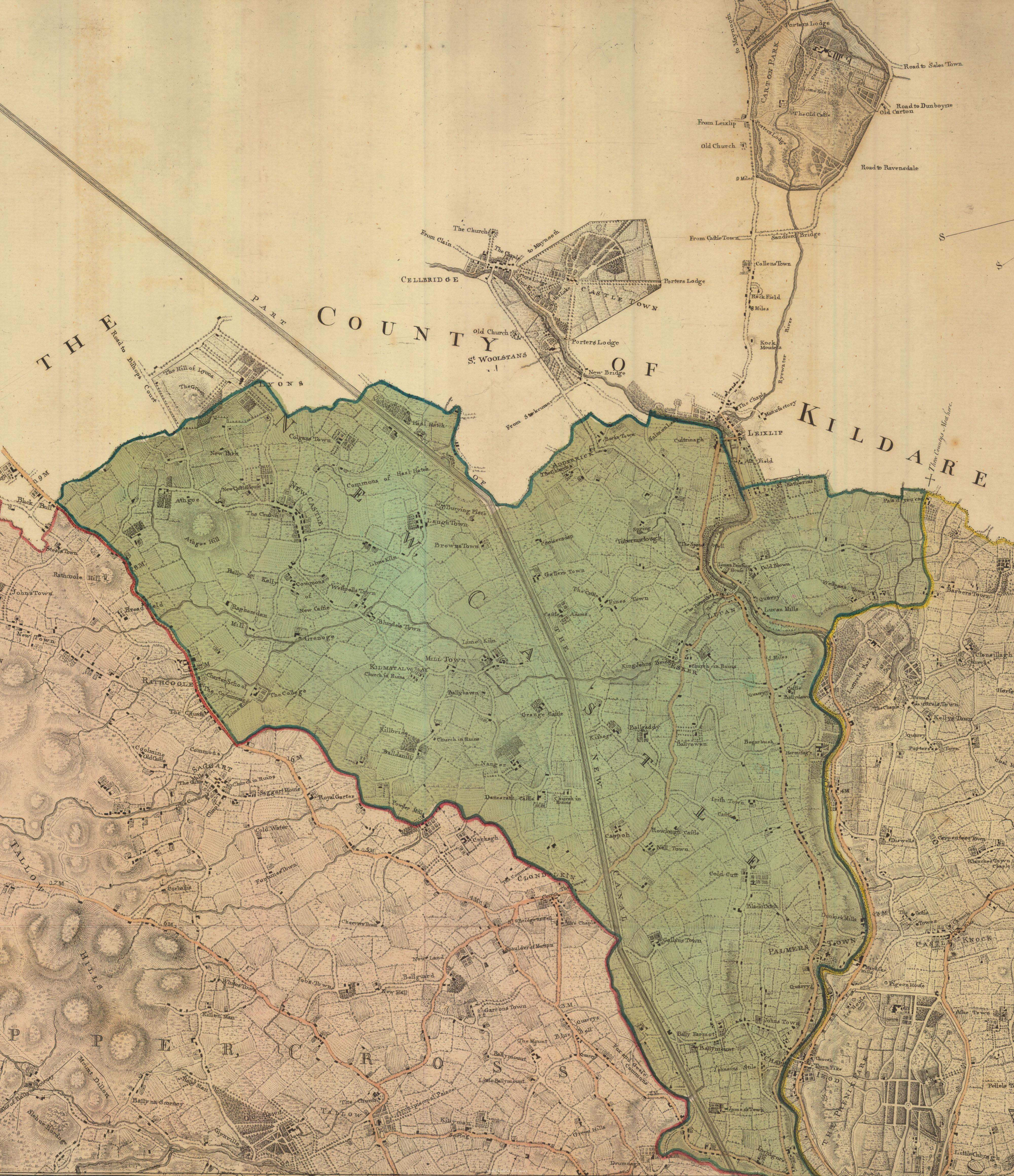 View/Open |
This item is protected by original copyright |
Items in Source are protected by copyright, with all rights reserved, unless otherwise indicated.