South Dublin County Libraries
Please use this identifier to cite or link to this item:
https://hdl.handle.net/10599/9720Full metadata record
| DC Field | Value | Language |
|---|---|---|
| dc.contributor.author | Herman Moll | en_IE |
| dc.contributor.other | Williams, Joe | en_IE |
| dc.coverage.spatial | ---Dublin | en_IE |
| dc.coverage.temporal | c.1714 | en_IE |
| dc.date.accessioned | 2013-11-05T03:00:37Z | - |
| dc.date.available | 2013-11-05T03:00:37Z | - |
| dc.date.issued | 1714 | en_IE |
| dc.identifier.other | wm_Dublin Map from a New Map of Ireland by Herman Moll 1714.jpg | |
| dc.identifier.uri | https://hdl.handle.net/10599/9720 | - |
| dc.description | Map of Dublin City 1714 from a 'New Map of Ireland' by Herman Moll from Oxmantown on the north bank to Saint Stephen's Green on the south bank of the Liffey. | en_IE |
| dc.format | TIFF | en_IE |
| dc.language.iso | English | en_IE |
| dc.publisher | Dublin Corporation Libraries | en_IE |
| dc.rights | Dublin Corporation Libraries | en_IE |
| dc.subject | Dublin City 1714 | en_IE |
| dc.subject | Oxmantown | en_IE |
| dc.subject | Saint Stephen's Green | en_IE |
| dc.title | Dublin City 1714 | en_IE |
| dc.type | Image | en_IE |
| dc.internal.visibility | 1 | en_IE |
| Appears in Collections: | Joe Williams Postcard Collection Published Items | |
Files in This Item:
| File | Description | Size | Format | |
|---|---|---|---|---|
| wm_Dublin Map from a New Map of Ireland by Herman Moll 1714.jpg | Generated Web Image | 3.05 MB | JPEG | 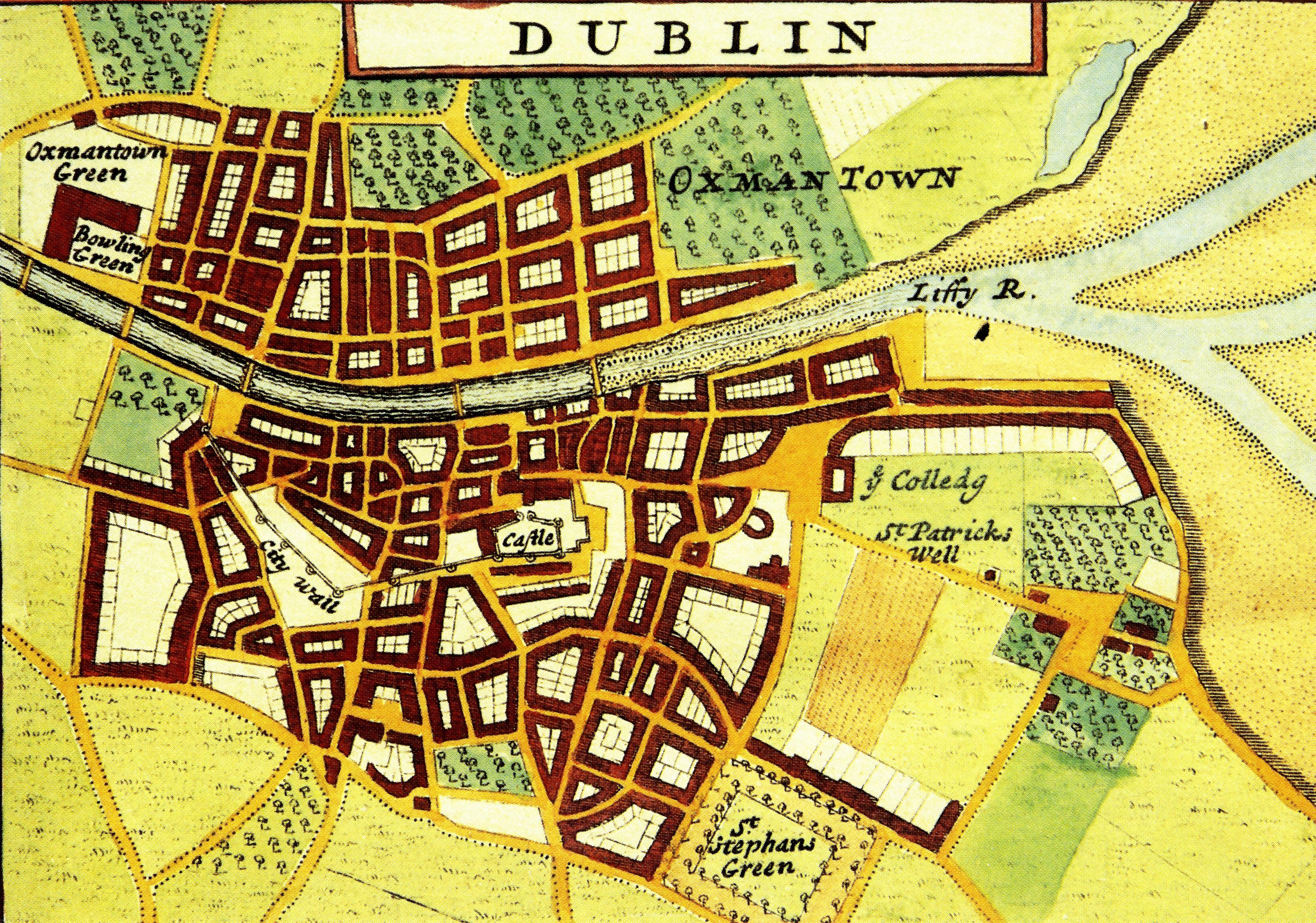 View/Open |
This item is protected by original copyright |
Items in Source are protected by copyright, with all rights reserved, unless otherwise indicated.