South Dublin County Libraries
Úsáid le do thoil an t-aitheantóir seo chun an mhír seo a lua nó a nascadh:
https://hdl.handle.net/10599/9720| Teideal: | Dublin City 1714 |
| Údair: | Herman Moll Williams, Joe |
| Eochairfhocail: | Dublin City 1714 Oxmantown Saint Stephen's Green |
| Dáta Eisithe: | 1714 |
| Foilsitheoir: | Dublin Corporation Libraries |
| Cur Síos: | Map of Dublin City 1714 from a 'New Map of Ireland' by Herman Moll from Oxmantown on the north bank to Saint Stephen's Green on the south bank of the Liffey. |
| URI: | https://hdl.handle.net/10599/9720 |
| Copyright: | Dublin Corporation Libraries |
| Tá sé i mBailiúcháin: | Joe Williams Postcard Collection Published Items |
Comhaid sa Mhír seo:
| Comhad | Cur Síos | Méid | Formáid | |
|---|---|---|---|---|
| wm_Dublin Map from a New Map of Ireland by Herman Moll 1714.jpg | Generated Web Image | 3.05 MB | JPEG | 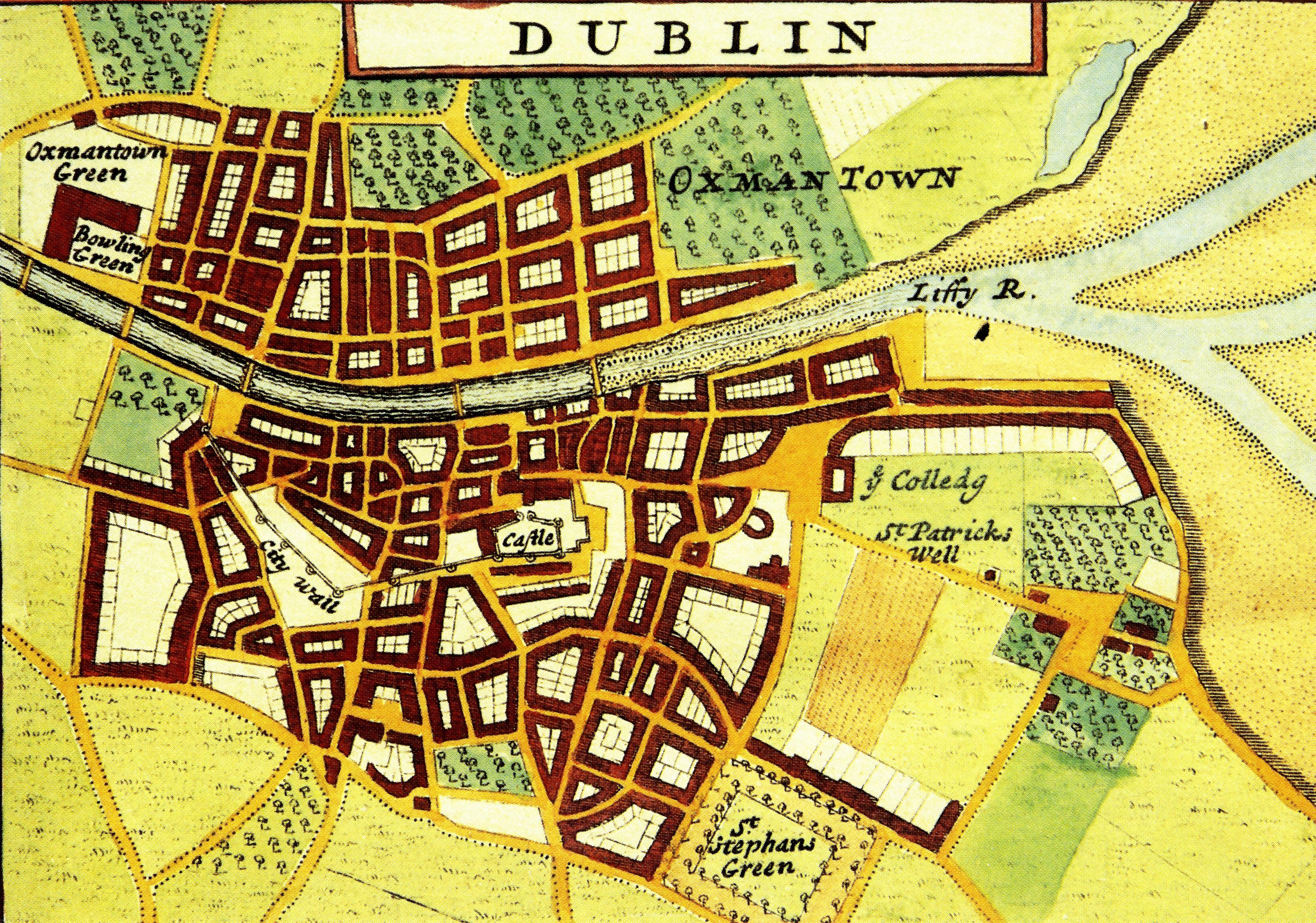 Féach/Oscail |
Tá cosaint chóipchirt bunaidh ag an mír seo |
Tá cosaint cóipchirt ag míreanna in Source, agus tá gach ceart ar cosaint, mura ndeirtear a mhalairt.