South Dublin County Libraries
Úsáid le do thoil an t-aitheantóir seo chun an mhír seo a lua nó a nascadh:
https://hdl.handle.net/10599/10334| Teideal: | Ordnance Survey Office Map No. 2 of Ballitore County Kildare 1907 -1908 |
| Údair: | Ordnance Survey Office Ireland Cruise, Aidan |
| Eochairfhocail: | Ordnance Survey map |
| Dáta Eisithe: | 1908 |
| Foilsitheoir: | Ordnance Survey Office Ireland c.1908 |
| Cur Síos: | A numbered Ordnance Survey Office map of the centre of the Quaker village of Ballitore, Co. Kildare 1907 - 1908 thought to be related to c.1960 era photographs and survey sheets of property hosted on SOURCE associated with this Quaker collection. |
| URI: | https://hdl.handle.net/10599/10334 |
| Tá sé i mBailiúcháin: | Published Items Quaker Maps |
Comhaid sa Mhír seo:
| Comhad | Cur Síos | Méid | Formáid | |
|---|---|---|---|---|
| wm_10334_Ballintore Village Centre Map 2 (numbered).jpg | Generated Web Image | 2.59 MB | JPEG | 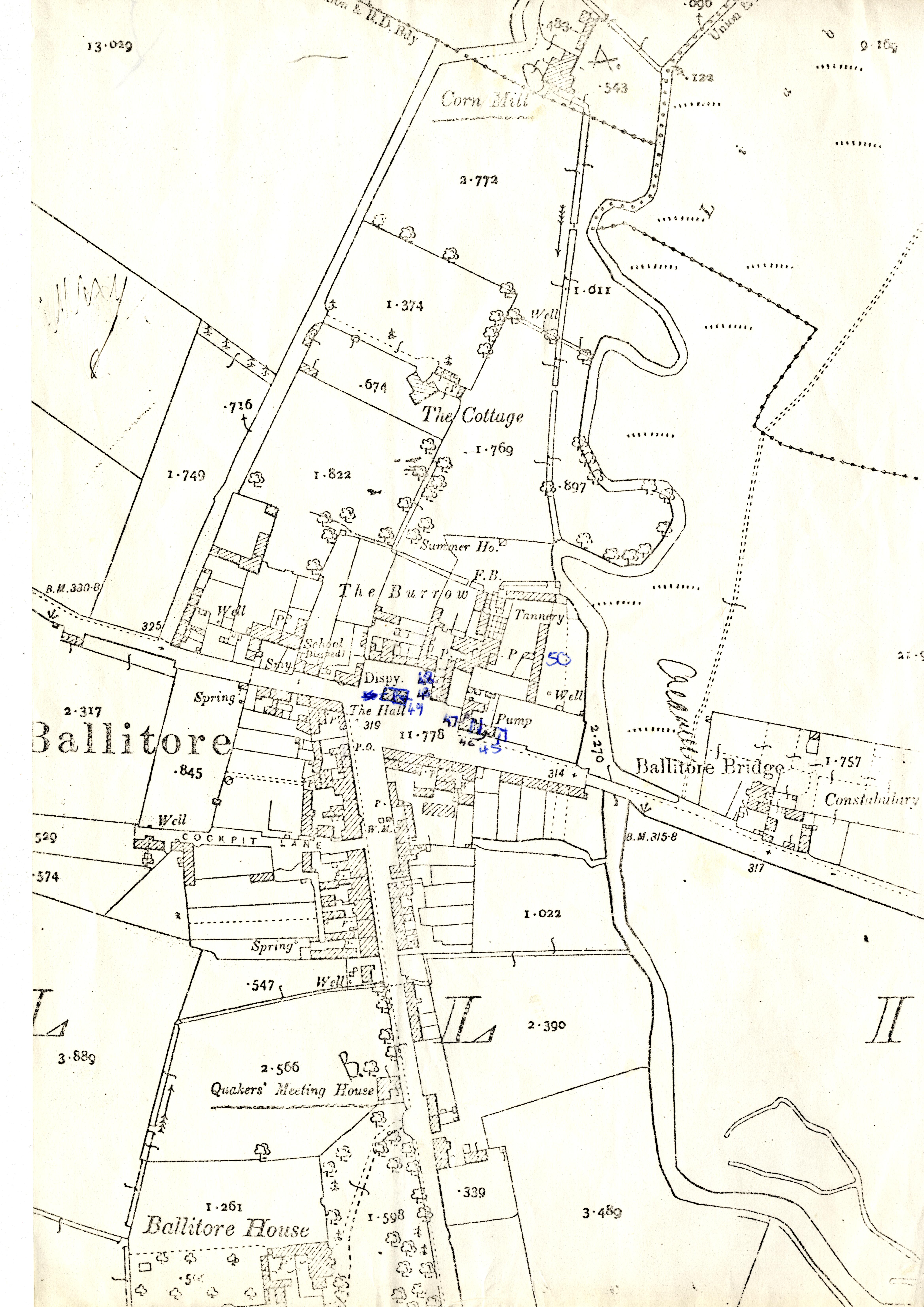 Féach/Oscail |
Tá cosaint chóipchirt bunaidh ag an mír seo |
Tá cosaint cóipchirt ag míreanna in Source, agus tá gach ceart ar cosaint, mura ndeirtear a mhalairt.