South Dublin County Libraries
Úsáid le do thoil an t-aitheantóir seo chun an mhír seo a lua nó a nascadh:
https://hdl.handle.net/10599/4945| Teideal: | Taylor's map of the environs of Dublin extending 10 to 14 miles from the castle by actual survey on a scale of 2 inches to one mile [Lucan] |
| Údair: | Taylor, John Courtesy of Andrew Bonar Law |
| Eochairfhocail: | map Coldblown Edmondsbury Woodville Iron mills bridge Mill-race Sand Hill Ballyowen Esker Cottage Canonbrook Turnpike Spa Well Fyanstown Castle Adams Kishogue |
| Dáta Eisithe: | 7-Meá-2009 |
| Foilsitheoir: | John Taylor |
| Cur Síos: | Portion of John Taylor's map of Dublin, showing Lucan village and surrounding area |
| URI: | https://hdl.handle.net/10599/4945 |
| Tá sé i mBailiúcháin: | Maps Published Items |
Comhaid sa Mhír seo:
| Comhad | Cur Síos | Méid | Formáid | |
|---|---|---|---|---|
| wm_Taylor_Lucan.jpg | 572.11 kB | JPEG | 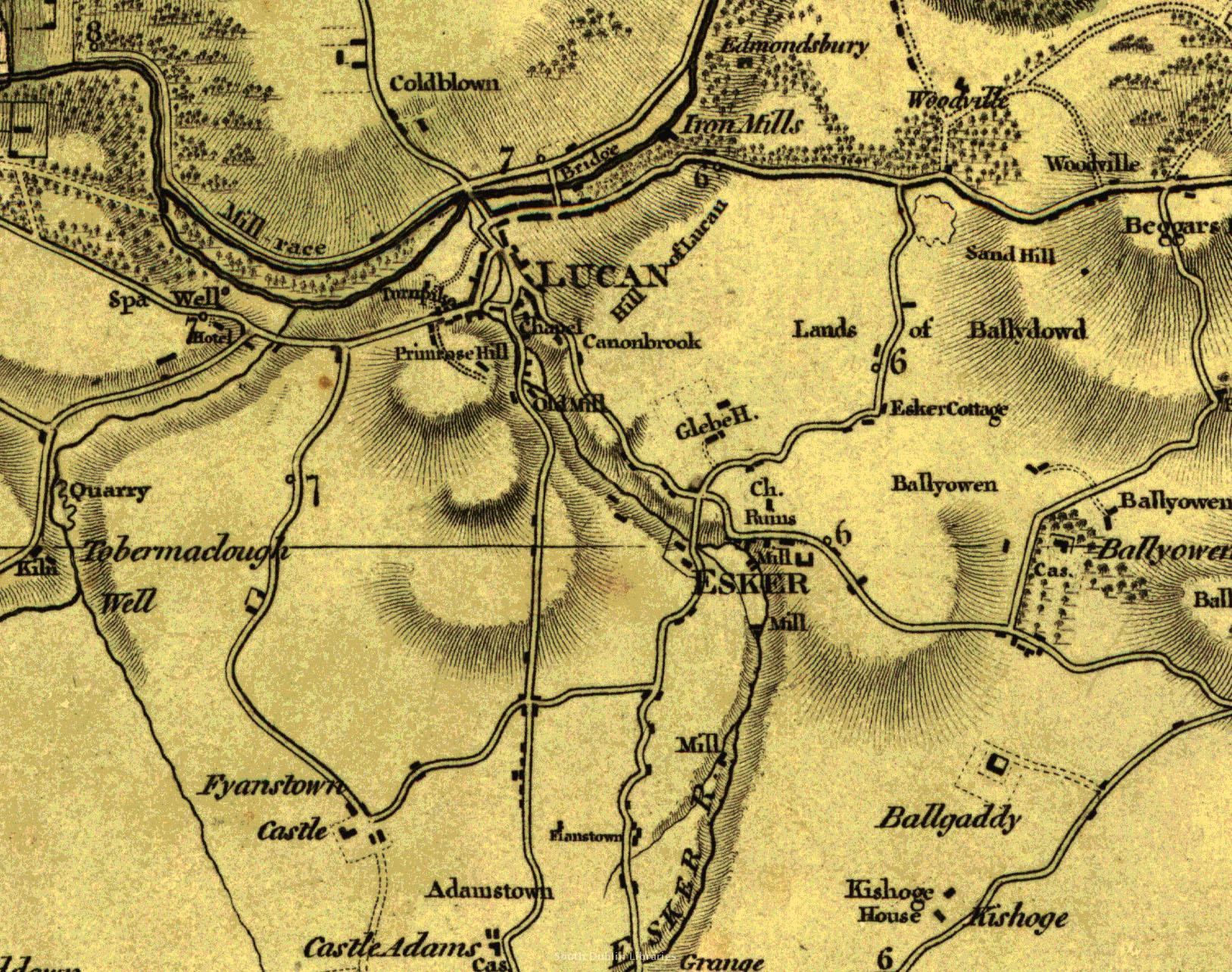 Féach/Oscail |
Tá cosaint chóipchirt bunaidh ag an mír seo |
Tá cosaint cóipchirt ag míreanna in Source, agus tá gach ceart ar cosaint, mura ndeirtear a mhalairt.