South Dublin County Libraries
Please use this identifier to cite or link to this item:
https://hdl.handle.net/10599/4961| Title: | Taylor's map of the environs of Dublin extending 10 to 14 miles from the castle by actual survey on a scale of 2 inches to one mile [Rathfarnham] |
| Authors: | Taylor, John Courtesy of Andrew Bonar Law |
| Keywords: | map Ely Demesne Rathfarnham Castle Newtown Cypress Grove Kilvere House Templeogue Bridge Butterfield Lane Washington Lodge Old Orchard Willbrook Nutgrove school Wintebarn Landscape Belfield Ballyroan Marley House Elm Park Elm Grove Elm Cottage Whitechurch Mill Waterfall Sally Garden Brooklawn Mills Barton Lodge Sweetmount Rathfarnham House Fields of Oden Lands of Ballybowden Woodbine. |
| Issue Date: | 7-Sep-2009 |
| Publisher: | John Taylor |
| Description: | Portion of John Taylor's map of Dublin, showing Rathfarnham and surrounding area |
| URI: | https://hdl.handle.net/10599/4961 |
| Appears in Collections: | Maps Published Items |
Files in This Item:
| File | Description | Size | Format | |
|---|---|---|---|---|
| wm_Taylor_Rathfarnham.jpg | 490.15 kB | JPEG | 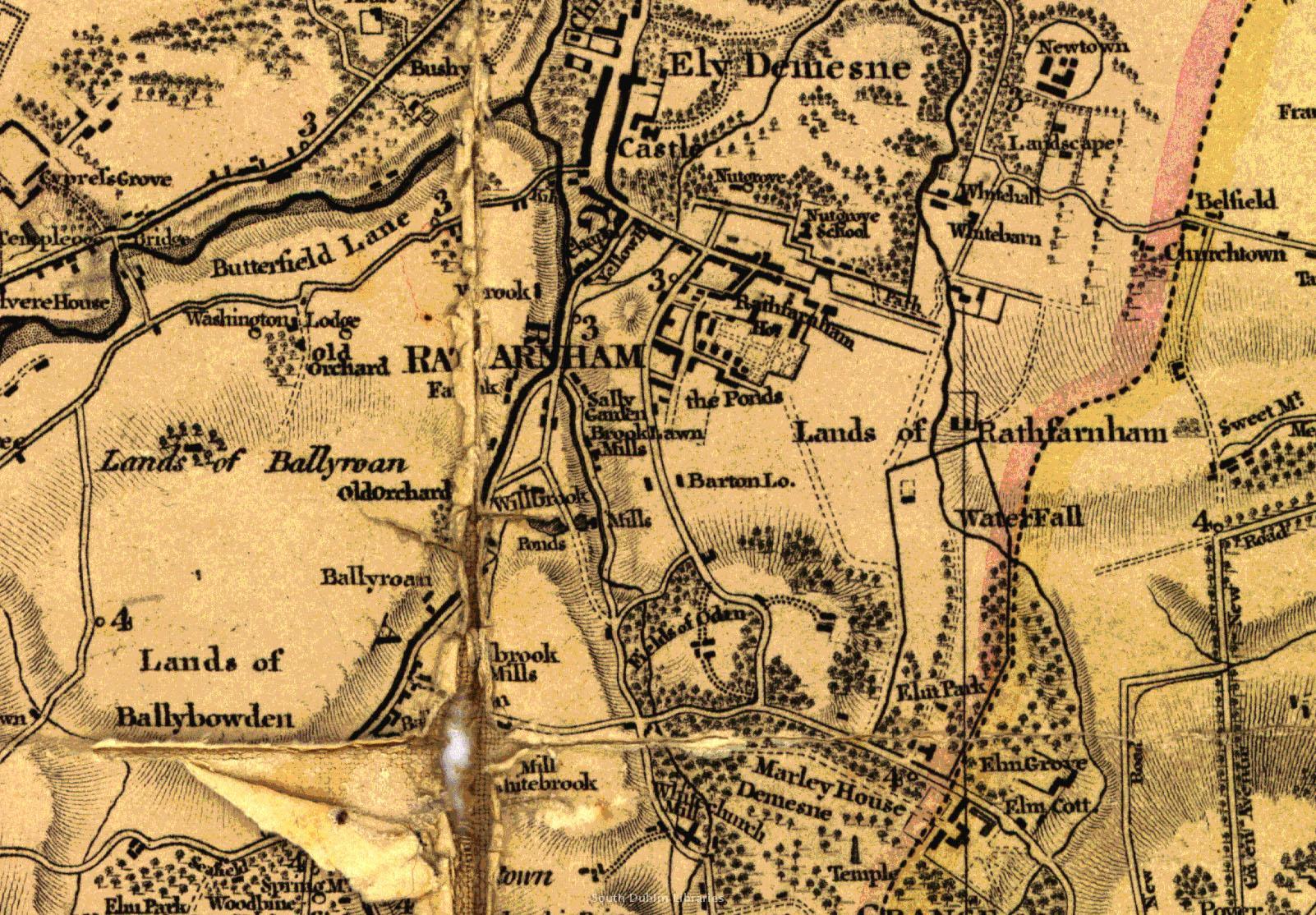 View/Open |
This item is protected by original copyright |
Items in Source are protected by copyright, with all rights reserved, unless otherwise indicated.