South Dublin County Libraries
Úsáid le do thoil an t-aitheantóir seo chun an mhír seo a lua nó a nascadh:
https://hdl.handle.net/10599/4970| Teideal: | Parish of Tallaght Co. Dublin |
| Údair: | Ordnance Survey Courtesy of Andrew Bonar Law |
| Eochairfhocail: | map Fortfield Palm Villa Cypress Grove Temple Mound Kilvare church flour mill mill pond rockery Templeogue Bridge Templeogue House sun dial terrace |
| Dáta Eisithe: | 7-Meá-2009 |
| Foilsitheoir: | Ordnance Survey |
| Cur Síos: | Map of Templeogue comprised of joined sheets of 25" Ordnance Survey Maps. Surveyed in 1864 by Captain Martin R.E. and zincographed in 1865 under the direction of Captain Wilkinson R.E. at the Ordnance Survey Office, Phoenix Park. Colonel Sir H. James R.E. F.R.S. M.R.I.A. &c. Superintendent of the Ordnance Survey. |
| URI: | https://hdl.handle.net/10599/4970 |
| Tá sé i mBailiúcháin: | Maps Published Items |
Comhaid sa Mhír seo:
| Comhad | Cur Síos | Méid | Formáid | |
|---|---|---|---|---|
| wm_25OS_Templeogue.jpg | 2.57 MB | JPEG | 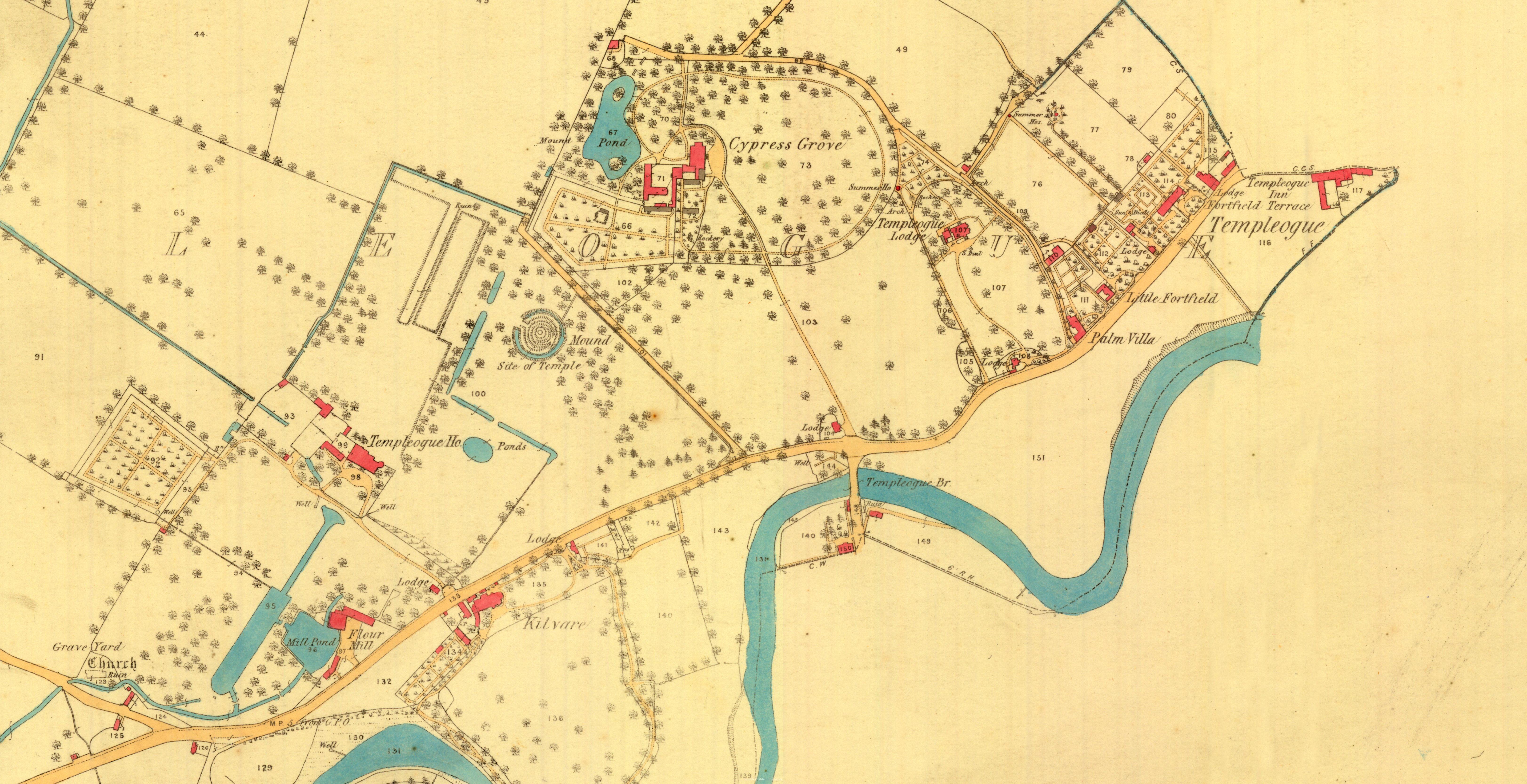 Féach/Oscail |
Tá cosaint chóipchirt bunaidh ag an mír seo |
Tá cosaint cóipchirt ag míreanna in Source, agus tá gach ceart ar cosaint, mura ndeirtear a mhalairt.