South Dublin County Libraries
Please use this identifier to cite or link to this item:
https://hdl.handle.net/10599/4970| Title: | Parish of Tallaght Co. Dublin |
| Authors: | Ordnance Survey Courtesy of Andrew Bonar Law |
| Keywords: | map Fortfield Palm Villa Cypress Grove Temple Mound Kilvare church flour mill mill pond rockery Templeogue Bridge Templeogue House sun dial terrace |
| Issue Date: | 7-Sep-2009 |
| Publisher: | Ordnance Survey |
| Description: | Map of Templeogue comprised of joined sheets of 25" Ordnance Survey Maps. Surveyed in 1864 by Captain Martin R.E. and zincographed in 1865 under the direction of Captain Wilkinson R.E. at the Ordnance Survey Office, Phoenix Park. Colonel Sir H. James R.E. F.R.S. M.R.I.A. &c. Superintendent of the Ordnance Survey. |
| URI: | https://hdl.handle.net/10599/4970 |
| Appears in Collections: | Maps Published Items |
Files in This Item:
| File | Description | Size | Format | |
|---|---|---|---|---|
| wm_25OS_Templeogue.jpg | 2.57 MB | JPEG | 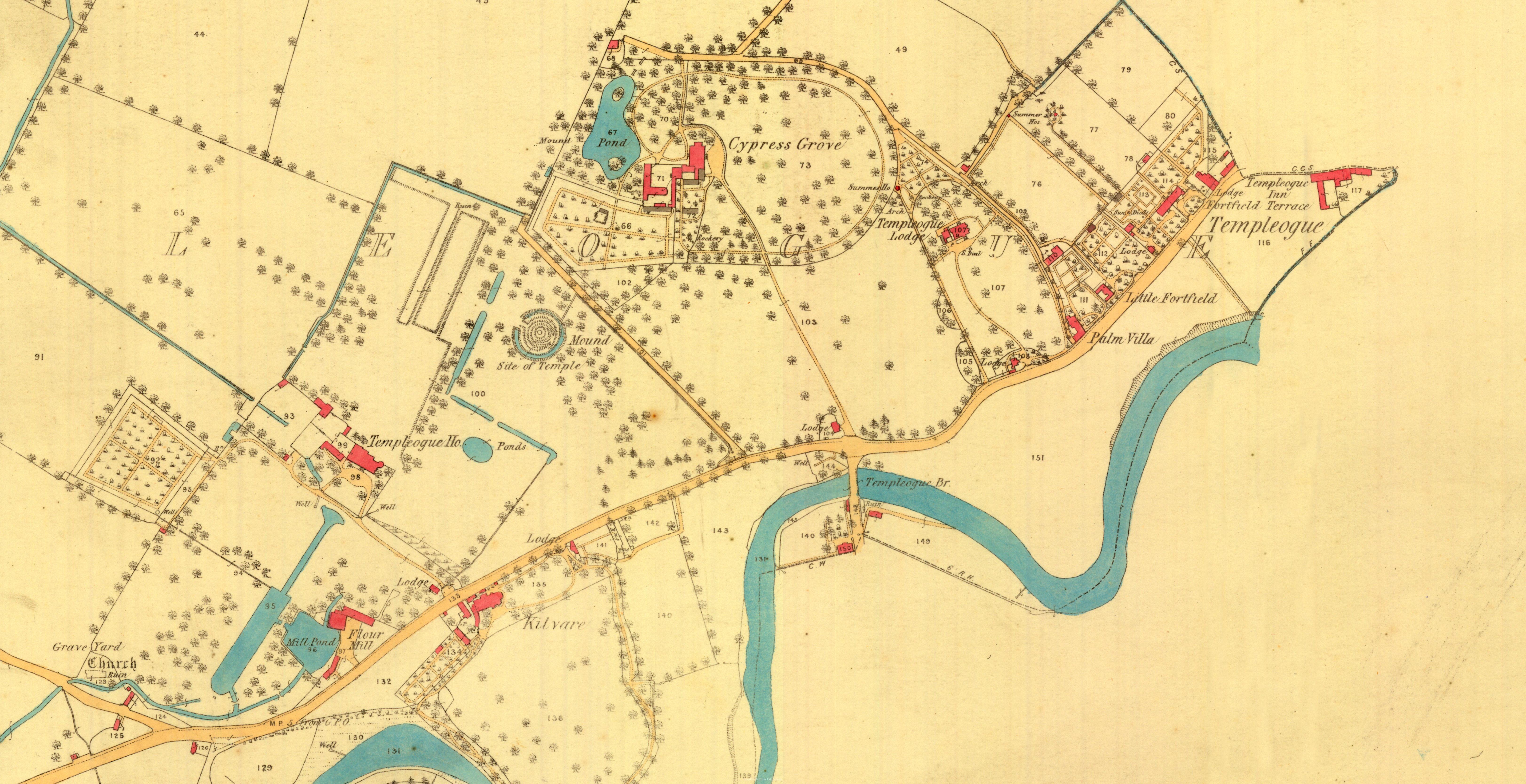 View/Open |
This item is protected by original copyright |
Items in Source are protected by copyright, with all rights reserved, unless otherwise indicated.