South Dublin County Libraries
Úsáid le do thoil an t-aitheantóir seo chun an mhír seo a lua nó a nascadh:
https://hdl.handle.net/10599/5052| Teideal: | Parish of Clondalkin County Dublin |
| Údair: | Ordnance Survey Courtesy of Andrew Bonar Law |
| Eochairfhocail: | map Clondalkin House Sallypark Paper Mill Glebe House Mill Pond Round Tower Orchard House Betty Fort Moyle Park House Presentation Convent Brickfield Gasometer sand pit constabulary barracks dispensary |
| Dáta Eisithe: | 7-Meá-2009 |
| Foilsitheoir: | Ordnance Survey |
| Cur Síos: | Map of Clondalkin, comprised of joined sheets XVII.15, XVII.16, XXI.3 and XXI.4. (Scale 1:2,500) |
| URI: | https://hdl.handle.net/10599/5052 |
| Tá sé i mBailiúcháin: | Maps Published Items |
Comhaid sa Mhír seo:
| Comhad | Cur Síos | Méid | Formáid | |
|---|---|---|---|---|
| wm_25OS_Clondalkin.jpg | 2.2 MB | JPEG | 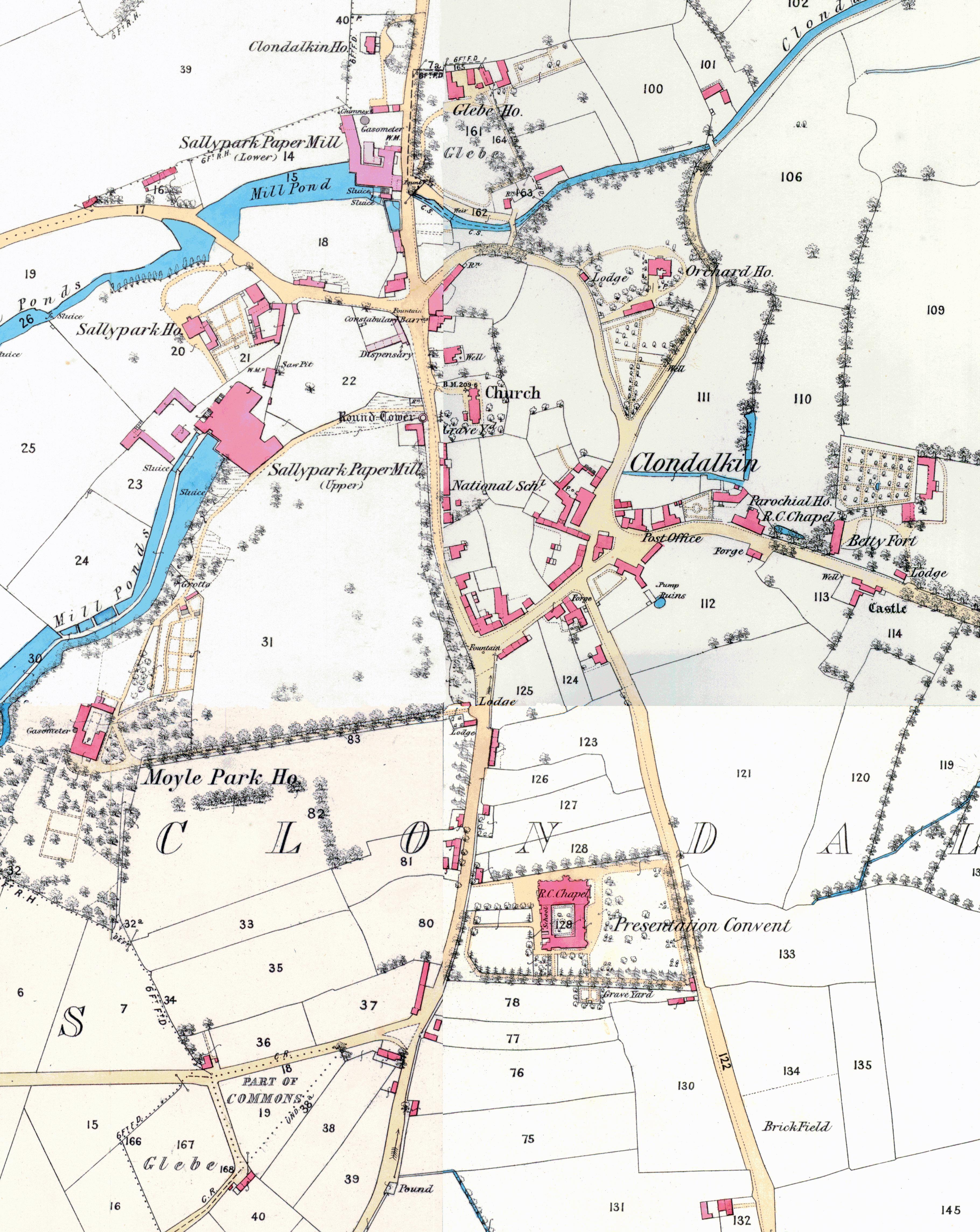 Féach/Oscail |
Tá cosaint chóipchirt bunaidh ag an mír seo |
Tá cosaint cóipchirt ag míreanna in Source, agus tá gach ceart ar cosaint, mura ndeirtear a mhalairt.